Lake Lenore, Saskatchewan
| Lake Lenore | |
|---|---|
| Village | |
| Village of Lake Lenore | |
 Lake Lenore Location of Lake Lenore in Saskatchewan  Lake Lenore Lake Lenore (Canada) | |
| Coordinates: 52°23′35″N 104°56′28″W / 52.393°N 104.941°W | |
| Country |
|
| Province |
|
| Region | Central |
| Census division | 15 |
| Rural Municipality | St. Peter No. 369 |
| Post office Founded | 1906 |
| Government | |
| • Type | Municipal |
| • Governing body | Lake Lenore Village Council |
| • Mayor | Travis Thompson |
| • Administrator | Barb Politeski |
| Area | |
| • Total | 0.97 km2 (0.37 sq mi) |
| Population (2016) | |
| • Total | 284 |
| • Density | 292.9/km2 (759/sq mi) |
| Time zone | UTC-6 (CST) |
| Postal code | S0K 2J0 |
| Area code(s) | 306 |
| Highways |
|
| Railways | Canadian National Railway |
| Website | Village of Lake Lenore |
| [1][2][3][4] | |
Lake Lenore is a village within the Rural Municipality of St. Peter No. 369, in the province of Saskatchewan, Canada. The village is located 144.6 km north-east of the city of Saskatoon. Outside of the village is a lake that shares its name, Lake Lenore, renowned for its fishing activity as well the Rural Municipality of Lake Lenore No. 399 to the north. Lake Lenore possesses a fully operational school, Co-op Grocery and Agro Service Station and also contains a Credit Union and Public Library. The village had a population of 284 in the 2016 Canada Census, (a -4.4% decrease from 297 in the 2011 Canada Census).
Demographics
| Canada census – Lake Lenore, Saskatchewan community profile | |||
|---|---|---|---|
| 2016 | 2011 | 2006 | |
| Population: | 284 (-4.4% from 2011) | 297 (-2.9% from 2006) | 306 (-2.5% from 2001) |
| Land area: | 0.97 km2 (0.37 sq mi) | 0.97 km2 (0.37 sq mi) | 0.97 km2 (0.37 sq mi) |
| Population density: | 292.9/km2 (759/sq mi) | 306.4/km2 (794/sq mi) | 315.7/km2 (818/sq mi) |
| Median age: | 33.8 (M: 31.9, F: 36.8) | 37.8 (M: 34.8, F: 39.2) | 34.0 (M: 35.5, F: 31.8) |
| Total private dwellings: | 128 | 133 | 124 |
| Median household income: | $60,184 | ||
| References: 2016[5] 2011[6] 2006[7] earlier[8] | |||
See also
References
- ↑ National Archives, Archivia Net. "Post Offices and Postmasters". Archived from the original on 2006-10-06. Retrieved 2014-10-13.
- ↑ Government of Saskatchewan, MRD Home. "Municipal Directory System". Archived from the original on 2016-01-15. Retrieved 2014-10-13.
- ↑ Canadian Textiles Institute. (2005), CTI Determine your provincial constituency, archived from the original on 2007-09-11
- ↑ Commissioner of Canada Elections, Chief Electoral Officer of Canada (2005), Elections Canada On-line, archived from the original on 2007-04-21
- ↑ "2016 Community Profiles". Canada 2016 Census. Statistics Canada. February 21, 2017. Retrieved 2017-03-15.
- ↑ "2011 Community Profiles". Canada 2011 Census. Statistics Canada. July 5, 2013. Retrieved 2014-10-13.
- ↑ "2006 Community Profiles". Canada 2006 Census. Statistics Canada. March 30, 2011. Retrieved 2014-10-13.
- ↑ "2001 Community Profiles". Canada 2001 Census. Statistics Canada. February 17, 2012.
External links
- Municipal Directory Saskatchewan - Village of Lake Lenore
- Saskatchewan City & Town Maps
- Saskatchewan Gen Web - One Room School Project
- Post Offices and Postmasters - ArchiviaNet - Library and Archives Canada
- Saskatchewan Gen Web Region
- Online Historical Map Digitization Project
- GeoNames Query
- 2006 Community Profiles
Places adjacent to Lake Lenore, Saskatchewan | ||||||||||
|---|---|---|---|---|---|---|---|---|---|---|
| ||||||||||
| Subdivisions | |
|---|---|
| Communities | |
| Cities | |
| Topics |
|
| |
| Cities | 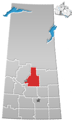 | |
|---|---|---|
| Towns | ||
| Villages | ||
| Resort villages | ||
| Rural municipalities | ||
| Unincorporated communities | ||
Coordinates: 52°23′35″N 104°56′28″W / 52.393°N 104.941°W
This article is issued from
Wikipedia.
The text is licensed under Creative Commons - Attribution - Sharealike.
Additional terms may apply for the media files.