Christopher Lake
| Christopher Lake | |
|---|---|
| Village | |
| Village of Christopher Lake | |
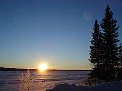 Sunrise above the frozen Christopher Lake (Christmas 2006) | |
 Christopher Lake  Christopher Lake | |
| Coordinates: 53°32′24″N 105°47′38″W / 53.5400°N 105.794°W | |
| Country |
|
| Province |
|
| Region | Central |
| Census division | 15 |
| Rural Municipality | Lakeland No. 521 |
| Government | |
| • Type | Municipal |
| • Governing body | Christopher Lake Village Council |
| • Mayor | Denis Daughton |
| • Administrator | Jeannie Rip |
| Area | |
| • Total | 4.56 km2 (1.76 sq mi) |
| Population (2016) | |
| • Total | 289 |
| • Density | 63.3/km2 (164/sq mi) |
| Time zone | UTC-6 (CST) |
| Postal code | S0J 0N0 |
| Area code(s) | 306 |
| Highways |
|
| Railways | None |
| [1][2][3][4] | |
Christopher Lake[5] is a village within the Rural Municipality of Lakeland No. 521, Saskatchewan, Canada. The village had a population of 289 in the 2016 Census, (a 2.8% increase from 281 in the 2011 Census). The village lies in the boreal forest of central Saskatchewan, 2 km south and east of a large lake of the same name (Christopher Lake). The village is approximately 40 km north of the city of Prince Albert and about 5 km east of its partner resort area of Emma Lake, west of the junction of Highway 2 and 263.
Christopher Lake is considered one of the most beautiful lakes in Saskatchewan. The major industry in the RM of Lakeland is tourism .
Christopher Lake is home to the Little Red River Cree First Nation band government.
Demographics
| Canada census – Christopher Lake community profile | |||
|---|---|---|---|
| 2016 | 2011 | 2006 | |
| Population: | 289 (+2.8% from 2011) | 281 (+23.7% from 2006) | 215 (% from 2001) |
| Land area: | 4.56 km2 (1.76 sq mi) | 63.3 km2 (24.4 sq mi) | |
| Population density: | 63.3/km2 (164/sq mi) | 76.8/km2 (199/sq mi) | |
| Median age: | 44.8 (M: 45.0, F: 44.6) | 45.5 (M: 44.5, F: 46.0) | |
| Total private dwellings: | 138 | 119 | |
| Median household income: | $N/A | ||
| References: 2016[6] 2011[7] 2006[8] earlier[9] | |||
See also
References
- ↑ National Archives, Archivia Net, Post Offices and Postmasters, archived from the original on 2006-10-06
- ↑ Government of Saskatchewan, MRD Home, Municipal Directory System, archived from the original (– Scholar search) on November 21, 2008
- ↑ Canadian Textiles Institute. (2005), CTI Determine your provincial constituency, archived from the original on 2007-09-11
- ↑ Commissioner of Canada Elections, Chief Electoral Officer of Canada (2005), Elections Canada On-line, archived from the original on 2007-04-21
- ↑ Map, Weather and Travel Information from www.travelsradiate.com
- ↑ "2016 Community Profiles". Canada 2016 Census. Statistics Canada. February 21, 2017. Retrieved 2017-03-15.
- ↑ "2011 Community Profiles". Canada 2011 Census. Statistics Canada. July 5, 2013. Retrieved 2012-10-30.
- ↑ "2006 Community Profiles". Canada 2006 Census. Statistics Canada. March 30, 2011. Retrieved 2009-02-24.
- ↑ "2001 Community Profiles". Canada 2001 Census. Statistics Canada. February 17, 2012.
External links
| Subdivisions | |
|---|---|
| Communities | |
| Cities | |
| Topics |
|
| |
| Cities | 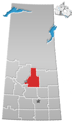 | |
|---|---|---|
| Towns | ||
| Villages | ||
| Resort villages | ||
| Rural municipalities | ||
| Unincorporated communities | ||
This article is issued from
Wikipedia.
The text is licensed under Creative Commons - Attribution - Sharealike.
Additional terms may apply for the media files.