Lac Ste. Anne-Parkland
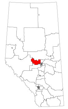 Lac Ste. Anne-Parkland within Alberta (2017 boundaries) | |||
| Provincial electoral district | |||
| Legislature | Legislative Assembly of Alberta | ||
| MLA |
| ||
| District created | 2017 | ||
| First contested | 2019 | ||
| Demographics | |||
| Population (2016)[1] | 46,546 | ||
| Area (km²) | 5,486 | ||
| Pop. density (per km²) | 8.5 | ||
Lac Ste. Anne-Parkland is a future provincial electoral district in Alberta, Canada. The district will be one of 87 districts mandated to return a single member (MLA) to the Legislative Assembly of Alberta using the first past the post method of voting. It will be contested for the first time in the 2019 Alberta election.
Geography
The district is located northwest of Edmonton, containing all of Lac Ste. Anne County and part of Parkland County, taking its name from the two municipal districts. It also contains a portion of Sturgeon County. It includes the Treaty 6 reserves of the Alexander First Nation, the Alexis Nakota Sioux First Nation, and the Paul Band at Wabamun Lake. The main towns and villages are Onoway, Wabamun, Alberta Beach and Mayerthorpe.
History
| Members for Lac Ste. Anne-Parkland | ||||
|---|---|---|---|---|
| Assembly | Years | Member | Party | |
| See Whitecourt-Ste. Anne 1993–2019 | ||||
| 30th | 2019– | To be determined | ||
The district was created in 2017 when the Electoral Boundaries Commission recommended joining most of Whitecourt-Ste. Anne with parts of Barrhead-Morinville-Westlock, Spruce Grove-St. Albert, and Stony Plain in an effort to remove one district from central-western Alberta.[2]
Electoral results
| Redistributed results, Alberta general election, 2015 | ||||
|---|---|---|---|---|
| Party | Votes | % | ||
| New Democratic | 7,775 | 39.49% | ||
| Wildrose | 5,997 | 30.46% | ||
| Progressive Conservative | 5,297 | 26.90% | ||
| Others | 621 | 3.15% | ||
| Alberta general election, 2019 | ||||||||
|---|---|---|---|---|---|---|---|---|
| Party | Candidate | Votes | % | ±% | ||||
| United Conservative | Dale Johnson | |||||||
| Alberta Party | Don McCargar | |||||||
| Total valid votes | ||||||||
| Rejected, spoiled and declined | ||||||||
| Registered electors | ||||||||
| Turnout | ||||||||
References
- ↑ Statistics Canada: 2016
- ↑ Alberta Electoral Boundaries Commission (Oct 2017). "Final Report" (PDF). p. 52. Retrieved 2018-02-01.
 |
Athabasca-Barrhead-Westlock |
| |||||
| West Yellowhead | Morinville-St. Albert | ||||||
| St. Albert | |||||||
| Drayton Valley-Devon | Spruce Grove-Stony Plain | Edmonton-West Henday |