L Taraval

The L Taraval is a Muni Metro line in San Francisco, California, mainly serving the Parkside District.
History
Around 1907, the private United Railroads (URR) opened its Parkside Shuttle line, which split from the #17 line on 20th Avenue and ran along Taraval Street, 33rd Avenue, Vicente Street, and 35th Avenue.[3] This trackage, which saw irregular passenger service, formed a barrier to continued expansion of the city-owned Municipal Railway into the Parkside district. On November 25, 1918, the city and the private URR signed the "Parkside Agreements", which allowed Muni streetcars to use URR trackage on Taraval Street and on Ocean Avenue in exchange for a cash payment and shared maintenance costs.[4]:74
Muni's L Taraval line opened as a shuttle from West Portal to 33rd Avenue (on rebuilt URR trackage west of 20th Avenue) on April 12, 1919. It was extended along Taraval to 48th Avenue at Ocean Beach on January 14, 1923; that October 15, the shuttle service was replaced with larger streetcars running through to downtown.[4]:75 The URR discontinued their Parkside Shuttle in late 1927.[5] The L Taraval was subsequently extended south (turning off Taraval at 46th) to the San Francisco Zoo, the line's current outer terminus, on September 15, 1937.[6] The L was partially converted to modern light rail operation as part of the opening of the Muni Metro system in 1980.[6] While many streetcar lines were converted to buses after World War II, the L Taraval remained a streetcar line due to its use of the Twin Peaks Tunnel.

The L Taraval Rapid project was conceived to increase pedestrian safety and speed up trains. Nine stops will be eliminated, the roadway upon which the track is laid will be repainted as a transit-only lane, and concrete boarding islands will be installed at some stops.[7][8] Preliminary stop elimination occurred on February 25, 2017,[9] though some plans were amended due to community backlash.[10]
The line was temporarily replaced by buses from June 25 to August 24, 2018 due to the Twin Peaks Tunnel shutdown.[11]
Route description
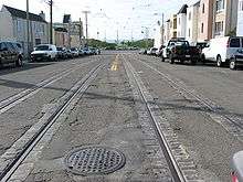
The line runs from the Embarcadero Station in the Financial District to the 46th Avenue and Wawona Street, near the San Francisco Zoo in the Sunset District. The downtown portion of the line runs in the Market Street Subway, which is shared with six other Muni Metro lines. It continues through the much older Twin Peaks Tunnel, shared by the K Ingleside and M Ocean View lines, emerging at West Portal Station. Once out of the tunnel, the L begins street running operation. It takes Ulloa Street to 15th Avenue and then turns west onto Taraval Street. It then follows Taraval to 46th Avenue, where it turns south towards the Zoo. The end of the line loops around Vicente, 47th Avenue and Wawona with the terminal stop on Wawona between 46th and 47th Avenues.
Tracks on Taraval Street extend west from 46th Avenue to 48th Avenue (Great Highway), but they are not used in revenue service. However, chartered streetcars and LRVs can operate there if requested.
The L Taraval line stops at large stations for the downtown section of the route and at smaller stops on the rest of the line. Most of the smaller stops are nothing more than a sign on the side of the street designating a stop and a few others are concrete islands in the middle of the street next to the tracks that provide access for wheelchairs. Muni bus routes provide service to all stations and other systems with access to the stations are noted.
Operation
The L Taraval operates 7 days a week, primarily with train service beginning at 5 a.m. weekdays, 6 a.m. Saturdays and 8 a.m. Sundays and running until 12:30 a.m. Frequency headways range from 7 to 10 minutes during the day, and 15 to 20 during nighttime service. Late-night service is provided by the L Owl diesel bus line. This line is generally the same as the daytime L Taraval line, except it follows surface streets instead of going through the streetcar-only Market Street Subway and Twin Peaks Tunnel. The line begins at Steuart Street and Market Street, near Embarcadero Station, and follows Market past all of the Market Street Subway's seven underground stations served by the daytime L Taraval line. West of Castro Street, it turns south on Market Street, which becomes Portola Drive. It follows Portola between the Diamond Heights neighborhood and Twin Peaks, turns onto Woodside and then Laguna Honda Boulevard, where it loops around at Forest Hill Station. It then backtracks on Laguna Honda Boulevard, Dewey, Claremont and Ulloa to West Portal Station, where it rejoins the daytime L line.
Station and stop listing
inbound to outbound
| Station | Neighborhood | Other Muni Metro Lines |
Notes |
|---|---|---|---|
| Financial District | Inbound terminus Connects to F Market & Wharves and BART; within walking distance of E Embarcadero Serves Ferry Building | ||
| Connects to F Market & Wharves and BART | |||
| Connects to F Market & Wharves and BART | |||
| Civic Center | Connects to F Market & Wharves and BART | ||
| Civic Center and Tenderloin | Connects to F Market & Wharves | ||
| Duboce Triangle | *Connects with J Church on surface stop at 14th Street Connects with F Market & Wharves streetcar | ||
| Castro | |||
| Forest Hill and Laguna Honda | |||
| West Portal | Muni bus: 48, 57, 91 Owl | ||
| Ulloa and Forest Side | Parkside | Muni bus: 48 | |
| Taraval and 15th Avenue | |||
| Taraval and 17th Avenue | Inbound only[9] | ||
| Taraval and 19th Avenue | Muni bus lines: 28, 28R, 91 Owl Intersects with Highway 1 (19th Avenue locally) | ||
| Merged from separate 22nd Avenue and 24th Avenue stops in 2017 | |||
| Taraval and 26th Avenue | |||
| Taraval and 30th Avenue | Muni bus: 66 | ||
| Taraval and 32nd Avenue | |||
| Muni bus: 29 | |||
| Taraval and 40th Avenue | |||
| Taraval and 42nd Avenue | |||
| Taraval and 44th Avenue | |||
| 46th Avenue and Taraval (inbound) Taraval and 46th Avenue (outbound) |
Muni bus: 18 | ||
| 46th Avenue and Ulloa | Muni bus: 18 | ||
| 46th Avenue and Vicente | Muni bus: 18 | ||
| Outbound terminus Serves San Francisco Zoo Muni bus: 18 |
References
- ↑ "TEP Route Data & Proposed Changes". San Francisco Municipal Transportation Agency (SFMTA). 2013. Retrieved 2013-12-15.
- ↑ Demery, Jr., Leroy W. (November 2011). "U.S. Urban Rail Transit Lines Opened From 1980" (PDF). publictransit.us. Archived from the original (pdf) on November 4, 2013. Retrieved November 2, 2013.
- ↑ Chevalier, August (1911). "The "Chevalier" Map of San Francisco" – via David Rumsey Map Collection.
- 1 2 Perles, Anthony (1981). The People's Railway: The History of the Municipal Railway of San Francisco. Interurban Press. ISBN 0916374424.
- ↑ Stindt, Fred A. (October 1990). San Francisco's Century of Street Cars. p. 119. ISBN 0961546514.
- 1 2 McKane, John; Perles, Anthony (1982). Inside Muni: The Properties and Operations of the Municipal Railway of San Francisco. Glendale, CA (US): Interurban Press. p. 195. ISBN 0-916374-49-1.
- ↑ Rodriguez, Joe Fitzgerald (20 September 2016). "SFMTA approves controversial L-Taraval changes in name of safety". San Francisco Examiner. Retrieved 11 February 2017.
- ↑ Rodriguez, Joe Fitzgerald (19 September 2016). "Major L-Taraval changes up for vote Tuesday". San Francisco Examiner. Retrieved 11 February 2017.
- 1 2 "Muni to launch next big shakeup Saturday, changing routes, stops, and more". SF Gate. 23 February 2017. Retrieved 25 February 2017.
- ↑ Rodriguez, Joe Fitzgerald (26 January 2018). "SFMTA no longer plans to remove 17th Avenue Safeway stop". San Francisco Examiner. Retrieved 26 January 2018.
- ↑ "Twin Peaks Tunnel Improvements". San Francisco Municipal Transportation Agency. June 25, 2018. Archived from the original on June 26, 2018.
External links
| Wikimedia Commons has media related to L Taraval. |
- Muni Metro and San Francisco rail map (195KB PDF)
- L Taraval route information from the SF Muni Map Project
| Muni Metro | |||||||
|---|---|---|---|---|---|---|---|
| Muni Metro system features | |||||||
| Heritage streetcar services | |||||||
| Other Muni services | |||||||
| Projects |
| ||||||
| Connecting services | |||||||
| Miscellaneous |
| ||||||