Lázaro Cárdenas, Quintana Roo
| Lázaro Cárdenas | |||
|---|---|---|---|
| Municipality | |||
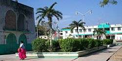 Kantunil Kin central plaza | |||
| |||
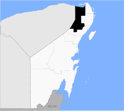 Location of Lázaro Cárdenas in Quintana Roo | |||
|
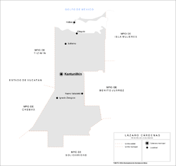
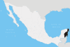
Lázaro Cárdenas Location within Mexico | |||
| Coordinates: 21°06′N 87°29′W / 21.100°N 87.483°WCoordinates: 21°06′N 87°29′W / 21.100°N 87.483°W | |||
| Country | Mexico | ||
| State | Quintana Roo | ||
| Named for | Lázaro Cárdenas | ||
| Municipal seat | Kantunilkín | ||
| Government[1] | |||
| • Municipal President | Clementino Angulo Cupul | ||
| Area | |||
| • Municipality | 3,881 km2 (1,498 sq mi) | ||
| Elevation | 20 m (70 ft) | ||
| Population (2010)[2] | |||
| • Municipality | 25,333 | ||
| • Density | 6.5/km2 (17/sq mi) | ||
| • Urban | 7,150 | ||
| Time zone | UTC-5 (Eastern Standard Time) | ||
| INEGI Code | 23007 | ||
| Website |
www | ||
.png)

Lázaro Cárdenas (Spanish ![]()
It is named after Lázaro Cárdenas del Río who was President of Mexico from 1934 to 1940.
Geography
Like most of the Yucatan Peninsula, Lázaro Cárdenas is entirely flat with a gentle slope towards the sea, so from west to east.
Like the rest of the peninsula's surface, the land has a limestone base that does not allow the formation of surface water flows such as rivers and streams, the water instead forms flows in underground rivers that sometimes rise to the surface in the cenotes. Lakes and cenotes are the major bodies of water in the municipality.
Communities
The municipality is made up of 82 populated localities (localidades), as well as 81 unpopulated localities. The largest localities (cities, towns, and villages) are:[2]
| Name | Population (2010 Census) |
|---|---|
| Kantunilkín | 7,150 |
| Ignacio Zaragoza | 2,213 |
| Holbox | 1,486 |
| Chiquilá | 1,466 |
| Nuevo Valladolid | 1,294 |
| Nuevo Xcán | 1,130 |
| El Tintal | 1,074 |
| San Ángel | 1,041 |
| El Ideal | 818 |
| Solferino | 799 |
| San Francisco | 767 |
| El Cedral | 752 |
| Nuevo Durango | 225 |
| Total municipality | 25,333 |
 Ignacio Zaragoza
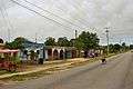 Nuevo Valladolid
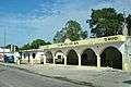 Nuevo X-Can
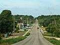 El Tintal
Demographics
| Historical population | ||
|---|---|---|
| Year | Pop. | ±% p.a. |
| 1995 | 18,307 | — |
| 2000 | 20,411 | +2.20% |
| 2005 | 22,434 | +1.91% |
| 2010 | 25,333 | +2.46% |
| Source: INEGI Instituto Nacional de Estadística y Geografía[3] | ||
References
- 1 2 El municipio de Lázaro Cárdenas Archived 2008-02-14 at the Wayback Machine. Official Site.
- 1 2 2010 census tables: INEGI Archived 2013-05-02 at the Wayback Machine.
- ↑ INEGI. Instituto Nacional de Estadística y Geografía. Censo de Población y Vivienda 1995, 2000, 2005, 2010. Archived 2013-09-28 at the Wayback Machine.
| Wikimedia Commons has media related to Lázaro Cárdenas, Quintana Roo. |
Chetumal (capital) | |||||||||||
| Municipalities (seats) |
|  | |||||||||
| Places of interest |
| ||||||||||