Felipe Carrillo Puerto, Quintana Roo
| Felipe Carrillo Puerto | |
|---|---|
 | |
|
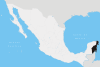
Felipe Carrillo Puerto Location within Mexico | |
| Coordinates: 19°34′43″N 88°02′43″W / 19.57861°N 88.04528°WCoordinates: 19°34′43″N 88°02′43″W / 19.57861°N 88.04528°W | |
| Country | Mexico |
| State | Quintana Roo |
| Municipality | Felipe Carrillo Puerto |
| Named for | Felipe Carrillo Puerto |
| Government | |
| • Municipal President | Gabriel Carballo |
| Elevation | 20 m (70 ft) |
| Population (2010) | |
| • Total | 25,744 |
| Demonym(s) | Carrilloportense |
| Time zone | UTC-5 (Eastern Standard Time) |
| Climate | Aw |
| Website |
www |
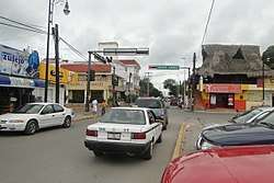
Felipe Carrillo Puerto is the municipal seat and largest city in Felipe Carrillo Puerto Municipality in the Mexican state of Quintana Roo. According to the 2010 census, the city's population was 25,744 persons, mostly of Maya descent.[1]
The city of Felipe Carrillo Puerto was founded in 1850 by independent Maya people during the Caste War of Yucatán under the name Chan Santa Cruz. After it was conquered by Mexican troops in 1901, it was renamed "Santa Cruz del Bravo" before acquiring its present name. The Sian Ka'an Biosphere Reserve lies just east of the city.
Climate
| Climate data for Felipe Carrillo Puerto, Quintana Roo (1951–2010) | |||||||||||||
|---|---|---|---|---|---|---|---|---|---|---|---|---|---|
| Month | Jan | Feb | Mar | Apr | May | Jun | Jul | Aug | Sep | Oct | Nov | Dec | Year |
| Record high °C (°F) | 37.0 (98.6) |
39.0 (102.2) |
42.0 (107.6) |
44.0 (111.2) |
40.5 (104.9) |
40.0 (104) |
39.0 (102.2) |
38.5 (101.3) |
40.0 (104) |
38.0 (100.4) |
37.5 (99.5) |
39.5 (103.1) |
44.0 (111.2) |
| Average high °C (°F) | 28.8 (83.8) |
29.9 (85.8) |
31.7 (89.1) |
33.2 (91.8) |
34.0 (93.2) |
33.1 (91.6) |
33.2 (91.8) |
33.4 (92.1) |
33.0 (91.4) |
31.8 (89.2) |
30.3 (86.5) |
29.0 (84.2) |
31.8 (89.2) |
| Daily mean °C (°F) | 22.9 (73.2) |
23.6 (74.5) |
25.2 (77.4) |
26.7 (80.1) |
28.0 (82.4) |
27.8 (82) |
27.9 (82.2) |
27.8 (82) |
27.7 (81.9) |
26.5 (79.7) |
24.8 (76.6) |
23.3 (73.9) |
26.0 (78.8) |
| Average low °C (°F) | 17.0 (62.6) |
17.2 (63) |
18.7 (65.7) |
20.3 (68.5) |
22.0 (71.6) |
22.5 (72.5) |
22.5 (72.5) |
22.2 (72) |
22.4 (72.3) |
21.2 (70.2) |
19.2 (66.6) |
17.7 (63.9) |
20.2 (68.4) |
| Record low °C (°F) | 4.5 (40.1) |
7.0 (44.6) |
8.0 (46.4) |
6.0 (42.8) |
13.5 (56.3) |
5.0 (41) |
15.5 (59.9) |
6.0 (42.8) |
17.0 (62.6) |
11.5 (52.7) |
9.0 (48.2) |
7.5 (45.5) |
4.5 (40.1) |
| Average precipitation mm (inches) | 54.4 (2.142) |
50.2 (1.976) |
38.5 (1.516) |
40.4 (1.591) |
117.0 (4.606) |
171.8 (6.764) |
150.2 (5.913) |
160.3 (6.311) |
210.4 (8.283) |
170.8 (6.724) |
84.2 (3.315) |
57.0 (2.244) |
1,305.2 (51.386) |
| Average precipitation days (≥ 0.1 mm) | 8.4 | 5.7 | 4.1 | 3.6 | 7.8 | 13.6 | 13.9 | 14.9 | 17.2 | 15.4 | 10.4 | 8.9 | 123.9 |
| Average relative humidity (%) | 76 | 75 | 71 | 69 | 71 | 77 | 76 | 78 | 79 | 80 | 78 | 78 | 76 |
| Mean monthly sunshine hours | 213 | 245 | 273 | 273 | 258 | 215 | 232 | 232 | 196 | 216 | 215 | 201 | 2,769 |
| Source #1: Servicio Meteorológico National (humidity 1981–2000)[2][3][4] | |||||||||||||
| Source #2: Deutscher Wetterdienst (sun, 1961–1990)[5][lower-alpha 1] | |||||||||||||
References
- ↑ 2010 census tables: INEGI Archived May 2, 2013, at the Wayback Machine.
- ↑ "Estado de Quintana Roo–Estacion: Felipe Carrillo Puerto (DGE)". NORMALES CLIMATOLÓGICAS 1951–2010 (in Spanish). Servicio Meteorológico National. Retrieved 7 May 2015.
- ↑ "Extreme Temperatures and Precipitation for Felipe Carrillo Puerto (DGE) 1952–2009" (in Spanish). Servicio Meteorológico Nacional. Retrieved 7 May 2015.
- ↑ "NORMALES CLIMATOLÓGICAS 1981–2000" (PDF) (in Spanish). Servicio Meteorológico Nacional. Retrieved 7 May 2015.
- ↑ "Station 76698 Felipe Carrillo Puerto, Q.ROO". Global station data 1961–1990—Sunshine Duration. Deutscher Wetterdienst. Retrieved 3 May 2015.
Notes
- ↑ Station ID for Felipe Carrillo Puerto, Q.ROO. is 76698 Use this station ID to locate the sunshine duration
External links

Chetumal (capital) | |||||||||||
| Municipalities (seats) |
|  | |||||||||
| Places of interest |
| ||||||||||
This article is issued from
Wikipedia.
The text is licensed under Creative Commons - Attribution - Sharealike.
Additional terms may apply for the media files.