Kunkletown, Pennsylvania
| Kunkletown, Pennsylvania | |
|---|---|
| Unincorporated community | |
 Saint Matthew's Church in Kunkletown | |
 Kunkletown  Kunkletown | |
| Coordinates: 40°50′52″N 75°26′54″W / 40.84778°N 75.44833°W | |
| Country | United States |
| State | Pennsylvania |
| County | Monroe |
| Township | Eldred |
| Elevation[1] | 531 ft (162 m) |
| Time zone | UTC-5 (Eastern (EST)) |
| • Summer (DST) | UTC-4 (EDT) |
| ZIP code | 18058 |
| Area code(s) | (610 Exchange: 381) |
| GNIS feature ID | 1178712[1] |
Kunkletown is an unincorporated community in Eldred Township, Monroe County, Pennsylvania, United States.[1] It is located at an elevation of 531 feet. It is at ZIP Code 18058.
History
An 1845 book is the first published reference to Kunklesville. It says it bore "the name of its proprietor, [and that it] was started about 15 years ago, consisting of seven or eight dwellings, one tavern, one store, a school house, a German Reformed Church and a grist mill."[2] A Stroudsburg, Pennsylvania newspaper referred to it as Kunkletown in December 1846.[3]
Demographics
The population of Kunkletown's ZIP code in the 2010 census was 9,464, of whom 8,924 were Caucasian, 377 were African-American, 499 were Hispanic, 81 were Asian, 77 were Indian, 9 were Hawaiian, and 161 were of other races. The average home value in 2000 was $114,800, and the average household income that year was $44,580.[4]
Notable people
- Gray Morrow, illustrator (lived there at time of death; born in Fort Wayne, Indiana)
References
- 1 2 3 "Kunkletown, Pennsylvania". Geographic Names Information System. United States Geological Survey.
- ↑ Rupp, I. Daniel (1845). History of Northampton, Lehigh, Monroe, Carbon, and Schuylkill Counties. Via Rowland, Bob (August 21, 2004). "The Kunkles in Kunkletown, PA". Ancestry.com. Archived from the original on March 24, 2012. Retrieved March 24, 2012.
- ↑ Rowland
- ↑ "Kunkletown, PA". ZIP-codes.com. Retrieved March 24, 2012.
External links
- "PA Home Town Locator". HTL, Inc. Retrieved March 24, 2012.
- Thomas, Daniel. "Attractions Near Kunkletown, PA". Demand Media via USA Today Travel. Retrieved March 24, 2012.
Municipalities and communities of Monroe County, Pennsylvania, United States | ||
|---|---|---|
| Boroughs | 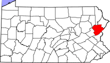 | |
| Townships | ||
| CDPs | ||
| Unincorporated communities |
| |
| Footnotes | ‡This populated place also has portions in an adjacent county | |
Coordinates: 40°50′52″N 75°26′54″W / 40.84778°N 75.44833°W