Middle Smithfield Township, Monroe County, Pennsylvania
| Middle Smithfield Township | |
|---|---|
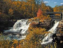 Resica Falls in Middle Smithfield Township | |
.svg.png) Location of Pennsylvania in the United States | |
| Coordinates: 41°05′00″N 74°59′35″W / 41.08333°N 74.99306°WCoordinates: 41°05′00″N 74°59′35″W / 41.08333°N 74.99306°W | |
| Country | United States |
| State | Pennsylvania |
| County | Monroe |
| Area[1] | |
| • Total | 54.23 sq mi (140.46 km2) |
| • Land | 53.16 sq mi (137.68 km2) |
| • Water | 1.07 sq mi (2.78 km2) |
| Elevation | 636 ft (194 m) |
| Population (2010) | |
| • Total | 15,997 |
| • Estimate (2016)[2] | 15,647 |
| • Density | 294.34/sq mi (113.65/km2) |
| Time zone | UTC-5 (EST) |
| • Summer (DST) | UTC-4 (EDT) |
| Area code(s) | 570 |
| FIPS code | 42-089-49080 |
| Website |
www |
Middle Smithfield Township is a township in Monroe County, Pennsylvania, United States. The population was 11,495 at the 2000 census. 2008 population estimates by the United States Census Bureau place the population at 14,900.[3]
History
The Cold Spring Farm Springhouse, John Michael Farm, Schoonover Mountain House, Capt. Jacob Shoemaker House, John Turn Farm, Zion Lutheran Church are located in Delaware Water Gap National Recreation Area at Middle Smithfield Township and listed on the National Register of Historic Places.[4]
Geography
According to the United States Census Bureau, the township has a total area of 54.2 square miles (140.2 km2), of which, 53.1 square miles (137.6 km2) of it is land and 1.0 square miles (2.6 km2) of it (1.88%) is water.
Demographics
| Historical population | |||
|---|---|---|---|
| Census | Pop. | %± | |
| 2000 | 11,495 | — | |
| 2010 | 15,997 | 39.2% | |
| Est. 2016 | 15,647 | [2] | −2.2% |
| U.S. Decennial Census[5] | |||
As of the census[6] of 2000, there were 11,495 people, 3,973 households, and 3,031 families residing in the township. The population density was 216.3 people per square mile (83.5/km2). There were 6,021 housing units at an average density of 113.3/sq mi (43.8/km2). The racial makeup of the township was 85.24% White, 7.66% African American, 0.22% Native American, 1.31% Asian, 0.01% Pacific Islander, 3.18% from other races, and 2.38% from two or more races. Hispanic or Latino of any race were 8.61% of the population.
There were 3,973 households, out of which 42.8% had children under the age of 18 living with them, 63.4% were married couples living together, 7.9% had a female householder with no husband present, and 23.7% were non-families. 17.6% of all households were made up of individuals, and 5.5% had someone living alone who was 65 years of age or older. The average household size was 2.89 and the average family size was 3.29.
In the township the population was spread out, with 30.9% under the age of 18, 6.1% from 18 to 24, 32.3% from 25 to 44, 21.8% from 45 to 64, and 9.0% who were 65 years of age or older. The median age was 36 years. For every 100 females, there were 102.6 males. For every 100 females age 18 and over, there were 98.9 males.
The median income for a household in the township was $50,435, and the median income for a family was $54,821. Males had a median income of $40,852 versus $27,868 for females. The per capita income for the township was $20,235. About 2.8% of families and 4.5% of the population were below the poverty line, including 4.8% of those under age 18 and 6.1% of those age 65 or over.
References
- ↑ "2016 U.S. Gazetteer Files". United States Census Bureau. Retrieved Aug 14, 2017.
- 1 2 "Population and Housing Unit Estimates". Retrieved June 9, 2017.
- ↑ https://www.census.gov/popest/cities/tables/SUB-EST2008-05-42.xls
- ↑ National Park Service (2009-03-13). "National Register Information System". National Register of Historic Places. National Park Service.
- ↑ "Census of Population and Housing". Census.gov. Retrieved June 4, 2016.
- ↑ "American FactFinder". United States Census Bureau. Retrieved 2008-01-31.
External links
Municipalities and communities of Monroe County, Pennsylvania, United States | ||
|---|---|---|
| Boroughs | 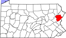 | |
| Townships | ||
| CDPs | ||
| Unincorporated communities |
| |
| Footnotes | ‡This populated place also has portions in an adjacent county | |