Kulamavu Dam
| Kulamavu Dam | |
|---|---|
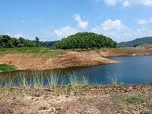 Kulamavu dam reservoir | |
 Location in Kerala 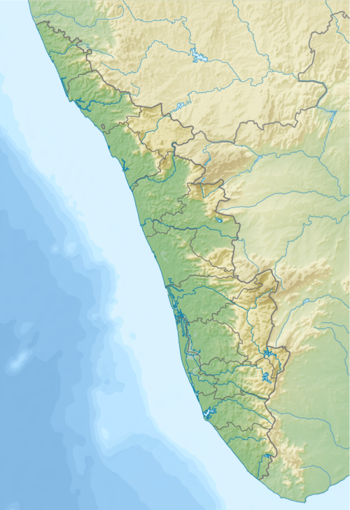 Kulamavu Dam (Kerala)  Kulamavu Dam (Tamil Nadu) | |
| Country | India |
| Location | Kulamavu, Idukki, Kerala |
| Coordinates | 9°48′10.59″N 76°53′46″E / 9.8029417°N 76.89611°ECoordinates: 9°48′10.59″N 76°53′46″E / 9.8029417°N 76.89611°E |
| Purpose | Hydroelectric |
| Status | Operational |
| Construction began | April 30, 1969 |
| Opening date | February 1977 |
| Owner(s) | Kerala State Electricity Board |
| Dam and spillways | |
| Type of dam | Gravity, masonry |
| Impounds | Periyar River |
| Height (foundation) | 100 m (328 ft) |
| Length | 385 m (1,263 ft) |
| Width (crest) | 220 ft (67 m) |
| Dam volume | 620,300 m3 (811,300 cu yd) |
| Spillway type | UG |
| Spillway capacity | 1,600 m3/s (57,000 cu ft/s) |
| Reservoir | |
| Catchment area | 38 km2 |
| Normal elevation | 2,500 ft (760 m) |
| Turbines | 6 x 130 MW Pelton-type |
| Installed capacity | 780 MW |
Kulamavu Dam is a gravity/masonry dam on the Periyar river. It is one of the three dams associated with the Idukki hydro electric power project in the Indian state of Kerala.[1] The dam is situated on the Thodupuzha - Puliyanmala state highway (SH-33), about 23 km (14 mi) from Idukki arch dam, 22 km (14 mi) from Cheruthoni dam and 38 km (24 mi) from Thodupuzha.
The dams of Idukki, Cheruthoni and Kulamavu extend to an area of 33 km². The construction of these three dams formed a 60 km² artificial lake. The water stored in it was used for the production of electricity at the power house in Moolamattom.[2]
See also
References
- ↑ "Dam". Retrieved 2017-05-06.
- ↑ "History of Idukki arch dam" (PDF). manojissacparayan.files.wordpress.com. Retrieved 2016-12-04.
External links
| Wikimedia Commons has media related to Kulamavu dam reservoir. |
This article is issued from
Wikipedia.
The text is licensed under Creative Commons - Attribution - Sharealike.
Additional terms may apply for the media files.