Knox, New York
| Knox | |
|---|---|
| Town | |
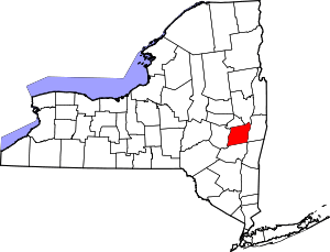
 Location in Albany County and the state of New York. | |
| Coordinates: 42°41′21″N 74°6′10″W / 42.68917°N 74.10278°W | |
| Country | United States |
| State | New York |
| County | Albany |
| Government | |
| • Type | Town Council |
| • Supervisor | Vasilios Lefkaditis (D) |
| • Town Council |
Members' List
|
| Area[1] | |
| • Total | 41.94 sq mi (108.62 km2) |
| • Land | 41.76 sq mi (108.16 km2) |
| • Water | 0.17 sq mi (0.45 km2) |
| Elevation | 1,230 ft (375 m) |
| Population (2010) | |
| • Total | 2,692 |
| • Estimate (2016)[2] | 2,713 |
| • Density | 64.96/sq mi (25.08/km2) |
| Time zone | UTC-5 (Eastern (EST)) |
| • Summer (DST) | UTC-4 (EDT) |
| ZIP code | 12107 |
| Area code(s) | 518 |
| FIPS code | 36-001-40002 |
| GNIS feature ID | 0979122 |
Knox is a town in Albany County, New York, United States. The population was 2,692 at the 2010 census.
The Town is in the northwest part of Albany County and is west of Albany, the state capital.
History
The Town of Knox was established in 1822 from part of the Town of Berne. During the American Revolution loyalties of the inhabitants was split, but the issue was resolved when Tories moved away.
The Knox District School No. 5 was listed on the National Register of Historic Places in 2005.[3]
Geography
According to the United States Census Bureau, the town has a total area of 41.9 square miles (109 km2), of which, 41.8 square miles (108 km2) of it is land and 0.1 square miles (0.26 km2) of it (0.33%) is water.
The west town line is the border of Schoharie County, and the north town line is the border of Schenectady County.
Demographics
| Historical population | |||
|---|---|---|---|
| Census | Pop. | %± | |
| 1830 | 2,189 | — | |
| 1840 | 2,143 | −2.1% | |
| 1850 | 2,021 | −5.7% | |
| 1860 | 2,025 | 0.2% | |
| 1870 | 1,656 | −18.2% | |
| 1880 | 1,694 | 2.3% | |
| 1890 | 1,411 | −16.7% | |
| 1900 | 1,244 | −11.8% | |
| 1910 | 1,007 | −19.1% | |
| 1920 | 975 | −3.2% | |
| 1930 | 863 | −11.5% | |
| 1940 | 960 | 11.2% | |
| 1950 | 1,172 | 22.1% | |
| 1960 | 1,320 | 12.6% | |
| 1970 | 1,819 | 37.8% | |
| 1980 | 2,471 | 35.8% | |
| 1990 | 2,661 | 7.7% | |
| 2000 | 2,647 | −0.5% | |
| 2010 | 2,692 | 1.7% | |
| Est. 2016 | 2,713 | [2] | 0.8% |
| U.S. Decennial Census[4] | |||
As of the census[5] of 2000, there were 2,647 people, 953 households, and 743 families residing in the town. The population density was 63.4 people per square mile (24.5/km²). There were 1,041 housing units at an average density of 24.9 per square mile (9.6/km²). The racial makeup of the town was 97.43% White, 0.76% African American, 0.19% Native American, 0.49% Asian, 0.08% Pacific Islander, 0.08% from other races, and 0.98% from two or more races. Hispanic or Latino of any race were 0.30% of the population.
There were 953 households out of which 39.8% had children under the age of 18 living with them, 65.2% were married couples living together, 8.4% had a female householder with no husband present, and 22.0% were non-families. 16.5% of all households were made up of individuals and 6.3% had someone living alone who was 65 years of age or older. The average household size was 2.78 and the average family size was 3.13.
In the town, the population was spread out with 27.8% under the age of 18, 5.1% from 18 to 24, 30.0% from 25 to 44, 28.2% from 45 to 64, and 8.9% who were 65 years of age or older. The median age was 38 years. For every 100 females, there were 100.5 males. For every 100 females age 18 and over, there were 98.1 males.
The median income for a household in the town was $55,658, and the median income for a family was $63,697. Males had a median income of $39,112 versus $30,054 for females. The per capita income for the town was $22,670. About 3.8% of families and 5.4% of the population were below the poverty line, including 6.6% of those under age 18 and 11.0% of those age 65 or over.
Communities and locations in Knox
- East Township – A hamlet in the northeast part of the town on Route 146.
- Knox (formerly "Knoxville") – The hamlet of Knox is in the south part of the town, located at the junction of State Route 156 (Berne-Altamont Road) and County Road 252 (Knox Cave Road). Beaverdam Creek flows past the hamlet.
- Peoria – A former community on the south town line.
- Thompson Lake – A lake partly in the southeast part of the town.
- West Berne – A hamlet at the town line in the southwest part of the town.
- West Township – A hamlet in the northwest part of the town on Route 146.
References
- ↑ "2016 U.S. Gazetteer Files". United States Census Bureau. Retrieved Jul 4, 2017.
- 1 2 "Population and Housing Unit Estimates". Retrieved June 9, 2017.
- ↑ National Park Service (2009-03-13). "National Register Information System". National Register of Historic Places. National Park Service.
- ↑ "Census of Population and Housing". Census.gov. Archived from the original on May 12, 2015. Retrieved June 4, 2015.
- ↑ "American FactFinder". United States Census Bureau. Retrieved 2008-01-31.
External links
| Wikimedia Commons has media related to Knox, New York. |
- Town Website
- Berne Historical Project has genealogy of Hilltown families including Knox
- Albany Hilltowns is a One-Place Study on the history of the Albany County Hilltowns of Berne, Knox, Westerlo, and Rensselaerville, and the families that lived there.
Coordinates: 42°40′16″N 74°06′56″W / 42.67111°N 74.11556°W