Kino Springs, Arizona
| Kino Springs, Arizona | |
|---|---|
| Census-designated place | |
 Kino Springs, Arizona | |
|
Coordinates: 31°21′47″N 110°48′36″W / 31.36306°N 110.81000°WCoordinates: 31°21′47″N 110°48′36″W / 31.36306°N 110.81000°W[1] | |
| Country | United States |
| State | Arizona |
| County | Santa Cruz |
| Area[2] | |
| • Total | 0.26 sq mi (0.67 km2) |
| • Land | 0.26 sq mi (0.67 km2) |
| • Water | 0.00 sq mi (0.00 km2) |
| Elevation[1] | 3,999 ft (1,219 m) |
| Population (2010) | |
| • Total | 136 |
| • Estimate (2016)[3] | N/A |
| Time zone | UTC-7 (MST (no daylight saving time)) |
| Area code(s) | 520 |
| FIPS code | 04-37935 |
Kino Springs is a census-designated place (CDP) in Santa Cruz County, Arizona, United States. The population was 136 at the 2010 census.[4]
Geography
Kino Springs is located 3 miles (5 km) southeast of Beyerville and 5 miles (8 km) east of Nogales. Kino Springs lies on the western foothills of the Patagonia Mountains with the highest peak, Mount Washington, rising about four miles due east. The Mexican border lies about 1.5 miles to the south.[5]
According to the United States Census Bureau, the CDP has a total area of 0.27 square miles (0.7 km2), all of it land.[4]
Demographics
| Historical population | |||
|---|---|---|---|
| Census | Pop. | %± | |
| U.S. Decennial Census[6] | |||
References
- 1 2
- ↑ "2016 U.S. Gazetteer Files". United States Census Bureau. Retrieved Jul 18, 2017.
- ↑ "Population and Housing Unit Estimates". Retrieved June 9, 2017.
- 1 2 "Geographic Identifiers: 2010 Demographic Profile Data (G001): Kino Springs CDP, Arizona". U.S. Census Bureau, American Factfinder. Retrieved December 4, 2012.
- ↑ Arizona Atlas & Gazetteer, DeLorme, 4th ed. 2001, p. 73 ISBN 0899333257
- ↑ "Census of Population and Housing". Census.gov. Retrieved June 4, 2016.
Municipalities and communities of Santa Cruz County, Arizona, United States | ||
|---|---|---|
| City | 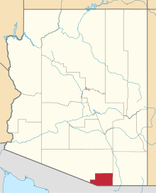 | |
| Town | ||
| CDPs | ||
| Populated places | ||
| Ghost towns | ||
This article is issued from
Wikipedia.
The text is licensed under Creative Commons - Attribution - Sharealike.
Additional terms may apply for the media files.