Beyerville, Arizona
| Beyerville, Arizona | |
|---|---|
| Census-designated place | |
 Beyerville, Arizona | |
| Coordinates: 31°23′25″N 110°52′42″W / 31.39028°N 110.87833°WCoordinates: 31°23′25″N 110°52′42″W / 31.39028°N 110.87833°W[1] | |
| Country | United States |
| State | Arizona |
| County | Santa Cruz |
| Area[2] | |
| • Total | 0.33 sq mi (0.86 km2) |
| • Land | 0.33 sq mi (0.86 km2) |
| • Water | 0.00 sq mi (0.00 km2) |
| Elevation[1] | 3,642 ft (1,110 m) |
| Population (2010) | |
| • Total | 177 |
| • Estimate (2016)[3] | N/A |
| Time zone | UTC-7 (MST (no daylight saving time)) |
| Area code(s) | 520 |
| FIPS code | 04-05970 |
Beyerville is a census-designated place (CDP) in Santa Cruz County, Arizona, United States. The population was 177 at the 2010 census.[4]
Geography
Beyerville is located along the Santa Cruz River. Arizona State Route 82 passes through the community. Nogales lies 4 miles (6 km) to southwest, Patagonia lies 10 miles (16 km) northeast and Sonoita lies 19 miles (31 km) northeast along route 82.[5]
According to the United States Census Bureau, the CDP has a total area of 0.35 square miles (0.9 km2), all of it land.[4]
Demographics
| Historical population | |||
|---|---|---|---|
| Census | Pop. | %± | |
| U.S. Decennial Census[6] | |||
See also
References
- 1 2
- ↑ "2016 U.S. Gazetteer Files". United States Census Bureau. Retrieved Jul 18, 2017.
- ↑ "Population and Housing Unit Estimates". Retrieved June 9, 2017.
- 1 2 "Geographic Identifiers: 2010 Demographic Profile Data (G001): Beyerville CDP, Arizona". U.S. Census Bureau, American Factfinder. Retrieved December 4, 2012.
- ↑ Arizona Atlas & Gazetteer, DeLorme, 4th ed. 2001, p. 73 ISBN 0899333257
- ↑ "Census of Population and Housing". Census.gov. Retrieved June 4, 2016.
Municipalities and communities of Santa Cruz County, Arizona, United States | ||
|---|---|---|
| City | 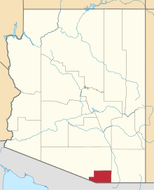 | |
| Town | ||
| CDPs | ||
| Populated places | ||
| Ghost towns | ||
This article is issued from
Wikipedia.
The text is licensed under Creative Commons - Attribution - Sharealike.
Additional terms may apply for the media files.