Khamaneh
| Khameneh خامنه | |
|---|---|
| City | |
 Khameneh | |
| Coordinates: 38°11′36″N 45°37′51″E / 38.19333°N 45.63083°ECoordinates: 38°11′36″N 45°37′51″E / 38.19333°N 45.63083°E | |
| Country |
|
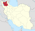
| Province | East Azerbaijan |
| County | Shabestar |
| Bakhsh | Central |
| Population (2016 Census) | |
| • Total | 3,056 [1] |
| Time zone | UTC+3:30 (IRST) |
| • Summer (DST) | UTC+4:30 (IRDT) |
Khamaneh (Persian: خامنه; also Romanized as Khāmeneh, Khamaneh, and Khāmneh; also known as Khumla and Khumna)[2] is a city in the Central District of Shabestar County, East Azerbaijan Province, Iran. At the 2011 census, its population was 2,541, in 812 families.[3]
History
The main industry of Khameneh used to be fabric and wool. Marefat (Nesar) school, the first school in Shabestar area, was built in Khameneh in 1898.
Khameneh used to be the trade heart of the area. The Thursdays fresh market is still very active and popular in this city. Historical bath(Hamam), old plantain, Harati Castle, historical mosques and Mir Panj mosque are the most famous historical buildings and sightseeings in Khameneh.
Notable natives
References
- ↑ https://www.amar.org.ir/english
- ↑ Khamaneh can be found at GEOnet Names Server, at this link, by opening the Advanced Search box, entering "-3070499" in the "Unique Feature Id" form, and clicking on "Search Database".
- ↑ "Census of the Islamic Republic of Iran, 1390 (2011)". Islamic Republic of Iran. Archived from the original (Excel) on 2016-10-06.
| Capital | |||||||||||||||||||||||||||||||||||
|---|---|---|---|---|---|---|---|---|---|---|---|---|---|---|---|---|---|---|---|---|---|---|---|---|---|---|---|---|---|---|---|---|---|---|---|
| Districts |
| ||||||||||||||||||||||||||||||||||
This article is issued from
Wikipedia.
The text is licensed under Creative Commons - Attribution - Sharealike.
Additional terms may apply for the media files.