Keyneton, South Australia
| Keyneton South Australia | |||||||||||||||
|---|---|---|---|---|---|---|---|---|---|---|---|---|---|---|---|
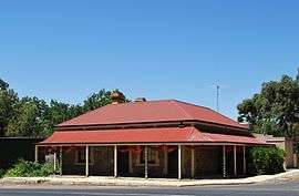 A building in Keyneton | |||||||||||||||
 Keyneton | |||||||||||||||
| Coordinates | 34°33′14″S 139°08′06″E / 34.55389°S 139.13500°ECoordinates: 34°33′14″S 139°08′06″E / 34.55389°S 139.13500°E | ||||||||||||||
| Population | 534 (2011 census)[1] | ||||||||||||||
| Postcode(s) | 5353 | ||||||||||||||
| Location |
| ||||||||||||||
| LGA(s) | Mid Murray Council | ||||||||||||||
| State electorate(s) | Schubert | ||||||||||||||
| Federal Division(s) | Barker | ||||||||||||||
| |||||||||||||||
Keyneton is a locality in South Australia.[2] The town is in the Mid Murray Council local government area, 82 kilometres (51 mi) north-east of the state capital, Adelaide. At the 2011 census, Keyneton and the surrounding area had a population of 534.[1]
The town was named after English pastoralist Joseph Keynes (related to the Keynes Family), who had settled the area in 1842 and whose descendants still live and farm in the area. It is in the Eden Valley wine region.
The historic former North Rhine Mine Engine House in Pine Hut Road and the Bridge Over the River Somme on the Sedan-Angaston Road are listed on the South Australian Heritage Register.[3][4]
References
| Wikimedia Commons has media related to Keyneton, South Australia. |
- 1 2 Australian Bureau of Statistics (31 October 2012). "Keyneton (State Suburb)". 2011 Census QuickStats. Retrieved 2010-02-06.

- ↑ "2905.0 - Statistical Geography: Volume 2 -- Census Geographic Areas, Australia, 2006". Australian Bureau of Statistics. Retrieved 8 December 2009.
- ↑ "Engine House for Direct Acting ('Bull') Pumping Engine, North Rhine Mine". South Australian Heritage Register. Department of Environment, Water and Natural Resources. Retrieved 28 May 2016.
- ↑ "Bridge over the River Somme [Under-strutted Timber]". South Australian Heritage Register. Department of Environment, Water and Natural Resources. Retrieved 28 May 2016.
This article is issued from
Wikipedia.
The text is licensed under Creative Commons - Attribution - Sharealike.
Additional terms may apply for the media files.