Drumconrath

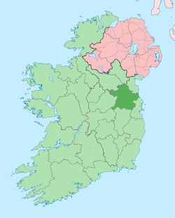
Drumconrath or Drumcondra (historically Drumconra, from Irish: Droim Conrach, meaning "ridge of Conrach")[1] is a small historic village situated in north County Meath, Ireland. The parish borders County Louth and is also close to the borders of Counties Monaghan and Cavan.
The parish has a population of 2,967 while the village itself has 405 people. The area of the parish is 7,566 acres (30.62 km2).[2].
There is evidence of settlement in the area since before 200BC in the ancient pathways and ringforts at Corstown and Drumsilagh. The battle of Ballyhoe (1539AD) between the O'Neills and the English,[3] took place nearby. Of this battle, local folklore says that a treasure was thrown into the lake during the battle and when a true Irish Gael on a white horse comes, he will swoop into the lake and take it.
A movie that was released in October 2016, was filmed in and near the surrounding area of Drumconrath. The name of this movie is "The Wilde Goose Lodge",[4] and a number of local people act in the movie.
Drumconrath was literally "Beyond the Pale" being the first Gaelic Settlement you meet leaving the Pale from Ardee. It was a hostile place for the English who left the safety of the Pale and frequent battles took place in the village.
The remains of a monastery on Church Hill, destroyed because of Henry VIII's Dissolution of the Monastery Act, overlook Lough Braken lake. Here, views of the Mourne Mountains in one direction and the Dublin Mountains in the other can be seen clearly.
During the 1798 rebellion, five parishioners were killed by the Louth Militia for refusing to allow them entry to the Church in the village. The area had strong Ribbonmen support and six men from the area were hanged for their part in the infamous burning of the Wildgoose Lodge Murders nearby.[5] The village kept its nationalist ideals, and many of the local men fought in the Anglo-Irish War and the Civil War with nearby Kingscourt Brigade, the families of the Hickeys and Keenans featuring prominently. It is recorded that this Brigade fired the last shot of the Anglo-Irish War (known locally as the Tan War) at 11:20 on 11 June 1921, twenty minutes after the truce.[6]
Set in forested drumlin countryside and surrounded by small lakes, it is a long-established angling centre with many walking areas. Lough Bracken and the smaller lakes of Corstown and Balrath, and the River Dee are situated in this area.

Village amenities including a doctor's GP practice, a post office, hair salon, pharmacy, butchers, primary school, a grocery store and a B&B within an old store. There are three housing estates bordering the village, De Valera Park on the road to Nobber and Hillside View on the road to Carrickmacross, and 5 houses on the Nobber-Drumconrath road that are now fully developed but recently derelict. The former was built in the early 1970s and the latter during the Celtic Tiger boom era. Night life in the village centres on 3 pubs in the village, The Old Thatch, Fay's Bar and Muldoon's with Muldoon's featuring a large function room for parties and events. There is a large community centre in the village where Saturday night bingo and other activities are held. There is a pitch & putt course to the rear. St. Peter & Paul's National School is situated on the Kingscourt road at the end of the village.[7]
There are two churches in the village. Saint Peter's Church of Ireland (now closed) and Saint Peter & Paul's Catholic Church. There are some burial graves surrounding Saint Peter's Church which are mostly abandoned and overgrown but the village has two other cemeteries on the Ardee road, one Catholic and one Protestant.
The local GAA team, Drumconrath GAA, plays on the local gaa field on the Navan road in Birdhill. Due to lack of players in the younger ages of the teams, the team usually recruits players from the local parish of Meath-hill to form the team "Drumconrath-Meath-Hill".
References
- ↑ Placenames Database of Ireland (see archival records)
- ↑ http://www.drumconrathparish.ie/index.php?option=com_content&task=view&id=476&Itemid=128
- ↑ http://freepages.genealogy.rootsweb.ancestry.com/~callahan/part3.htm
- ↑ https://www.imdb.com/title/tt4985692/
- ↑ "Archived copy". Archived from the original on 19 February 2013. Retrieved 2012-01-05.
- ↑ The Royal Irish Constabulary and the Black and Tans in County Louth 1919-1922 / Stephen O'Donnell
- ↑ http://www.drumconrathns.com/