Mersey River (Nova Scotia)
| Mersey | |
|---|---|
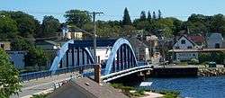 Bridge across the Mersey River at Liverpool | |
| Country | Canada |
| Physical characteristics | |
| Main source | Eleven Mile Lake (Annapolis County) |
| River mouth |
Atlantic Ocean sea level |
| Length | 146 km (91 mi)[1] |
| Basin features | |
| Basin size | 3,030 km2 (1,170 sq mi)[2] |
The Mersey River, formerly known as Rivière Rossignol by the Acadians, is a river in Nova Scotia, Canada. It is named after the River Mersey in Liverpool, England. The river proper flows from the eastern end of Eleven Mile Lake in Annapolis County southward to Kejimkujik Lake in Kejimkujik National Park, then through Lake Rossignol to empty into the Atlantic Ocean at the town of Liverpool, Nova Scotia. The true source of the river however is as far northwest as Sandy Bottom Lake (Annapolis County) or Tuskopeake Brook (Annapolis County) on the northern tributary.
The river was a major transportation route for the Mi'kmaq people of Nova Scotia. Later, it was used to transport logs out of the interior of the province. The river was described in Albert Bigelow Paine's The Tent Dwellers, albeit under the name 'Liverpool river'. There are a number of hydroelectric projects on the river, which has been exploited for more than a hundred years.[3]
Much of the headwater area is composed of fen.[4] It is a popular river for novice canoeists. Smallmouth bass has been found in the Mersey and neighbouring watersheds.[5]
See also
References
- ↑ "Britannica Concise Encyclopedia: Mersey River". Answers dot com. Retrieved 5 October 2012.
- ↑ Natural History of Nova Scotia, Volume 1, Chapter T8 "Freshwater Hydrology", Nova Scotia Museum (1996) p.152
- ↑ Yorston, W.G. (1906). "Water Powers on the Mersey River, N.S" (PDF). Nova Scotian Institute of Science. 11 (Part 4): 651–666. Retrieved 5 October 2012.
- ↑ NS Museum of Natural History. "Theme Regions: 412 Mersey Meadows". Natural History of Nova Scotia. Province of Nova Scotia. Archived from the original on 7 February 2012. Retrieved 5 October 2012.
- ↑ "Monitoring Programs > Invasive Fish Species Monitoring". Clean Annapolis River Project Website. Clean Annapolis River Project. Retrieved 5 October 2012.
Coordinates: 44°2′59.1″N 64°44′20.8″W / 44.049750°N 64.739111°W