Karahunj
| Karahunj | |
|---|---|
| community | |
 Karahunj | |
| Coordinates: 39°28′45″N 46°21′32″E / 39.47917°N 46.35889°ECoordinates: 39°28′45″N 46°21′32″E / 39.47917°N 46.35889°E | |
| Country |
|
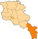
| Province | Syunik |
| Area[1] | |
| • Total | 19.16 km2 (7.40 sq mi) |
| Population (2011) | |
| • Total | 1,365 |
| • Density | 71/km2 (180/sq mi) |
| Time zone | GMT +4 |
| Karahunj at GEOnet Names Server | |
Karahunj (Armenian: Քարահունջ; also Romanized as K’arahunj, Karaundzh, and Karahundj) is a village and rural community (municipality) in Armenia in Syunik province known for archaeological site Zorats Karer, located 4 km south of the city of Goris. The National Statistical Service of the Republic of Armenia (ARMSTAT) reported its population was 1,303 in 2010,[2] up from 1,254 at the 2001 census.[3]
Notable people
- Norair Aslanyan, (1991-) footballer
See also
References
- ↑ "Syunik regional e-Governance System" (in Armenian). Syunik Province provincial government. Click on link entitled "Համայնքներ" (community) and search for the place by Armenian name.
- ↑ "Marzes of the Republic of Armenia and Yerevan City in Figures, 2010" (PDF). National Statistical Service of the Republic of Armenia (ARMSTAT).
- ↑ Report of the results of the 2001 Armenian Census, National Statistical Service of the Republic of Armenia
This article is issued from
Wikipedia.
The text is licensed under Creative Commons - Attribution - Sharealike.
Additional terms may apply for the media files.