Darbas
| Darbas Դարբաս | |
|---|---|
| rural community | |
 Saint Stephen's church in Darbas | |
 Darbas | |
| Coordinates: 39°26′24″N 46°07′20″E / 39.44000°N 46.12222°ECoordinates: 39°26′24″N 46°07′20″E / 39.44000°N 46.12222°E | |
| Country |
|
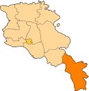
| Marz (Province) | Syunik |
| Area[1] | |
| • Total | 28.09 km2 (10.85 sq mi) |
| Population (2011) | |
| • Total | 556 |
| • Density | 20/km2 (51/sq mi) |
| Time zone | UTC+4 ( ) |
| Darbas at GEOnet Names Server | |
Darbas (Armenian: Դարբաս), is a village and rural community (municipality) in the Syunik Province of Armenia.
In addition to the village of Darbas, the nearby village of Shamb also belongs to the community of Darbas. The distance between Darbas and Shamb is approximately 8 kilometers by road. The 2011 Armenia census reported the population of Darbas as 556, and the population of Shamb as 416.[2] up from 1,141 at the 2001 census.[3] ARMSTAT reported the village's population as 556 at the 2011 census,[4] In the 2001 census, Darbas had a population of 698.[3] There are primary schools and basic health clinics in both Darbas and Shamb. The school and health clinic in Darbas are the largest and most resourced in the Darbas valley.
Saint Stephen's Church of Darbas was opened in 2010.
See also
References
- ↑ "Syunik regional e-Governance System" (in Armenian). Syunik Province provincial government. Click on link entitled "Համայնքներ" (community) and search for the place by Armenian name.
- ↑ "Marzes of the Republic of Armenia and Yerevan City in Figures, 2010" (PDF). National Statistical Service of the Republic of Armenia (ARMSTAT).
- 1 2 Report of the results of the 2001 Armenian Census, National Statistical Service of the Republic of Armenia
- ↑ "Report of the Results of the 2011 Armenian Census" (PDF). National Statistical Service of the Republic of Armenia.