Kapai
| Kapai | |
|---|---|
| Municipality | |
| Municipality of Kapai | |
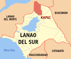 Map of Lanao del Sur with Kapai highlighted | |
.svg.png) Kapai Location within the Philippines | |
| Coordinates: 8°05′N 124°24′E / 8.08°N 124.4°ECoordinates: 8°05′N 124°24′E / 8.08°N 124.4°E | |
| Country |
|
| Region | Autonomous Region in Muslim Mindanao (ARMM) |
| Province | Lanao del Sur |
| District | 1st District |
| Barangays | 20 (see Barangays) |
| Government [1] | |
| • Type | Sangguniang Bayan |
| • Mayor | Hamza E. Gauraki |
| • Electorate | 6,065 voters (2016) |
| Area [2] | |
| • Total | 398.50 km2 (153.86 sq mi) |
| Population (2015 census)[3] | |
| • Total | 18,894 |
| • Density | 47/km2 (120/sq mi) |
| Time zone | UTC+8 (PST) |
| ZIP code | 9709 |
| PSGC | 153610000 |
| IDD : area code | +63 (0)63 |
| Climate type | Tropical climate |
| Income class | 4th municipal income class |
| Revenue (₱) | 95,062,636.00 (2016) |
| Native languages |
Maranao Tagalog |
| Website |
www |
Kapai, officially the Municipality of Kapai, is a 4th class municipality in the province of Lanao del Sur, Philippines. According to the 2015 census, it has a population of 18,894 people.[3]
Barangays
Kapai is politically subdivided into 20 barangays.
- Cormatan
- Dimagaling (Dimagalin Proper)
- Dimunda
- Doronan
- Poblacion (Kapai Proper)
- Malna Proper
- Pagalongan
- Parao
- Kasayanan
- Kasayanan West
- Dilabayan
- Dilimbayan
- Kibolos
- Kining
- Pindolonan
- Babayog
- Gadongan
- Lidasan
- Macadar
- Pantaon
Demographics
| Population census of Kapai | ||
|---|---|---|
| Year | Pop. | ±% p.a. |
| 1918 | 596 | — |
| 1939 | 891 | +1.93% |
| 1948 | 1,476 | +5.77% |
| 1960 | 5,029 | +10.75% |
| 1970 | 5,169 | +0.27% |
| 1975 | 9,243 | +12.36% |
| 1980 | 5,544 | −9.71% |
| 1990 | 11,221 | +7.31% |
| 1995 | 13,310 | +3.25% |
| 2000 | 16,564 | +4.80% |
| 2007 | 18,916 | +1.85% |
| 2010 | 17,370 | −3.06% |
| 2015 | 18,894 | +1.61% |
| Source: Philippine Statistics Authority[3][4][5][6] | ||
References
- ↑ "Municipality". Quezon City, Philippines: Department of the Interior and Local Government. Retrieved 31 May 2013.
- ↑ "Province: Lanao del Sur". PSGC Interactive. Quezon City, Philippines: Philippine Statistics Authority. Retrieved 12 November 2016.
- 1 2 3 Census of Population (2015). "ARMM – Autonomous Region in Muslim Mindanao". Total Population by Province, City, Municipality and Barangay. PSA. Retrieved 20 June 2016.
- ↑ Census of Population and Housing (2010). "ARMM – Autonomous Region in Muslim Mindanao". Total Population by Province, City, Municipality and Barangay. NSO. Retrieved 29 June 2016.
- ↑ Censuses of Population (1903–2007). "ARMM – Autonomous Region in Muslim Mindanao". Table 1. Population Enumerated in Various Censuses by Province/Highly Urbanized City: 1903 to 2007. NSO.
- ↑ "Province of Lanao del Sur". Municipality Population Data. Local Water Utilities Administration Research Division. Retrieved 17 December 2016.
External links
Places adjacent to Kapai | |
|---|---|
This article is issued from
Wikipedia.
The text is licensed under Creative Commons - Attribution - Sharealike.
Additional terms may apply for the media files.