Tagoloan, Lanao del Norte
| Tagoloan | |
|---|---|
| Municipality | |
| Municipality of Tagoloan | |
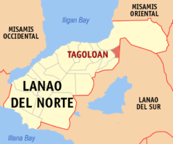 Map of Lanao del Norte with Tagoloan highlighted | |
.svg.png) Tagoloan Location within the Philippines | |
| Coordinates: 8°08′00″N 124°16′00″E / 8.1333333°N 124.2666667°ECoordinates: 8°08′00″N 124°16′00″E / 8.1333333°N 124.2666667°E | |
| Country |
|
| Region | Northern Mindanao (Region X) |
| Province | Lanao del Norte |
| District | 1st District |
| Founded | June 21, 1969 |
| Barangays | 7 (see Barangays) |
| Government [1] | |
| • Type | Sangguniang Bayan |
| • Mayor | Maminta S. Dimakuta |
| • Electorate | 8,592 voters (2016) |
| Area [2] | |
| • Total | 69.70 km2 (26.91 sq mi) |
| Population (2015 census)[3] | |
| • Total | 13,253 |
| • Density | 190/km2 (490/sq mi) |
| Time zone | UTC+8 (PST) |
| ZIP code | 9222 |
| PSGC | 103520000 |
| IDD : area code | +63 (0)63 |
| Climate type | Tropical climate |
| Income class | 5th municipal income class |
| Revenue (₱) | 49,027,775.77 (2016) |
| Native languages |
Maranao Cebuano Binukid Tagalog |
Tagoloan, officially the Municipality of Tagoloan, is a 5th class municipality in the province of Lanao del Norte, Philippines. According to the 2015 census, it has a population of 13,253 people.[3]
History
Republic Act 5822, 21 June 1969: The barrios of Kiasar, Darimbang, Dimayon, Inagongan, Malibato, Dalamas, and Panalawan, all of the Municipality of Baloi, Province of Lanao del Norte, are separated from said municipality and constituted into a distinct and independent municipality, to be known as the Municipality of Tagoloan, same province. The seat of government of the new municipality shall be in the poblacion of Barrio Darimbang.
Barangays
Tagoloan is politically subdivided into 7 barangays.
- Dalamas
- Darimbang
- Dimayon
- Inagongan
- Kiazar (Poblacion)
- Malimbato
- Panalawan
Demographics
| Population census of Tagoloan | ||
|---|---|---|
| Year | Pop. | ±% p.a. |
| 1970 | 5,900 | — |
| 1975 | 5,475 | −1.49% |
| 1980 | 6,058 | +2.04% |
| 1990 | 6,853 | +1.24% |
| 1995 | 8,027 | +3.01% |
| 2000 | 8,233 | +0.54% |
| 2007 | 9,274 | +1.66% |
| 2010 | 11,674 | +8.74% |
| 2015 | 13,253 | +2.44% |
| Source: Philippine Statistics Authority[3][4][5][6] | ||
References
- ↑ "Municipality". Quezon City, Philippines: Department of the Interior and Local Government. Retrieved 31 May 2013.
- ↑ "Province: Lanao del Norte". PSGC Interactive. Quezon City, Philippines: Philippine Statistics Authority. Retrieved 12 November 2016.
- 1 2 3 Census of Population (2015). "Region X (Northern Mindanao)". Total Population by Province, City, Municipality and Barangay. PSA. Retrieved 20 June 2016.
- ↑ Census of Population and Housing (2010). "Region X (Northern Mindanao)". Total Population by Province, City, Municipality and Barangay. NSO. Retrieved 29 June 2016.
- ↑ Censuses of Population (1903–2007). "Region X (Northern Mindanao)". Table 1. Population Enumerated in Various Censuses by Province/Highly Urbanized City: 1903 to 2007. NSO.
- ↑ "Province of Lanao del Norte". Municipality Population Data. Local Water Utilities Administration Research Division. Retrieved 17 December 2016.
External links
- Philippine Standard Geographic Code
- Philippine Census Information
- Local Governance Performance Management System
Places adjacent to Tagoloan, Lanao del Norte | ||||||||||
|---|---|---|---|---|---|---|---|---|---|---|
| ||||||||||
Tubod (capital) | |
| Municipalities | |
| Highly urbanized city |
|
This article is issued from
Wikipedia.
The text is licensed under Creative Commons - Attribution - Sharealike.
Additional terms may apply for the media files.