Binidayan
| Binidayan | |
|---|---|
| Municipality | |
| Municipality of Binidayan | |
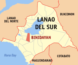 Map of Lanao del Sur with Binidayan highlighted | |
.svg.png) Binidayan Location within the Philippines | |
| Coordinates: 7°48′N 124°10′E / 7.8°N 124.17°ECoordinates: 7°48′N 124°10′E / 7.8°N 124.17°E | |
| Country |
|
| Region | Autonomous Region in Muslim Mindanao (ARMM) |
| Province | Lanao del Sur |
| District | 2nd District |
| Barangays | 26 (see Barangays) |
| Government [1] | |
| • Type | Sangguniang Bayan |
| • Mayor | Abdullah D. Datumulok |
| • Electorate | 7,845 voters (2016) |
| Area [2] | |
| • Total | 280.00 km2 (108.11 sq mi) |
| Population (2015 census)[3] | |
| • Total | 22,079 |
| • Density | 79/km2 (200/sq mi) |
| Time zone | UTC+8 (PST) |
| ZIP code | 9310 |
| PSGC | 153605000 |
| IDD : area code | +63 (0)63 |
| Climate type | Tropical climate |
| Income class | 4th municipal income class |
| Revenue (₱) | 72,669,948.45 (2016) |
| Native languages |
Maranao Tagalog |
Binidayan, officially the Municipality of Binidayan, is a 4th class municipality in the province of Lanao del Sur, Philippines. According to the 2015 census, it has a population of 22,079 people.[3]
Barangays
Binidayan is politically subdivided into 26 barangays.
- Badak
- Baguiangun
- Balut Maito
- Basak
- Bubong Cabasaran
- Bubonga-Ranao
- Dansalan Dacsula
- Ingud
- Kialilidan
- Lumbac
- Macaguiling
- Madaya
- Magonaya
- Maindig
- Masolun
- Bario Olama
- Pagalamatan
- Pantar
- Picalilangan
- Picotaan
- Pindolonan
- Poblacion
- Soldaroro
- Tambac
- Timbangan
- Tuca
Demographics
| Population census of Binidayan | ||
|---|---|---|
| Year | Pop. | ±% p.a. |
| 1918 | 880 | — |
| 1939 | 2,954 | +5.94% |
| 1948 | 6,533 | +9.22% |
| 1960 | 13,881 | +6.48% |
| 1970 | 14,542 | +0.47% |
| 1975 | 13,875 | −0.94% |
| 1980 | 11,680 | −3.38% |
| 1990 | 15,211 | +2.68% |
| 1995 | 16,157 | +1.14% |
| 2000 | 18,081 | +2.44% |
| 2007 | 21,569 | +2.46% |
| 2010 | 19,493 | −3.62% |
| 2015 | 22,079 | +2.40% |
| Source: Philippine Statistics Authority[3] [4] [5] [6] | ||
References
- ↑ "Municipality". Quezon City, Philippines: Department of the Interior and Local Government. Retrieved 31 May 2013.
- ↑ "Province: Lanao del Sur". PSGC Interactive. Quezon City, Philippines: Philippine Statistics Authority. Retrieved 12 November 2016.
- 1 2 3 Census of Population (2015). "ARMM – Autonomous Region in Muslim Mindanao". Total Population by Province, City, Municipality and Barangay. PSA. Retrieved 20 June 2016.
- ↑ Census of Population and Housing (2010). "ARMM – Autonomous Region in Muslim Mindanao". Total Population by Province, City, Municipality and Barangay. NSO. Retrieved 29 June 2016.
- ↑ Censuses of Population (1903–2007). "ARMM – Autonomous Region in Muslim Mindanao". Table 1. Population Enumerated in Various Censuses by Province/Highly Urbanized City: 1903 to 2007. NSO.
- ↑ "Province of Lanao del Sur". Municipality Population Data. Local Water Utilities Administration Research Division. Retrieved 17 December 2016.
External links
- Philippine Standard Geographic Code
- Philippine Census Information
- Local Governance Performance Management System
This article is issued from
Wikipedia.
The text is licensed under Creative Commons - Attribution - Sharealike.
Additional terms may apply for the media files.