Lumbaca-Unayan
| Lumbaca-Unayan | |
|---|---|
| Municipality | |
| Municipality of Lumbaca-Unayan | |
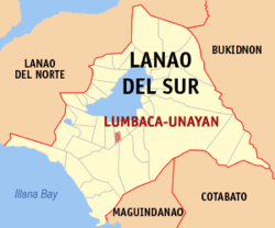 Map of Lanao del Sur with Lumbaca-Unayan highlighted | |
.svg.png) Lumbaca-Unayan Location within the Philippines | |
| Coordinates: 7°46′N 124°15′E / 7.77°N 124.25°ECoordinates: 7°46′N 124°15′E / 7.77°N 124.25°E | |
| Country |
|
| Region | Autonomous Region in Muslim Mindanao (ARMM) |
| Province | Lanao del Sur |
| District | 2nd District |
| Founded | November 27, 2004 |
| Barangays | 9 (see Barangays) |
| Government [1] | |
| • Type | Sangguniang Bayan |
| • Mayor | Somerado Guro |
| • Vice Mayor | Jamalia Dimatunday-Aloyodan |
| • Electorate | 5,583 voters (2016) |
| Area [2] | |
| • Total | 42.28 km2 (16.32 sq mi) |
| Population (2015 census)[3] | |
| • Total | 7,260 |
| • Density | 170/km2 (440/sq mi) |
| Time zone | UTC+8 (PST) |
| ZIP code | 9707 |
| PSGC | 153641000 |
| IDD : area code | +63 (0)63 |
| Climate type | Tropical climate |
| Revenue (₱) | 37,668,765.04 (2016) |
| Native languages |
Maranao Tagalog |
Lumbaca-Unayan, officially the Municipality of Lumbaca-Unayan, is a class municipality in the province of Lanao del Sur, Philippines. According to the 2015 census, it has a population of 7,260 people.[3]
Through the Muslim Mindanao Autonomy Act No. 106, signed by Nur Misuari on November 22, 2000, the new municipality was created from Lumbatan. A positive affirmation was given in a plebiscite on November 27, 2004.
Barangays
Lumbaca-Unayan is politically subdivided into 9 barangays.
- Bangon
- Proper Beta
- Calalon (formerly Ka_alawan)
- Calipapa
- Dapolac (not included)
- Dilausan
- Dimapaok
- Lumbaca-Dilausan
- Pualas (not included)
- Oriental Beta
- Tringun
History
In 2004, nine barangays of Pat ka Apo sa Macadar in Lumbatan were made into Lumbaca-Unayan, a separate municipality among nine Princess of Unayan (e.g.in Meranau terms: 1. Andong sa Macadar 2. Ungklan sa Bita,3. Sana Lumbayanague, 4. Uyoda sa Madamba, 5. Inoda sa Ganassi, 6. Ayor sa Linindingan, 7. inkini sa Tubaran, 8.Togon sa Kadinguilan, 9. Dadauba sa Biabi 10. BOrowa Pagayawan).
Demographics
| Population census of Lumbaca-Unayan | ||
|---|---|---|
| Year | Pop. | ±% p.a. |
| 2007 | 11,766 | — |
| 2010 | 6,279 | −20.43% |
| 2015 | 7,260 | +2.80% |
| Source: Philippine Statistics Authority[3][4][5][6] | ||
References
- ↑ "Municipality". Quezon City, Philippines: Department of the Interior and Local Government. Retrieved 31 May 2013.
- ↑ "Province: Lanao del Sur". PSGC Interactive. Quezon City, Philippines: Philippine Statistics Authority. Retrieved 12 November 2016.
- 1 2 3 Census of Population (2015). "ARMM – Autonomous Region in Muslim Mindanao". Total Population by Province, City, Municipality and Barangay. PSA. Retrieved 20 June 2016.
- ↑ Census of Population and Housing (2010). "ARMM – Autonomous Region in Muslim Mindanao". Total Population by Province, City, Municipality and Barangay. NSO. Retrieved 29 June 2016.
- ↑ Censuses of Population (1903–2007). "ARMM – Autonomous Region in Muslim Mindanao". Table 1. Population Enumerated in Various Censuses by Province/Highly Urbanized City: 1903 to 2007. NSO.
- ↑ "Province of Lanao del Sur". Municipality Population Data. Local Water Utilities Administration Research Division. Retrieved 17 December 2016.
External links
- Philippine Standard Geographic Code
- Philippine Census Information
- Local Governance Performance Management System
Places adjacent to Lumbaca-Unayan | ||||||||||
|---|---|---|---|---|---|---|---|---|---|---|
| ||||||||||