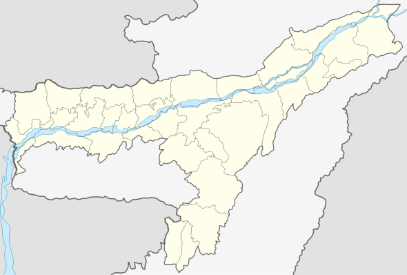
Kamrup Metropolitan district
| Kamrup Metropolitan district | |
|---|---|
 Kamrup Metropolitan district  Kamrup Metropolitan district | |
| Coordinates: 26°11′0″N 91°44′0″E / 26.18333°N 91.73333°ECoordinates: 26°11′0″N 91°44′0″E / 26.18333°N 91.73333°E | |
| Country |
|
| State | Assam |
| Division | Lower Assam |
| Headquarters | Guwahati |
| Area | |
| • Total | 1,527.84 km2 (589.90 sq mi) |
| Population (2011) | |
| • Total | 1,260,419 |
| • Density | 820/km2 (2,100/sq mi) |
| Time zone | UTC+05:30 (IST) |
| ISO 3166 code | IN-AS |
| Website | kamrupmetro.nic.in |
Kamrup Metropolitan is one of the 33 districts in Assam state in north-eastern India. It was carved out of the erstwhile undivided Kamrup district in 2003 and covers an area equivalent to the area under the jurisdiction of the Guwahati Metropolitan Development Authority area. Dispur Legislative Assembly Constituency in Kamrup Metro district with 3.53 lakh voters is the largest constituency in Assam.[1]
History
It was created on 3 February 2003 by bifurcating the erstwhile Kamrup district.[2]
Geography
Administrative headquarters of Kamrup Metropolitan district is at Guwahati city.[3] The district occupies an area of 1527.84 km².
Climate
| Climate data for Guwahati | |||||||||||||
|---|---|---|---|---|---|---|---|---|---|---|---|---|---|
| Month | Jan | Feb | Mar | Apr | May | Jun | Jul | Aug | Sep | Oct | Nov | Dec | Year |
| Record high °C (°F) | 30 (86) |
33 (91) |
38 (100) |
40 (104) |
38 (100) |
40 (104) |
37 (99) |
37 (99) |
37 (99) |
35 (95) |
32 (90) |
28 (82) |
40 (104) |
| Average high °C (°F) | 23 (73) |
25 (77) |
30 (86) |
31 (88) |
31 (88) |
31 (88) |
32 (90) |
32 (90) |
31 (88) |
30 (86) |
27 (81) |
24 (75) |
29 (84) |
| Average low °C (°F) | 10 (50) |
12 (54) |
15 (59) |
20 (68) |
22 (72) |
25 (77) |
25 (77) |
25 (77) |
24 (75) |
21 (70) |
16 (61) |
11 (52) |
19 (66) |
| Record low °C (°F) | 5 (41) |
6 (43) |
6 (43) |
11 (52) |
16 (61) |
18 (64) |
20 (68) |
21 (70) |
20 (68) |
15 (59) |
10 (50) |
5 (41) |
5 (41) |
| Average precipitation mm (inches) | 11.4 (0.449) |
12.8 (0.504) |
57.7 (2.272) |
142.3 (5.602) |
248.0 (9.764) |
350.1 (13.783) |
353.6 (13.921) |
269.9 (10.626) |
166.2 (6.543) |
79.2 (3.118) |
19.4 (0.764) |
5.1 (0.201) |
1,717.7 (67.626) |
| Source: wunderground.com [4] | |||||||||||||
Demographics
According to the 2011 census Kamrup Metropolitan district has a population of 1,260,419,[5] roughly equal to the nation of Estonia[6] or the US state of New Hampshire.[7] This gives it a ranking of 384th in India (out of a total of 640).[5] The district has a population density of 2,010 inhabitants per square kilometre (5,200/sq mi) .[5] Its population growth rate over the decade 2001-2011 was 18.95%.[5] Kamrup Metropolitan has a sex ratio of 922 females for every 1000 males,[5] and a literacy rate of 88.66%.[5]
See also
References
- ↑ "Kamrup(Metro) plan to increase voters' turnout".
- ↑ Law, Gwillim (2011-09-25). "Districts of India". Statoids. Retrieved 2011-10-11.
- ↑ "Home page". Kamrup Metropolitan district website. Retrieved 19 March 2010.
- ↑ "Historical Weather for Delhi, India". Weather Underground. Retrieved 27 November 2008.
- 1 2 3 4 5 6 "District Census 2011". Census2011.co.in. 2011. Retrieved 2011-09-30.
- ↑ US Directorate of Intelligence. "Country Comparison:Population". Retrieved 2011-10-01.
Estonia 1,282,963 July 2011 est.
- ↑ "2010 Resident Population Data". U. S. Census Bureau. Archived from the original on 2011-08-23. Retrieved 2011-09-30.
New Hampshire 1,316,470