Indian meridian
|
Indian meridian | |
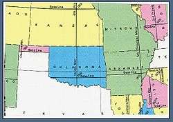 U.S. Bureau of Land Management map showing the principal meridians in Oklahoma. | |
 Initial Point | |
| Location | Davis Vicinity, Garvin County, Oklahoma |
|---|---|
| Coordinates | 34°30′24.44″N 97°14′51.16″W / 34.5067889°N 97.2475444°WCoordinates: 34°30′24.44″N 97°14′51.16″W / 34.5067889°N 97.2475444°W |
| Built | 1870 |
| NRHP reference # | 70000533 [1] |
| Added to NRHP | October 6, 1970 |
The Indian meridian, in longitude 97° 14′ 30″ west from Greenwich, extends from Red River to the south boundary of Kansas, and, with the base line in latitude 34° 30′ north, governs the surveys in Oklahoma east of 100° west longitude from Greenwich (all of Oklahoma except the Oklahoma panhandle).
This line was chosen arbitrarily as part of the land survey of 1870 conducted by E. N. Darling and Thomas H. Barrett, at an arbitrary point about one mile south of Fort Arbuckle (about six miles west of present Davis, Oklahoma). From this initial point, the north-south line was designated as the Indian meridian and the East–West line was designated as the Indian baseline.[2][3]
The Indian Meridian initial point is listed in the National Register of Historic Places with ID #70000533.
See also
References
- ↑ National Park Service (2009-03-13). "National Register Information System". National Register of Historic Places. National Park Service.
- ↑ Everett, Dianna (2009). "Indian Meridian (and Indian Base Line)". Encyclopedia of Oklahoma History and Culture (Citing the 1871 Report of the Commissioner of the General Land Office). Oklahoma Historical Society.
- ↑ "1871 Instructions To The Surveyors General" (PDF). Bureau of Land Management National Training Center. U.S. Department of the Interior. 1871.
Sources
- Raymond, William Galt (1914). Plane Surveying for Use in the Classroom and Field (via Google Books). New York: American Book Company.
External links
- "Cadastral Survey [Indian Meridian]". U.S. Bureau of Land Management. Retrieved 2012-10-04.
- "Principal Meridians and Base Lines". U.S. Bureau of Land Management. Retrieved 2012-10-04.
- "Indian Principal Meridan". Principal Meridian Project. Retrieved 2012-10-04.
- "Indian Meridian". The Center for Land Use Interpretation. Retrieved 2012-10-04.
- "Initial Point of Oklahoma". Oklahoma Society of Land Surveyors. Archived from the original on 2012-11-06. Retrieved 2012-10-07.
- "Oklahoma and Indian Territory". Oklahoma Digital Maps Collection - Russal Brawley Collection. Oklahoma State University. 1892. Retrieved 2012-10-04.