Indian Creek Township, Monroe County, Indiana
| Indian Creek Township | |
|---|---|
| Township | |
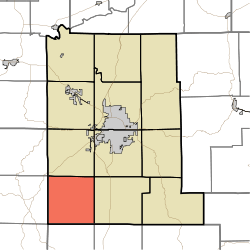 Location in Monroe County | |
| Coordinates: 39°02′12″N 86°38′20″W / 39.03667°N 86.63889°WCoordinates: 39°02′12″N 86°38′20″W / 39.03667°N 86.63889°W | |
| Country |
|
| State |
|
| County | Monroe |
| Government | |
| • Type | Indiana township |
| Area | |
| • Total | 35.1 sq mi (91 km2) |
| • Land | 35.07 sq mi (90.8 km2) |
| • Water | 0.03 sq mi (0.08 km2) 0.09% |
| Elevation[1] | 771 ft (235 m) |
| Population (2010) | |
| • Total | 1,634 |
| • Density | 46.6/sq mi (18.0/km2) |
| Time zone | UTC-5 (Eastern (EST)) |
| • Summer (DST) | UTC-4 (EDT) |
| ZIP codes | 47403, 47462 |
| Area code(s) | 812, 930 |
| GNIS feature ID | 453426 |
Indian Creek Township is one of eleven townships in Monroe County, Indiana, United States. As of the 2010 census, its population was 1,634 and it contained 681 housing units.[2]
History
The John F. and Malissa Koontz House was listed on the National Register of Historic Places in 2014.[3]
Geography
According to the 2010 census, the township has a total area of 35.1 square miles (91 km2), of which 35.07 square miles (90.8 km2) (or 99.91%) is land and 0.03 square miles (0.078 km2) (or 0.09%) is water.[2]
Unincorporated towns
- Buenavista at 39°01′59″N 86°39′20″W / 39.033103°N 86.655556°W
- Kirksville at 39°02′45″N 86°36′47″W / 39.045881°N 86.613054°W
- Victor at 39°03′39″N 86°34′51″W / 39.060881°N 86.580831°W
(This list is based on USGS data and may include former settlements.)
Cemeteries
According to local historical records the township contains 25 cemeteries, some dating back to the late 1830s.[4]
School districts
- Monroe County Community School Corporation
Political districts
- Indiana's 4th congressional district
- State House District 60
- State Senate District 44
References
- "Indian Creek Township, Monroe County, Indiana". Geographic Names Information System. United States Geological Survey. Retrieved 2009-09-27.
- United States Census Bureau 2008 TIGER/Line Shapefiles
- IndianaMap
- ↑ "US Board on Geographic Names". United States Geological Survey. October 25, 2007. Retrieved 2017-05-09.
- 1 2 "Population, Housing Units, Area, and Density: 2010 - County -- County Subdivision and Place -- 2010 Census Summary File 1". United States Census. Retrieved 2013-05-10.
- ↑ "National Register of Historic Places Listings". Weekly List of Actions Taken on Properties: 3/24/14 through 3/28/14. National Park Service. 2014-04-04. Archived from the original on 2015-04-28.
- ↑ Monroe County Cemetery Locator
External links
- Indiana Township Association
- United Township Association of Indiana
- City-Data.com page for Indian Creek Township
Places adjacent to Indian Creek Township, Monroe County, Indiana | |
|---|---|
This article is issued from
Wikipedia.
The text is licensed under Creative Commons - Attribution - Sharealike.
Additional terms may apply for the media files.