Hurricane Bud (2018)
| Category 4 major hurricane (SSHWS/NWS) | |
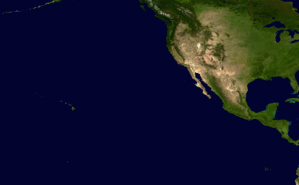
 Hurricane Bud as a Category 3 storm on June 11 | |
| Formed | June 9, 2018 |
|---|---|
| Dissipated | June 16, 2018 |
| (Remnant low after June 15) | |
| Highest winds |
1-minute sustained: 130 mph (215 km/h) |
| Lowest pressure | 948 mbar (hPa); 27.99 inHg |
| Fatalities | None |
| Damage | Unknown |
| Areas affected | Baja California Peninsula, Northwestern Mexico, Southwestern United States (especially Arizona) |
| Part of the 2018 Pacific hurricane season | |
Hurricane Bud was a powerful tropical cyclone that produced heavy rainfall and flash flooding across Northwestern Mexico and the Southwestern United States. Bud originated from a tropical wave that entered the East Pacific late on June 5. The system moved northwest and steadily organized, becoming a tropical depression late on June 9 and Tropical Storm Bud early the next day. Favorable upper-level winds and ample moisture allowed the storm to rapidly intensify to a hurricane late on June 10 and further to a major hurricane on June 11. Bud ultimately peaked the next morning with maximum sustained winds of 130 mph (215 km/h) and a minimum barometric pressure of 948 mbar (hPa; 27.99 inHg). It curved north while rapidly succumbing to the effects of ocean upwelling, making landfall on Baja California Sur as a minimal tropical storm early on June 15. On the next day, land interaction and increasing wind shear caused Bud to degenerate to a remnant low, and Bud dissipated completely on June 16.
Meteorological history

On June 4, the National Hurricane Center (NHC) began advertising the possibility of tropical development well south of Mexico from an area of low pressure that was expected to form over subsequent days.[1] A tropical wave pushed westward across Central America and into the far eastern Pacific late on June 5, accompanied by a disorganized mass of showers and thunderstorms.[2] Despite strong upper-level winds, the disturbance began to slowly organize late on June 7.[3] Deep convection wrapped around the western and southern semicircles of an increasingly defined circulation, prompting the NHC to designate a tropical depression at 21:00 UTC on June 9 while it was positioned about 365 miles (590 km) south of Zihuatanejo, Guerrero.[4] As wind shear decreased, upper-level outflow improved and the newly-formed cyclone coalesced several bands of intense convection; it intensified into Tropical Storm Bud six hours after formation.[5]
With a mid-level ridge positioned across much of Mexico, Bud travelled generally northwestward for the next several days. The storm's cloud pattern organized into a central dense overcast early on June 10,[6] and microwave imagery showcased the formation of a mid-level eye. Amid favorable environmental conditions, the NHC noted rapid intensification as a distinct possibility, especially as the inner core improved in structure.[7] By 21:00 UTC on June 10, a ragged eye became apparent intermittently on visible satellite imagery, and Bud was upgraded to a Category 1 hurricane accordingly.[8] An abrupt period of intensification quickly brought the cyclone to Category 2 strength by 06:00 UTC the next morning,[9] but this process temporarily levelled off as the eye became less distinct.[10] Bud ultimately attained Category 3 intensity by 12:00 UTC.[11] Thereafter, the ring of eyewall convection and the temperature of the storm's eye fluctuated in strength.[12] After maintaining a clear eye for several hours, Bud attained its peak intensity as a Category 4 major hurricane on the Saffir-Simpson hurricane wind scale, with winds of 130 mph (215 km/h) and a minimum barometric pressure of 948 mbar (hPa; 27.99 inHg), at 06:00 UTC on June 12.[13]

Despite exhibiting trochoidal oscillations as is typical for major hurricanes, Bud continued to move generally north-northwestward after peak. Progressively cooler water and ocean heat content values near zero resulted in significant ocean upwelling underneath the cyclone, leading to a rapid reduction in central convection. Bud weakened back to a Category 3 hurricane at 15:00 UTC on June 12,[14] and then fell further to Category 1 intensity by 03:00 UTC on June 13 as its eye disappeared.[15] After falling to a tropical storm at 12:00 UTC that same day, the cyclone levelled off in strength somewhat as the ocean upwelling beneath it abated.[16] Bud made landfall near Cabo San Lucas shortly after 03:00 UTC on June 15, with winds of 40 mph (65 km/h),[17] before progressing into the Gulf of California. Strong wind shear and land interaction reduced the storm to a tropical depression at 15:00 UTC,[18] and six hours later, to a remnant low while southwest of mainland Mexico.[19] On June 16, Bud's remnant low dissipated.
Preparations and impact
Mexico

As Bud strengthened off the coast of Mexico, the government of Mexico issued a tropical storm watch from Manzanillo to Cabo Corrientes, at 21:00 UTC on June 10, with the possibility that Bud's large wind field could bring gale-force winds to that portion of the Mexican coast.[8] The watch was later discontinued at 21:00 UTC on June 11 as Bud began to move away from the area.[20] Later on, as Bud was anticipated to make landfall on the Baja California Peninsula as a tropical storm, tropical storm warnings were issued for much of southern Baja California Sur on June 13, including the cities of La Paz and Cabo San Lucas.[21] As Bud neared landfall, new tropical storm watches were issued for La Paz to San Evaristo, as well as from Altata to Huatabampo on the mainland.[22] An orange alert was also instated for the popular tourist destination of Los Cabos Municipality, where roughly 21,000 tourists were residing during the storm.[23] These watches and warnings were progressively discontinued as Bud moved further into the Gulf of California and weakened to a tropical depression on June 15.[24][25]
Tropical Storm Bud made landfall near Cabo San Lucas just after 03:00 UTC on June 15 with maximum sustained winds of 40 mph (65 km/h),[17] bringing heavy rains and gusty winds to the southern Baja California Peninsula.[26] A weather station in Cabo San Lucas recorded sustained winds of 39 mph (63 km/h) and a gust to 47 mph (76 km/h).[27] Another station recorded a gust to 66 mph (106 km/h).[26] Schools within Los Cabos Municipality were closed, and ten flights at Los Cabos International Airport were cancelled,[23] though the airport resumed normal operations soon after.[28] Ports in the municipality were also closed beginning June 13. Overall, damage was expected to be significantly less than that wrought by Hurricane Odile four years prior.[28]
United States
The remnants of Bud sent a plume of moisture into the Southwestern United States, bringing much needed rainfall to the drought-stricken region. Tucson, Arizona reported its first precipitation since February 28, with 0.17 in (4.3 mm) of rain on June 15. Flash flood watches were issued for parts of Arizona, New Mexico, and southwestern Colorado.[29]
See also
- Other tropical cyclones of the same name
- List of Category 4 Pacific hurricanes
- List of Baja California hurricanes
- Hurricane Blanca (2015)
- Hurricane Rosa (2018) - A category 4 hurricane later in the season that has taken a similar path
References
- ↑ John P. Cangialosi (June 4, 2018). "Graphical Tropical Weather Outlook". National Hurricane Center. Retrieved June 9, 2018.
- ↑ Robbie Berg (June 5, 2018). "Graphical Tropical Weather Outlook". National Hurricane Center. Retrieved June 9, 2018.
- ↑ John L. Beven II (June 7, 2018). "Graphical Tropical Weather Outlook". National Hurricane Center. Retrieved June 13, 2018.
- ↑ David A. Zelinsky (June 9, 2018). Tropical Depression Three-E Discussion Number 1 (Report). Miami, Florida: National Hurricane Center. Retrieved June 13, 2018.
- ↑ Lixion A. Avila (June 9, 2018). Tropical Storm Bud Discussion Number 2 (Report). Miami, Florida: National Hurricane Center. Retrieved June 13, 2018.
- ↑ Richard J. Pasch (June 10, 2018). Tropical Storm Bud Discussion Number 3 (Report). Miami, Florida: National Hurricane Center. Retrieved June 13, 2018.
- ↑ Lixion A. Avila (June 10, 2018). Tropical Storm Bud Discussion Number 4 (Report). Miami, Florida: National Hurricane Center. Retrieved June 13, 2018.
- 1 2 Lixion A. Avila (June 10, 2018). Hurricane Bud Discussion Number 5 (Report). Miami, Florida: National Hurricane Center. Retrieved June 13, 2018.
- ↑ Richard J. Pasch (June 11, 2018). Hurricane Bud Intermediate Advisory Number 6A (Report). Miami, Florida: National Hurricane Center. Retrieved June 13, 2018.
- ↑ Richard J. Pasch (June 11, 2018). Hurricane Bud Discussion Number 7 (Report). Miami, Florida: National Hurricane Center. Retrieved June 13, 2018.
- ↑ Lixion A. Avila (June 11, 2018). Hurricane Bud Intermediate Advisory Number 7A (Report). Miami, Florida: National Hurricane Center. Retrieved June 13, 2018.
- ↑ Lixion A. Avila (June 11, 2018). Hurricane Bud Discussion Number 8 (Report). Miami, Florida: National Hurricane Center. Retrieved June 13, 2018.
- ↑ Richard J. Pasch (June 12, 2018). Hurricane Bud Discussion Number 11 (Report). Miami, Florida: National Hurricane Center. Retrieved June 13, 2018.
- ↑ Stacy R. Stewart (June 12, 2018). Hurricane Bud Discussion Number 12 (Report). Miami, Florida: National Hurricane Center. Retrieved June 13, 2018.
- ↑ Robbie J. Berg (June 13, 2018). Hurricane Bud Discussion Number 14 (Report). Miami, Florida: National Hurricane Center. Retrieved June 13, 2018.
- ↑ Stacy R. Stewart (June 13, 2018). Tropical Storm Bud Discussion Number 16 (Report). Miami, Florida: National Hurricane Center. Retrieved June 15, 2018.
- 1 2 John P. Cangialosi; Andrew Latto (June 14, 2018). Tropical Storm Bud Advisory Number 22 (Report). Miami, Florida: National Hurricane Center. Retrieved June 15, 2018.
- ↑ Michael J. Brennan (June 15, 2018). Tropical Depression Bud Discussion Number 24 (Report). Miami, Florida: National Hurricane Center. Retrieved June 15, 2018.
- ↑ Michael J. Brennan (June 13, 2018). Post-Tropical Cyclone Bud Discussion Number 25 (Report). Miami, Florida: National Hurricane Center. Retrieved June 15, 2018.
- ↑ Lixion A. Avila (June 11, 2018). Hurricane Bud Advisory Number 9 (Report). Miami, Florida: National Hurricane Center. Retrieved June 18, 2018.
- ↑ Stacy R. Stewart (June 13, 2018). Tropical Storm Bud Advisory Number 16 (Report). Miami, Florida: National Hurricane Center. Retrieved June 18, 2018.
- ↑ Stacy R. Stewart (June 14, 2018). Tropical Storm Bud Advisory Number 21 (Report). Miami, Florida: National Hurricane Center. Retrieved June 18, 2018.
- 1 2 "Mexico declares 'orange alert' as Tropical Storm Bud buffets Baja resort area". The Japan Times. Agence France-Presse. June 15, 2018. Retrieved June 18, 2018.
- ↑ Lixion A. Avila (June 15, 2018). Tropical Storm Bud Advisory Number 23 (Report). Miami, Florida: National Hurricane Center. Retrieved June 18, 2018.
- ↑ Michael J. Brennan (June 15, 2018). Tropical Depression Bud Advisory Number 24 (Report). Miami, Florida: National Hurricane Center. Retrieved June 18, 2018.
- 1 2 "Tropical Storm Bud Is Lashing Southern Baja California Peninsula, Including Los Cabos, Mexico, With Gusty Winds, Rain and High Surf". Weather Underground. June 14, 2018. Retrieved June 18, 2018.
- ↑ Stacy R. Stewart (June 14, 2018). Tropical Storm Bud Discussion Number 21 (Report). Miami, Florida: National Hurricane Center. Retrieved June 18, 2018.
- 1 2 Williams, Juliet (June 15, 2018). "Strong winds from Tropical Storm Bud hit Mexico's Los Cabos". Associated Press. Retrieved June 18, 2018.
- ↑ Donegan, Brian (June 16, 2018). "Moisture From the Remnants of Bud Is Spreading Needed-Rainfall Into the Southwest". Weather Undeground. Retrieved June 18, 2018.
External links
| Wikimedia Commons has media related to Hurricane Bud (2018). |
- The National Hurricane Center's advisory archive on Hurricane Bud
Tropical cyclones of the 2018 Pacific hurricane season | ||
|---|---|---|
 | ||
| ||