Howwood
Howwood
| |
|---|---|
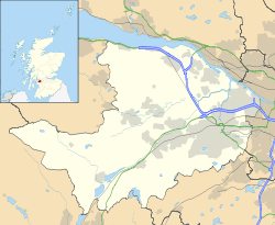 Howwood Howwood shown within Renfrewshire | |
| Population | 1,502 [1] |
| OS grid reference | NS397602 |
| Council area | |
| Lieutenancy area | |
| Country | Scotland |
| Sovereign state | United Kingdom |
| Post town | JOHNSTONE |
| Postcode district | PA9 |
| Dialling code | 01505 |
| Police | Scottish |
| Fire | Scottish |
| Ambulance | Scottish |
| EU Parliament | Scotland |
| UK Parliament | |
| Scottish Parliament | |
Howwood (Scots: The Howewuid,[2] Scottish Gaelic: Coille an Dail)[3] is a village in Renfrewshire, Scotland. It is between Johnstone and Lochwinnoch, just off the A737 dual carriageway between the nearby town of Paisley and the Ayrshire border. It is served by Howwood railway station. Its name is listed in the late 19th century Ordnance Gazetteer of Scotland (see: Gazetteer for Scotland) as "Howwood or Hollow-wood",[4] demonstrating the probable origins of its name.
History
Historically part of the civil parish of Lochwinnoch, it now supports its own Community Council.[5]
The chief industry in the village was formerly bleaching and the finishing of cotton cloth and thread, particularly from the mills of Paisley and the other Renfrewshire villages. Two main bleaching works existed at Bowfield and Midtownfield, the former being the last to close in the 1960s.[6]
Overlooking the village on Kenmure Hill is the Temple, a circular folly built around 1760 and whose purpose is unknown. [7] In the hills above Howwood also lie the remains of Elliston Castle, a tower house once home to the Semple family.[6] A battle took place between Government forces and Covenanters at Muirdykes on the 18 June 1685, led by the Cochrane family of Johnstone [8] The Iron Age hillfort of Walls Hill lies on Whittliemuir with the Walls Loch lying to the west of it.
References
- ↑ Renfrewshire Community Website - Howwood
- ↑ The Online Scots Dictionary
- ↑ List of railway station names in English, Scots and Gaelic – NewsNetScotland Archived 2013-01-22 at the Wayback Machine.
- ↑ Hodges, Holburn Head, Holehouse, Holekettle or Kettle Bridge, Holl, Holland, Hollandbush, Hollows, Hollow-Wood or Howwood, Hollybush, Hollylee, Holm, Holmains, Holme or Holme Rose, Holms Water, Holybush, Holydean Castle, Holy Isle
- ↑ Howwood Community Council
- 1 2 http://www.renfrewshire.gov.uk/ilwwcm/publishing.nsf/Content/Navigation-els-Howwood(OurHistoryandHeritage)Homepage
- ↑ http://www.howwood.com/history.php
- ↑ http://www.howwood.com/history.php
External links
| Wikimedia Commons has media related to Howwood. |