Hopkins, South Carolina
| Hopkins, South Carolina | |
|---|---|
| Census-designated place | |
 Location in Richland County and the state of South Carolina. | |
| Coordinates: 33°54′20″N 80°52′36″W / 33.90556°N 80.87667°WCoordinates: 33°54′20″N 80°52′36″W / 33.90556°N 80.87667°W | |
| Country | United States |
| State | South Carolina |
| County | Richland |
| Area | |
| • Total | 16.5 sq mi (42.8 km2) |
| • Land | 16.5 sq mi (42.8 km2) |
| • Water | 0.04 sq mi (0.1 km2) |
| Elevation | 170 ft (50 m) |
| Population (2010) | |
| • Total | 2,882 |
| • Density | 170/sq mi (67/km2) |
| Time zone | UTC-5 (Eastern (EST)) |
| • Summer (DST) | UTC-4 (EDT) |
| ZIP code | 29061 |
| FIPS code | 45-34990[1] |
| GNIS feature ID | 1246059[2] |
Hopkins is a census-designated place (CDP) in Richland County, South Carolina, United States, that was founded circa 1836 and named after John Hopkins. It is located 11 miles (18 km) southeast of downtown Columbia and is part of the Columbia Metropolitan Statistical Area. As of the 2010 census, the population of the Hopkins CDP was 2,882.[3]
Attractions
Hopkins is 6 miles (10 km) northwest of South Carolina's only national park, Congaree National Park, which is located off Bluff Road west of Gadsden. The Congaree National Park has contiguously preserved the largest tract of old-growth bottomland hardwood forest in the United States, and contains one of the tallest deciduous forests in the world. It has 27,000-acre (110 km2) of land and water. The park was designated an international Biosphere, a Globally Important Bird Area, and a National Natural Landmark. While in the park one can hike, backpack, camp, canoe, fish, birdwatch, and study nature.
Education
Richland County School District One operates public schools serving Hopkins.[4][5] Residents are zoned to Hopkins Elementary School, Horrell Hill Elementary School, Hopkins Middle School, Southeast Middle School, and Lower Richland High School.[6]
Notable people
- Joseph Neal, South Carolina state legislator, was born in Hopkins.[7]
- A'ja Wilson, basketball player for 2017 NCAA champion South Carolina, was born in Hopkins.
References
- ↑ "American FactFinder". United States Census Bureau. Retrieved 2008-01-31.
- ↑ "US Board on Geographic Names". United States Geological Survey. 2007-10-25. Retrieved 2008-01-31.
- ↑ "Geographic Identifiers: 2010 Demographic Profile Data (G001): Hopkins CDP, South Carolina". U.S. Census Bureau, American Factfinder. Retrieved January 14, 2013.
- ↑ "2010 CENSUS - CENSUS BLOCK MAP: Hopkins CDP, SC." U.S. Census Bureau. Retrieved on December 11, 2016.
- ↑ Home page. Lower Richland High School. Retrieved on December 11, 2016. "Address 2615 Lower Richland Boulevard, Hopkins, SC 29061"
- ↑ "RichlandOneSCPlotMaps150323.pdf." Richland County School District One. Retrieved on December 10, 2016.
- ↑ Votesmart.org.-Joseph Neal
External links
- Hopkins, SC, at ePodunk
- Congaree National Park
Municipalities and communities of Richland County, South Carolina, United States | ||
|---|---|---|
| Cities | 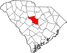 | |
| Towns | ||
| CDPs | ||
| Unincorporated communities | ||
| Footnotes | ‡This populated place also has portions in an adjacent county or counties | |