Ballentine, South Carolina
| Ballentine, South Carolina | |
|---|---|
| Country | United States |
| State | South Carolina |
| County | Richland |
| Area | |
| • Land | 2.2 sq mi (5.6 km2) |
| Time zone | UTC-5 (EST) |
| • Summer (DST) | UTC-4 (EDT) |
Ballentine (which includes Lake Murray of Richland, South Carolina) is the 13th wealthiest town in South Carolina, an unincorporated community in Richland County, South Carolina, United States. It is part of the Columbia, South Carolina metropolitan area.
The town was recently in the planning stages of being incorporated. Ballentine would be the seventh incorporated community in Richland County if it were to be incorporated. It would be the first created in the area since Arcadia Lakes was formed in 1959, according to the Municipal Association of South Carolina. The town would have had a population of about 2,500 people; however, the recent vote for incorporation was not successful.[1] The town's desire to incorporate was partially driven by the encroachment of nearby Irmo.
Ballentine is located on Lake Murray, a large reservoir formed in the 1930s by the Dreher Shoals Dam, which at the time was the largest earthen dam in the world. Ballentine refers to itself on the signs leading into town as "The Gateway To Lake Murray". The community experienced much growth during the late 20th century, sparked by the combination of its lakefront location and its proximity to the city of Columbia (via I-26). In the 21st century, Ballentine has been transformed by the addition of several significant subdivisions (Milford Park, Cedar Mill, Aderley), Liberty Tap Room on the Lake restaurant, Plex ice rink and trampoline park, intensive commercial development along Highway 76 (Walmart shopping center, YMCA, Chick-fil-A), Gateway Baptist Church, a brand new large library, and Ballentine Elementary school in Lexington & Richland County School District Five. Students from Ballentine Elementary go on to Dutch Fork High School, though some students in Ballentine are zoned for Chapin High School. The South Carolina United FC youth soccer club plays at the BB&T Soccer Complex behind Ballentine Park.
The John Jacob Calhoun Koon Farmstead was added to the National Register of Historic Places in 1986.[2]
References
- ↑ http://www.thestate.com/local/story/423849.html
- ↑ National Park Service (2010-07-09). "National Register Information System". National Register of Historic Places. National Park Service.
Municipalities and communities of Richland County, South Carolina, United States | ||
|---|---|---|
| Cities | 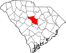 | |
| Towns | ||
| CDPs | ||
| Unincorporated communities | ||
| Footnotes | ‡This populated place also has portions in an adjacent county or counties | |
Coordinates: 34°07′28″N 81°14′14″W / 34.12444°N 81.23722°W