Lists of mountains and hills in the British Isles
The mountains and hills of the British Isles, are categorised into lists based on elevation (or "height"), prominance (or "relative height", or "drop"), and other criteria (e.g. isolation). These lists are used for peak bagging, whereby hillwalkers attempt to reach all the summits on a list, the oldest and best-known, being the 282 § Munros in Scotland, which amongst other criteria, must be above 3,000 feet (914.4 m).
A height above 2,000 ft, or more latterly 600 m, is considered necessary to be a "mountain" in the British Isles, and apart from the Munros (who favour isolation), all lists require a prominence of at least 15 metres (49.21 ft). A prominence of between 15–30 metres (49.21–98.43 ft) (e.g. some § Nuttalls and § Vandeleur-Lynams), does not meet the UIAA definition of an "independent" peak. Most lists consider a prominence between 30–150 metres (98.43–492.1 ft) as a "top", and not a mountain (e.g. many § Hewitts and § Simms). A popular designation are the § Marilyns, with a prominence above 150 metres (492.1 ft). Prominences above 600 metres (1,969 ft), are the § P600 (the "Majors"), the international classification of a "major" mountain.
General concepts
Elevation
There is no worldwide consensus on the definition of "mountain", but in Great Britain and Ireland it is often taken to be any summit at least 2,000 feet (or 610 metres) high (also called elevation).[1][2][3][4][5] The UK government defines mountain as land over 600 metres (1,969 ft) for the purposes of freedom of access.[6]
Prominence
In addition, all British Isles definitions, with the exception of definitions that rely on § Isolation, include a minimum topographical prominence requirement (also called relative height, or drop, or re-ascent, between neighbouring peaks), which is typically 30–600 m (98–1,969 ft).[3] The lowest minimum prominence is 15 metres (49.21 ft), the Nuttalls and Vandeleur-Lynams, however most definitions do not consider prominences below 30 metres (98.43 ft). Many definitions use the term Tops to refer to the sub-class of peaks that do not meet a 150 metres (492.1 ft) prominence threshold for the main definition, but have a prominence of between 30–150 metres (98.43–492.1 ft). Some definitions ignore height completely and just focus purely on prominence (e.g. P600s, Marilyns, and HuMPs).
Prominence requirements are even strongly debated regarding UIAA classification of major Himalayan mountains.[7][8] In 1994, regarding classification of summits, the UIAA stated that for a "peak" to be independent (e.g. not a sub-peak of a mountain), it needed a prominence over 30 m, and in addition, a "mountain" had to have a prominence over 300 m.[9]
Unlike the single measurement of elevation, prominence requires the detailed measurement of all contours around the peak, and is therefore subject to change and revision over time, and thus tables based on prominence are subject to revision.[10] Some definitions use an imperial measurement for height, but a metric measurement for the topological prominence (e.g. Murdos, Hewitts and Nuttals).
Isolation
No definition of a British Isles mountain or hill uses an explicit quantitative metric of topographic isolation (e.g. distance to the next point of equal height), however, the concept of isolation is embedded in the qualitative definition of a Scottish Munro, from the Scottish Mountaineering Club requirement of "sufficient separation" (instead of prominence).[11]
Cultural
Mountains in Scotland are frequently referred to as "hills" no matter what their height, as reflected in names such as the Cuillin Hills and the Torridon Hills.
Database of British and Irish Hills
The Database of British and Irish Hills (DoBIH) was created in 2001 "with the intention of providing a comprehensive, up-to-date resource for British hillwalkers".[12][13][14] It is now maintained by a team of eight editors, and is described by the Long Distance Walkers Association as "now the most reliable online source for all Registers" (ie all lists of summits attained).[15] The DoBIH has been used as the source by several important books on mountain classification in the British Isles, including Mark Jackson's 2010 book on HuMPS and TuMPS, titled "More Relative Hills of Britain".[16]
DoBIH is available as a downloadable database[13] or in an online version under the title Hill Bagging.[lower-alpha 1][18] As of August 2018 the database included 20,859 hills, including all Marilyns, Humps, Tumps, Simms, Dodds, Munros and Tops, Corbetts and Tops, Grahams and Tops, Donalds and Tops, Furths, Hewitts, Nuttalls, Buxton & Lewis, Bridges, Murdos, Deweys, Donald Deweys, Highland Fives, Wainwrights, Birketts, Synges, Fellrangers, County tops, SIBs (Significant Islands of Britain), Dillons, Arderins, Vandeleur-Lynams, Myrddyn Deweys, Carns and Binnions, "with subs and deletions".[19]
Since 2012, the DoBIH has a data-sharing agreement with the Irish online database of mountains and hills, called MountainViews, and they use each other's data.[12]
British Isles
P600 (the "Majors")
(any height, prominence 600 m)
The P600s are mountains in the British Isles that have a topographical prominence of at least 600 metres (1,969 feet), regardless of absolute height or other merits. The list was also developed by Alan Dawson in 2004 (creator of the Marilyn list), and refined in 2004 and 2006.[20] Dawson initially used a 2,000 ft metric (or 610 m, the P610s), and called his list the "Majors", as it is one of the shortest of the noted lists of mountains in the British Islands, and one of the most testing requirements. The term "Major" is often used by others when listing the P600 peaks.[21][22][23] There are 95 P600s in Great Britain: 81 in Scotland, 4 in England, 8 in Wales, 1 in the North of Ireland, and 1 on the Isle of Man.[20] There are 25 P600s in Ireland,[20] bringing the total number of P600 mountains in the British Isles to 120.
The British Isle P600s, contain 54 of the 282 Scottish Munros, and 10 of the 34 Non-Scottish Munros, which are also called § Furths; these 64 British Isles mountains meet the designation of being above 3,000 feet (914 metres) in height, and 600 metres (1,969 feet) in prominence (e.g. "Super-Majors").
P600 is an important international mountain classification criterion, along with Ultras (prominence above 1,500 metres (4,921 feet)).[24][25]
Marilyns
(any height, prominence 150 m)

The Marilyns are mountains and hills in the British Isles that have a topographical prominence of at least 150 metres (490 feet), regardless of absolute height or other merits. As at October 2018, there were 1,557 Marilyns in Great Britain:[26] 1,219 in Scotland, 175 in England, 158 in Wales and 5 on the Isle of Man (Black Mountain, on the England-Wales border, is counted as being in Wales). There are a 454 Marilyns in Ireland (389 in the Republic of Ireland and 66 in Northern Ireland), bringing the total for the British Isles to 2,011. The list was first compiled in 1992 by Alan Dawson.[27][25] The name was coined as an ironic contrast to the designation Munro, which is homophonous with (Marilyn) Monroe. The Marilyns are one of the most popular lists for peak baggers.
HuMPs
(any height, prominence 100 m)
The Marilyns were expanded in 2007 by the HuMPs (Hundred and upwards Metre Prominence) which reduces the prominence requirement to 100 m (330 ft). Therefore, all British Isles Marilyns are Britsh Isles HuMPS (but not visa versa).[28] The list was compiled by Mark Jackson from a number of sources and published online in 2010 in More Relative Hills of Britain.[16] There are 2,986 HuMPs in the British Isles: 2,168 in Scotland, 833 in Ireland, 444 in England, 366 in Wales and 11 in the Channel Islands.[28]
Simms
(height 600 m, prominence 30 m)
A Simm is a hill in Great Britain or Ireland that is over 600 m (1,969 ft) high and has a prominence of at least 30 m (98 ft). The word comes from Six-hundred Metre Mountain.[29] There are currently 2,754 recorded Simms in the British Isles, including 2,190 Scottish Simms, 192 English Simms, 149 Welsh Simms, 1 Isle of Man Simm, and 225 Irish Simms.[lower-alpha 2][29] By definition, all Simms are also TuMPs (see below) and most, if not all, are mountains, depending on whether 600 metres or 2,000 feet (610 m) (e.g. a § Hewitts), is used as the criterion. The idea of the Simm was introduced by Alan Dawson in June 2010, who noted that a Simm was the "broadest credible definition of what could be objectively conceived as a mountain in Britain".[25]
TuMPs
(any height, prominence 30 m)
In 2010, Mark Jackson further expanded the HuMPS and compiled the TuMPs (Thirty and uwpards Metre Prominence), a list of all hills in Britain having a prominence above 30 m (98 ft).[16][30] By definition, all Murdos, Corbett Tops, Graham Tops, Hewitts and Deweys are also TuMPs. There are 17,044 TuMPs;[31] approximately half of that number that did not appear in previously researched lists were researched by Mark Jackson between 2006 and 2009. Since 2012 the list has been published and maintained by the editors of The Database of British and Irish Hills.[26]
Scotland only
Munros
(height 3,000 ft, other SMC criteria)
The Munros are mountains in Scotland over 3,000 feet (914.4 m). The list was originally compiled by Sir Hugh Munro in 1891, and is modified from time to time by the Scottish Mountaineering Club (SMC).[32] Unlike most other lists, the Munros do not depend on a rigid prominence criterion for entry; instead, those that satisfy the subjective measure of being a "separate mountain" are regarded as Munros, while subsidiary summits are given the status of Munro Tops. There are 282 Munros, and 227 further Munro Tops, totalling 509 summits, all of them in the Scottish Highlands.
Real Munro is used to describe Munros with a prominence over 150 metres (490 ft) (the Marilyn prominence threshold).[33] There are 205 Real Munros in Scotland.
- List of Marilyns in Scotland (for Real Munros)
Of the 282 Scottish Munros, 54 meet the 600 metres (1,969 ft) in prominence to be P600s.
Murdos
(height 3,000 ft, prominence 30 m)
The Murdos apply objective criteria to the Munros and their associated tops. They comprise all the summits in Scotland over 3,000 feet (914.4 m) with a prominence of at least 30 metres (98 ft). There are currently 442 Murdos,[26] compared to 282 Munros, or 509 Munros plus Munro Tops. Alan Dawson first compiled the list in 1995.[34]
All Murdos are also Munro Tops, but many Munro Tops fail to qualify as Murdos because of insufficient relative height. Before 1997 there were seven Murdos that were not Munro Tops, some with quite substantial relative heights.[35] All seven were included in the 1997 edition of Munro's Tables, plus two non-Murdos: Little Pap on Lochnagar and Knight's Peak on Sgurr nan Gillean (deleted in September 2013 after surveying showed it to be below 3000 feet.[36] Little Pap has an estimated drop of only 22 metres[26] and the reason for its re-introduction to the list, following its removal in the 1981 edition of Munro's Tables,[37] is unclear.
- TACit Tables: The Murdos – original published list of Murdos by region
- List of Murdo mountains in Scotland
Corbetts
(height 2,500–3,000 ft, prominence 500 ft)
The Corbetts are peaks in Scotland that are between 2,500 and 3,000 feet (762.0 and 914.4 m) high with a prominence of at least 500 feet (152.4 m).[38] The list was compiled in the 1920s by John Rooke Corbett, a Bristol-based climber and SMC member, and was published posthumously after his sister passed it to the SMC.[32] As of October 2018 there are 222 Corbetts, many of them in areas of Scotland with no Munros, include Moidart, Ardgour, the Southern Uplands and the islands of Arran, Jura, Rùm and Harris.
A list of Corbett Tops, covering every mountain in Scotland with between 2,500 and 3,000 feet (762.0 and 914.4 m) of height and between 100 and 500 feet (30.48 and 152.4 m) of relative height, was published by Alan Dawson in 2001. There are currently 676 of them, including the 222 Corbetts.[26]
Grahams
(height 2,000–2,500 ft, prominence 150 m)
The Grahams are mountains in Scotland between 2,000 and 2,499 feet (610 and 762 metres) high, with a drop of at least 150 metres (490 feet) all round.[39] The list of mountains fitting these criteria was first published in 1992 by Alan Dawson in The Relative Hills of Britain[27] as the Elsies (LCs, short for Lesser Corbetts). They were later named Grahams after the late Fiona Torbet (née Graham) who had compiled a similar list around the same time. Dawson continues to maintain the list, which As of October 2018 contained 219 hills distributed as follows: Highlands south of the Great Glen 87, Highlands north of the Great Glen 84, Central and Southern Scotland 23, Skye 10, Mull 7, Harris 3, Jura 2, Arran 1, Rum 1, South Uist 1. The number of Grahams was reduced from 224, following surveys in 2014 that showed Corwharn, Ben Aslak and Ladylea Hill to be below 609.6 metres (2,000 feet) high.[26][40]
Dawson in 2004 published a list of Graham Tops covering every mountain in Scotland with between 2,000 and 2,500 feet (609.6 and 762.0 m) of height and between 30 and 150 metres (98.43 and 492.1 ft) of relative height. There are currently 995 of them, including the 219 Grahams.[26]
Donalds
(height 2,000 ft, prominence mostly over 100 ft, Scottish lowlands)
The Donalds are mountains in the Scottish Lowlands over 2,000 ft (610 m), amongst other criteria. The list was compiled by Percy Donald in 1935 and is maintained by the SMC.[32] Whether a high point is a Donald is determined by a complicated formula which also contains qualitative elements around "sufficient topographical interest".[41] The formula necessitates the splitting of Donalds into Donald Hills and Donald Tops. In general, all Donald Hills have a prominence over 100 feet (30.5 m), but the prominence of Donald Tops can range from 16–220 feet (4.9–67.1 m). Donalds can be Corbetts or Grahams and the SMC state that: "Percy Donald's original Tables are seen as a complete entity, unlike the Munros, Corbetts and Grahams."[41] There are 140 Donalds, comprising 89 Donald Hills and 51 Donald Tops.[41]
Given the complexity of the Donald classification, the simpler New Donalds were introduced by Alan Dawson in his 1995 book, The Grahams and the New Donalds, with an explicit prominence threshold of 30 m (98.4 ft);[42] there are 118 New Donalds, and while all Donald Hills are New Donalds, 22 Donald Tops are not.[43]
Outside Scotland
Furths
(height 3,000 ft, any prominence)
Furths are mountains in Great Britain and Ireland furth of (i.e. "outside") Scotland that would otherwise qualify as Munros or Munro Tops. They are sometimes referred to as the Irish, English or Welsh Munros. There are 34 furths; 15 in Wales, 13 in Ireland and 6 in England. The highest is Snowdon. Of these 34 SMC identified Furths, 33 have a prominence above 30 m (98 ft) (e.g. the Murdo Furths), 14 have a prominence above 150 m (490 ft) (e.g. the Real Munro Furths), and 10 have a prominence above 600 m (2,000 ft) (e.g. the P600 Furths).
The Scottish Mountaineering Club ("SMC") maintains the list of Furths and records claims of Munroists who go on to complete the Furths (called "Furthists").[44]
Hewitts
(height 2,000 ft, prominence 30 m)
The Hewitts are Hills in England, Wales and Ireland over two thousand feet (609.6 m), with a relative height of at least 30 metres (98 ft). The English[45] and Welsh[46] lists were compiled and are maintained by Alan Dawson. Dawson originally called them "Sweats" in his book, being Summits - Wales and England Above Two thousand;[47] the Irish[48] list is by Clem Clements. The list addresses one of the criticisms of the Nuttalls by requiring hills to have a relative height of 30 metres (98 ft), thus excluding the 125 least prominent Nuttalls from the list.
There are 528 Hewitts: 179 in England, 138 in Wales and 211 in Ireland. The current TACit booklets contain 525 mountains, with Black Mountain being counted in both England and Wales. Since their publication in 1997, Birks Fell in England and Mynydd Graig Goch have been added and Black Mountain deemed to be in Wales only.
There is no Scottish equivalent of a Hewitt (e.g. Murdos meet the criteria for mountains over 3,000 ft, but Corbetts and Grahams have higher prominence thresholds). However, Hewitts are a sub-class of the British Isles classification, the § Simms, the "metric Hewitt", with a 600 metres (1,968.5 ft) height threshold, and a 30 metres (98.4 ft) prominence threshold.
Nuttalls
(height 2,000 ft, prominence 15 m)
The Nuttalls are mountains in England and Wales only (e.g. not Ireland) over 2,000 feet (610 m) with a relative height of at least 15 metres (49 ft). There were 444 Nuttalls in the original list (254 in England and 190 in Wales), compiled by John and Anne Nuttall and published in 1989-90 in two volumes, The Mountains of England & Wales.[1][49] After updates[50] the total reached 446 in August 2018 with the inclusion of Miller Moss.[51]
By including high points that rise by as little as 15 metres (49 ft) above their surroundings, the list of Nuttalls is sometimes criticised for including too many insignificant minor tops. The Hewitts (see above) are one attempt to avoid this. The Nuttalls would therefore not be considered peaks or mountains under UIAA definitions.[9]
With the exception of Pillar Rock, a rocky outcrop on Pillar in the Lake District, the peaks of all of the Nuttalls can be reached without resort to rock climbing. As of August 2018, 296 people are known to have completed the list, though this includes some who did not climb Pillar Rock, which the authors permit. They have also announced that Tinside Rigg and Long Fell (added to the list in 2016) need not be climbed as they are in a restricted area of Warcop Artillery Range.[52]
England only
Wainwrights
(height 1,000 ft, Lake District NP)
The Wainwrights are mountains or hills (locally known as fells) in the English Lake District National Park that have a chapter in one of Alfred Wainwright's Pictorial Guides to the Lakeland Fells. There are 214 Wainwrights in the seven guides. There are no qualifications for inclusion other than an implied requirement of being at least 1,000 feet (300 m) high, to which Castle Crag in Borrowdale is the sole exception, at 951 feet (290 m). A further 116 summits were included in the supplementary guide, The Outlying Fells of Lakeland, which are known as the Wainwright Outlying Fells.[53]
Birketts
(height 1,000 ft, Lake District NP)
The Birketts are all the fell tops over 1,000 feet (304.8 m) within the boundaries of the Lake District National Park. Height and location, but not prominence, are the criteria. The list was devised by Bill Birkett as the basis for his 1994 book Complete Lakeland Fells.[55] There are 541 of these tops, and they include 209 of the 214 Wainwrights, and 59 of the 116 Wainwright Outlying Fells.[56] The 5 Wainwrights that are not Birketts are: Armboth Fell, Baystones, Castle Crag (which, at 951 feet (290 m), is Wainwright's only sub-1,000 ft summit), Graystones and Mungrisdale Common. Birketts are listed in the § Database of British and Irish Hills.[26]
Ireland only
Vandeleur-Lynams
(height 600 m, prominence 15 m)
The Vandeleur-Lynam is the Irish equivalent of a Nuttall, except that the definition is fully metric, with a height requirement of 600 metres (1,969 ft), and prominence requirement of 15 metres (49 ft).[57] As with the Nuttalls, Vandeleur-Lynams do not meet the UIAA requirements for a "peak" or "mountain".[9] In 1952, Irish climber Joss Lynam produced a list of 2,000 ft Irish summits with 50 ft drop with assistance from Rev CRP Vandeleur. Lynam updated a version of this list and published it in a reprint of "Mountaineering in Ireland" by Claude Wall, printed in 1976. The metricised equivalent was first published in 1997.[58] There are 273 Vandeleur-Lynams in Ireland.[59]
Arderins
(height 500 m, prominence 30 m)
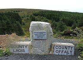
The Arderins are mountains in Ireland above 500 m (1,640 ft), with a prominence over 30 m (98 ft). The list was drawn up in 2002 by the Irish MountainViews publisher Simon Stewart from an early listing of the Myrddyn Deweys with hills from the Vandeleur-Lynams which meet the higher prominence criterion. The name, Arderins, was used in 2009, comes from the 527 m hill, Arderin, which is the County Top for County Laois and County Offaly in Ireland, and translates as "Height of Ireland".[60] The Arderins were published in the 2013 book, "A Guide to Ireland's Mountain Summits: The Vandeleur-Lynams & the Arderins".[57] Ireland has 407 Arderins.[61]
In addition, Mountainviews uses the term Arderin Begs for the additional class of peaks over 500 m (1,640 ft) in height, and with a prominance between 15–30 m (49–98 ft). In 2018, Ireland had 124 Arderin Begs.[62]
MountainViews
(height 500 m, prominence 100 m)
In 2013, Simon Stewart, publisher of Irish mountain database MountainViews, published: "A Guide to Ireland's Mountain Summits: The Vandeleur-Lynams & the Arderins".[57] In the Stewart added a new definition of an Irish mountain with height above 500 m (1,640 ft), and prominence over 100 m (328 ft), which consisted of 222 Irish mountains. MountainViews used this definition to create the list of 100 Highest Mountains in Ireland,[63] which has also become popular to use in Ireland.[64]
County tops
Climbing in the highest point of each county is a popular form of peak bagging, dating back to the 1920s when John Rooke Corbett was attempting to visit all British County Tops.
Other active lists
Dodds
(height 500–600 m, prominence 30 m)
The Dodds is a list of hills in the British Isles Wales between 500–600 metres (1,600–2,000 feet) in height, with a prominence above 30 metres (98 feet). In 2015, the Relative Hill of Britian site identified 1,339 Dodds.[65] The name comes from DOnald Deweys, Deweys and Scotland.[66] The original source is the list of Deweys in England or Wales between 500–600 metres (1,600–2,000 feet) in height, with a prominence above 30 metres (98 feet), which was first published by Michael Dewey in 1995. There are 426 Dewys identified: 241 in Wales, 180 in England, and 5 in Manx.[67]
Hardys
(hill range summits)
A Hardy is the highest point of a UK hill range, a UK island over 1,000 acres (400 hectares) or 4.05 km²) or a UK top-tier administrative area (counties and unitary authorities). There are now 347 Hardys with the recent addition (up to July 2016) of 5 low lying English coastal estuary islands: 61 hill ranges, 96 islands and 190 administrative areas. 183 are in England, 31 in Wales, 107 in Scotland and 26 in Northern Ireland. The list was first compiled in the 1990s by Ian Hardy.[68][69]
Non-active lists
Buxton & Lewis
A list of mountains, with height over 2,000 ft (610 m), in England and Wales was published by Buxton & Lewis in 1986. Althoughno longer maintained, it is referred to in some sources.[70]
Regional lists
The following are lists of hills for a given region in the British Isles:
England:
See also
Notes
References
- 1 2 Nuttall, John & Anne (2008). The Mountains of England & Wales – Volume 2: England (3rd ed.). Milnthorpe, Cumbria: Cicerone. ISBN 1-85284-037-4.
- ↑ Survey turns hill into a mountain at news.bbc.co.uk. Accessed on 3 Feb 2013.
- 1 2 A Mountain is a Mountain – isn't it? at www.go4awalk.com. Accessed on 3 Feb 2013.
- ↑ mountain at dictionary.reference.com. Accessed on 3 Feb 2013.
- ↑ Wilson, Peter (2001). Listing the Irish hills and mountains in Irish Geography, Vol 34(1), University of Ulster, Coleraine, p. 89. (pdf)
- ↑ Countryside and Rights of Way Act 2000, Part 1, Chapter 1, Section 1(2). Accessed on 14 Feb 2013.
- ↑ "Nepal mountain peak expansion bid stalls". BBC News. 18 October 2013.
- ↑ "A funny name for a mountain". Mark Horrell. 4 June 2014.
I explained how these five ridgetops couldn’t possibly be classified as 8000m peaks in their own right because each of them requires less than 135 metres of re-ascent between their respective parent peaks, Kangchenjunga and Lhotse (known as topographic prominence). It seems that where logic and common sense fail the NMA feels that flattery may work instead.
- 1 2 3 "MOUNTAIN CLASSIFICATION". UIAA. March 1994.
Topographic criterium: for each summit, the level difference between it and the highest adjacent pass or notch should be at least 30 m (calculated as average of the summits at the limit of acceptability).
- ↑ Alan Dawson (March 2016). "Surveying and mapping standards". The Relative Hills of Britain (rhb.org.uk).
- ↑ "Munros". Scottish Mountaineering Club. 2018.
The list of distinct Scottish peaks of 3000ft (914.4m) and over, of "sufficient separation" from their neighbouring peaks. The list that was originally drawn up by Sir H.T. Munro in the Scottish Mountaineering Club Journal in 1891 was unfinished at the time of his death. Munro did not write down a precise definition of what he meant by "sufficient separation", though the character of a mountain did enter into it. Through regular use these hills have become known as the Munros.
- 1 2 "The Database of British and Irish Hills - past, present and future". The Relative Hills of Britain (rhb.org.uk). May 2016.
- 1 2 "Welcome". The Database of British and Irish Hills. Retrieved 10 October 2018.
- ↑ "Birthday celebrations with two new Nuttalls". Ordnance Survey. 23 November 2016.
DoBIH was founded by Graham Jackson and Chris Crocker as a personal tool to help them log their own hill ascents. However, over the years DoBIH evolved into something much bigger with six editors and many hillwalkers supplying data.
- ↑ "Hillwakers' Register Claim Form" (PDF). Long Distance Walkers' Association. Retrieved 10 October 2018.
- 1 2 3 Jackson, Mark. "More Relative Hills of Britain" (PDF). Relative Hills of Britain. Archived from the original (PDF) on 12 October 2013. Retrieved 9 September 2011.
- ↑ "Copyright". Database of British and Irish Hills. 3 August 2018.
We place no restrictions on use of the data by third parties and encourage authors of other websites and applications to do so. We just ask users to observe the terms of the Creative Commons licence
- ↑ "Hill Bagging: the online version of the Database of British and Irish Hills". hill-bagging.co.uk. Retrieved 10 October 2018.
- ↑ "Downloads". Database of British and Irish Hills. Retrieved 10 October 2018.
- 1 2 3 Alan Dawson; Rob Woodall; Jonathan de Ferranti (2006). "THE BRITISH ISLES COMBINED LIST FOR THE UNITED KINGDOM AND REPUBLIC OF IRELAND".
Previously available lists used a cutoff of 2,000 feet (609.6 meters). The 2000 foot cutoff would result in a total of 111 mountains: 90 for Great Britain, 1 for Isle of Man, and 20 for Ireland. By lowering the cutoff to 600 meters (in order to be consistent with upcoming lists for Europe), we now reach a total of 119 mountains, including 93 for Great Britain, 1 on Man, and 25 in Ireland.
- ↑ "P600 MAP". MountainsofScotland. 2018.
A list of British and Irish hills with at least 600m of prominence, also known as the Major Mountains of Britain & Ireland. There are also 25 hills located in Ireland with 600m prominence. These are not displayed on the above map as OS maps do not cover Ireland.
- ↑ "The P600 Peaks". HillBagging.co.uk. 2018.
The map and list depict the P600m Peaks - a list of British and Irish hills with at least 600m of prominence, also known as the Major Mountains of Britain & Ireland. One of the hills, Rois-Bheinn, could be substituted by Beinn Odhar Bheag - both have a height of 882m, so you could assign to either the 774m prominence and both should be climbed.
- ↑ Mark Trengrove. "United Kingdom Mountains". Europeaklist.
At the bottom of this page you will find to download and print a list of the 119 Major Summits of Britain and Ireland (i.e. those that have at least 600 metres of prominence). Also to download and print is a register of the people who have completed this [P600] list.
- ↑ "Beyond Britan". Relative Hills of Britian.
In Britain the main thresholds for relative height (prominence) listings are 150m, 100m and 30m. Worldwide the thresholds for prominence are larger, typically 1500m, 600m and 150m. These may be referred to as Ultras or P1500s, Majors or P600s and Marilyns or P150s.
- 1 2 3 "Background to the lists". Database of British and Irish Hills. 2 August 2018.
- 1 2 3 4 5 6 7 8 "Database of British and Irish Hills". Retrieved 18 May 2015.
- 1 2 Dawson, Alan (1992). The Relative Hills of Britain. Milnthorpe: Cicerone Press. ISBN 1-85284-068-4.
- 1 2 "The HuMPS". HillBaggingUK.
The Humps: Humps are hills of any height with a drop of 100 metres or more on all sides The name Hump stands for HUndred Metre Prominence. By definition, all Marilyns qualify as Humps (but not vice versa). A Subhump is a hill which just fails (by up to 10m) to qualify on the drop rule, i.e. drop of 90m to 99m on all sides.
- 1 2 "The SIMMs". HillBaggingUK.
The Simms: A Simm is a hill in England, Wales or Scotland over 600m high with a drop of at least 30 metres all-round. Simm is an acronym for Six-hundred Metre Mountain. The Irish and Isle of Man Simms are also listed on this website. A Sub-Simm is a hill which just fails (by up to 10m) to qualify on the drop rule, i.e. over 600m with 20-29m drop.
- ↑ Marilyn Hall of Fame News, May 2012, p.30. Accessed on 27 Mar 2013. Archived 2013-09-03 at the Wayback Machine.
- ↑ "The TuMPs". HillBaggingUK.
The Tumps: A Tump is a hill in Scotland, England, Wales, the Isle of Man or the Channel Islands which is separated from adjacent tops by a height difference of at least 30 metres on all sides. The higher of the Tumps, including all over 500m in height, are included on other lists such as the Simms and Deweys. For the lower Tumps, the accuracy of the data on this site is not necessarily as dependable nor subject to as much scrutiny as those above 500m. For lower lying hills it can be much more difficult to identify the actual summit, so some grid references given may be more an indication of the general area of the summit. There is also a greater likelihood of encountering access problems when trying to bag lower Tumps, so please be considerate of land ownership and usage.
- 1 2 3 Bearhop, D.A. (1997). Munro's Tables. Scottish Mountaineering Club & Trust. ISBN 0-907521-53-3.
- ↑ "Magnificent munros: 17 Scottish mountains to bag in your lifetime". The Telegraph. 13 April 2017.
Of the 282, 200 are said to have a summit prominence of over 150 metres and are therefore known as "real munros", but that's for another day.
- ↑ Dawson, Alan (1995). The Murdos. Cambuskenneth, Stirling: TACit Press. ISBN 0-9522680-3-5. Archived from the original on 2006-06-15.
- ↑ Murdos designated new Munro Tops in 1997, "Archived copy". Archived from the original on 2007-07-08. Retrieved 2009-01-28.
- ↑ "Survey of Knight's Peak".
- ↑ The Munros and Tops 1891–1997, http://www.hills-database.co.uk/downloads.html#munrotab
- ↑ Dawson, Alan; Hewitt, Dave (1999). Corbett Tops and Corbetteers. Cambuskenneth, Stirling: TACit Press. ISBN 0-9534376-1-2.
- ↑ Dawson, Alan; Clements, E.D. 'Clem'; Gordon, James (2004). Graham Tops and Grahamists. Cambuskenneth, Stirling: TACit Press. ISBN 0-9534376-2-0.
- ↑ The Grahams and the Donalds. Scottish Mountaineering Trust. 2015. ISBN 978-1-907233-19-7.
- 1 2 3 "Donalds". Scottish Mountaineering Club. 2018.
There are currently 89 Donald Hills and a further 51 Donald Tops. A complete round of The Donalds should include all 140 summits. Percy Donald's original Tables are seen as a complete entity, unlike the Munros, Corbetts and Grahams.
- ↑ Alan Dawson (May 1995). "Review: The Grahams and the New Donalds". The Relative Hills of Britain.
- ↑ "The New Donalds". HillBaggingUK. 2018.
The New Donalds are an attempt to rationalize the qualifying criteria, being "hills in Central or Southern Scotland at least 2000 feet high (610m) with a drop of at least 30 metres (98 feet) all round". All New Donalds are either a Donald or a Donald Top, but some of the Donald Tops do not qualify as New Donalds.
- ↑ "Furth Completists (Furthists) List". Final Furths and Furthists. Retrieved 26 July 2016.
- ↑ Dawson, Alan (1997). The Hewitts and Marilyns of England. Cambuskenneth, Stirling: TACit Press. ISBN 0-9522680-7-8. Archived from the original on 2000-09-29.
- ↑ Dawson, Alan (1997). The Hewitts and Marilyns of Wales. Cambuskenneth, Stirling: TACit Press. ISBN 0-9522680-6-X. Archived from the original on 2006-12-05.
- ↑ "The Hewitts: The 2000 foot summits of England and Wales". WalkingHighlands. 2018.
The most satisfactory recent list in our opinion was originally compiled by Alan Dawson in his book, the Relative Hills of Britain, using a minimum reascent figure of 30 metres; this gives 317 summits in England and Wales, hills which Dawson originally named the Sweats (Summits - Wales and England Above Two thousand).
- ↑ Clements, E.D. 'Clem' (1998). The Hewitts and Marilyns of Ireland. Cambuskenneth, Stirling: TACit Press. ISBN 0-9522680-8-6.
- ↑ Nuttall, John & Anne (2009). The Mountains of England & Wales – Volume 1: Wales (3rd ed.). Milnthorpe, Cumbria: Cicerone. ISBN 1-85284-304-7.
- ↑ "Changes". The Mountains of England and Wales. John and Anne Nuttall. Retrieved 10 August 2018.
- ↑ "Lake District hill Miller Moss reclassified as a mountain". BBC News. 10 August 2018. Retrieved 10 August 2018.
- ↑ "Completers". The Mountains of England and Wales. John and Anne Nuttall. Retrieved 10 August 2018.
- ↑ "Wainwrights and Wainwright Outlying Fells". HillBaggingUK. 2018.
The Wainwrights: The Wainwrights are a list of hills appearing in the seven volumes of Alfred Wainwright's Pictorial Guides to the Lakeland Fells; the list is subjective - some of the hills are not summits at all - just prominent points at the end of a ridge or spur from a higher mountain.
The [Wainwright] Outlying Fells: Wainwright produced an additional volume entitled The Outlying Fells of Lakelands. - ↑ "Pillar Rock". HillBaggingUK.
Pillar Rock, qualifying as a separate summit to Pillar (Lake District) itself in the Nuttalls and other lists [the Birketts], is the bane of summit baggers everywhere. Wainwright says that, to walkers "Pillar Rock is positively out of bounds. Don't even try to get a foothold on it". It's graded as a "moderate" rock climb.
- ↑ Bill Birkett, Complete Lakeland Fells, London: HarperCollins / Premier Books (1994), ISBN 0583-32209-3
- ↑ "Birketts". Database of British and Irish Hills. 2018.
- 1 2 3 Mountainviews, (2013), "A Guide to Ireland's Mountain Summits: The Vandeleur-Lynams & the Arderins", Collins Books, Cork, ISBN 978-1-84889-164-7
- ↑ "The Vandeleur-Lynams". HillBagging.co.uk.
- ↑ "Vandeleur-Lynams: Irish mountains of 600+m with a prominence of 15m". MountainViews.ie. October 2018.
- ↑ "The Arderins". HillBagging.co.uk.
- ↑ "Arderins: Irish mountains of 500+m with a prominence of 30m". MountainViews.ie. October 2018.
- ↑ Simon Stewart (2018). "Arderins + Arderin Begs: Irish mountains of 500+m with a prominence of 15+m". MountainViews.
Listing selection: All summits (531) in list Arderins + Arderin Begs
- ↑ "Credits and Acknowledgements: Lists of the summits, islands and coastal features for Ireland". Mountainview.ie. 2018.
The "Hundred Highest" list includes summits with a prominence at a minimum of 100 m, and has been introduced to give a height based list, not too long, with a spread of locations for Ireland.
- ↑ "10 of the Highest Mountains to Climb in Ireland". Outsider.ie. 2018.
We’ve compiled a list of the 10 highest mountains in Ireland for you to get your teeth into.
- ↑ "Dodds". The Relative Hills of Britian.
A Dodd is a hill in Britain at least 500m high and under 600m that has a drop (relative height) of 30 metres or more on all sides. There were 1340 Dodds at the end of 2015.
- ↑ "The Dodds". HillBaggingUK.
A Dodd is a hill in England, Wales or Scotland between 500m and 599m high with a drop of at least 30 metres all round. The name Dodds was originally derived from DOnald Deweys, Deweys and Scotland. A Sub-Dodd, is a hill which just fails (by up to 10m) to qualify on the drop rule, i.e. between 500m and 599m with 20-29m drop.
- ↑ "The Dewys". HillBaggingUK.
The Deweys: A Dewey is "a mountain or hill in England, Wales or the Isle of Man, that exceeds 500 metres in height, but is below 610 metres (2000ft) in altitude; it must be separated from adjacent tops by a height difference of at least 30 metres on all sides". The definition is similar to the Hewitts and Simms, except that Hewitts must be above 2000ft, and Simms above 600m. The Deweys are named after the list's compiler, Michael Dewey, the list appearing as one of the chapters in his book, Mountain Tables.
- ↑ Hardy, Ian, MVO (2010). The Hardys – The UK's High Points (3rd Edition). Potters Bar, Hertfordshire: Ian Hardy. ISBN 978 0 9565533 3 1 (internet version, http://www.thehardys.org/), ISBN 978 0 9565533 5 5 (DVD version).
- ↑ Hardys Hill List and GPS Waypoints at www.haroldstreet.org.uk. Retrieved 6 Jan 2017.
- ↑ Other lists at www.hill-bagging.co.uk. Retrieved 4 Oct 2016.
External links
- The Database of British and Irish Hills (DoBIH), the largest database of British Isles mountains
- Hill Bagging UK & Ireland, the searchable interface for the DoBIH
- MountainViews: The Irish Mountain Website, the DoBIH for Ireland (Republic and North)
- MountainViews: Irish Online Mountain Database, the searchable database for the MountainViews
- The Relative Hills of Britain, a website dedicated to mountain and hill classification
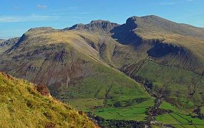
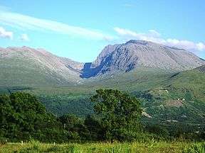
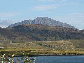
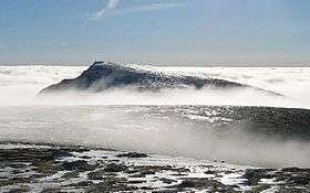
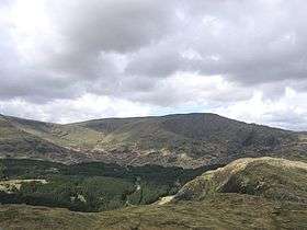
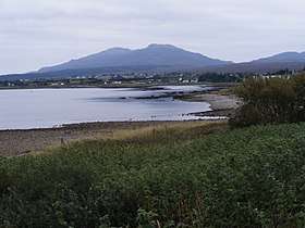
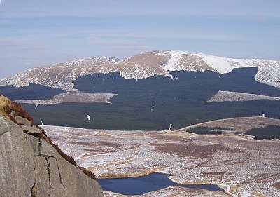
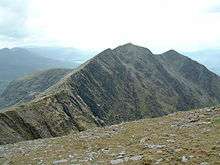
Mountains and hills of Great Britain and Ireland | ||
|---|---|---|
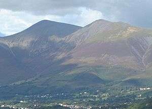
| Scotland |  | |
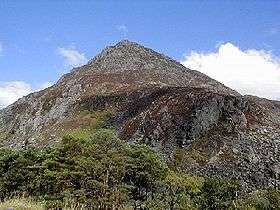
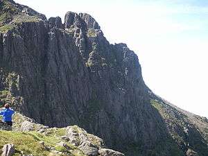
| England | ||
| Wales | ||
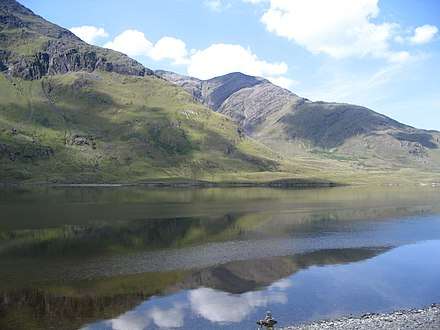
| Northern Ireland | ||
| Republic of Ireland | ||