Heredia Province
| Heredia | |||
|---|---|---|---|
| Province | |||
| |||
 | |||
| Coordinates: 10°25′N 84°0′W / 10.417°N 84.000°WCoordinates: 10°25′N 84°0′W / 10.417°N 84.000°W | |||
| Country | Costa Rica | ||
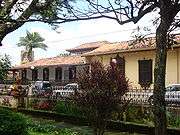
| Capital city | Heredia (pop. 42,600) | ||
| Largest city | Heredia | ||
| Area | |||
| • Total | 2,657 km2 (1,026 sq mi) | ||
| Population (2011) | |||
| • Total | 433,677 | ||
| • Density | 160/km2 (420/sq mi) | ||
| ISO 3166 code | CR-H | ||
Heredia (Spanish pronunciation: [eˈɾeðja]) is a province of Costa Rica. It is in the north-central part of the country. As a result, the province covers areas as diverse as the agriculture-rich Northern plains to the more metropolitan areas such as the city of Heredia in the Central Valley. It contains several major environmentally important areas such as the Braulio Carrillo National Park and the Sarapiqui River. The capital is the city of Heredia.
To the north it borders Nicaragua, to the east is the province Limón, to the south the province San José, and to the west Alajuela.
Geography
The province covers an area of 2,657 km². The province is home to a variety of environments, including primary forests, tropical dry forests, and montane forests.[1][2]
Demographics
In 1850, the province had a population of approximately 13,390.[3] As of 2011, it has a population of 433,677.[4]
Administrative divisions
The province is subdivided into 10 cantons and 47 districts.
Cantons
- Heredia (Heredia)
- Barva (Barva)
- Santo Domingo (Santo Domingo)
- Santa Bárbara (Santa Bárbara)
- San Rafael (San Rafael)
- San Isidro (San Isidro)
- Belén (San Antonio)
- Flores (San Joaquín)
- San Pablo (San Pablo)
- Sarapiquí (Puerto Viejo)
References
- ↑ Instituto Geográfico Nacional (IGN), 2001
- ↑ http://www.mydestination.com/costarica/6177537/heredia-province
- ↑ Baily, John (1850). Central America; Describing Each of the States of Guatemala, Honduras, Salvador, Nicaragua, and Costa Rica. London: Trelawney Saunders. p. 177.
- ↑ Resultados Generales Censo 2011 Archived 2012-10-21 at the Wayback Machine. p. 22
External links
| Wikimedia Commons has media related to Heredia Province. |

- Map of Heredia, Costa Rica