Hatzav
| Hatzav חָצָב | |
|---|---|
 | |
 Hatzav | |
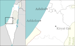
| Coordinates: 31°46′47.64″N 34°46′11.63″E / 31.7799000°N 34.7698972°ECoordinates: 31°46′47.64″N 34°46′11.63″E / 31.7799000°N 34.7698972°E | |
| District | Southern |
| Council | Be'er Tuvia |
| Affiliation | Moshavim Movement |
| Founded | 1949 |
| Founded by | Libyan refugees |
| Area | 3,200 dunams (3.2 km2 or 1.2 sq mi) |
| Population (2017)[1] | 1,468 |
| • Density | 460/km2 (1,200/sq mi) |
| Name meaning | Squill |
Hatzav (Hebrew: חָצָב, lit. Squill) is a moshav in central Israel. Located on Highway 40 between Gedera and Be'er Sheva, it covers 3,200 dunams and falls under the jurisdiction of Be'er Tuvia Regional Council. In 2017 it had a population of 1,468.[1]
History
The moshav was founded in 1949 by refugees from Tripoli in Libya,[2] including Ben-Zion Halfon, later a member of the Knesset.
Hatzav is founded on the lands of the depopulated Palestinian village of Al-Masmiyya al-Kabira.[3]
It is split into two parts; the farming area and the "Yellow Squares" section. The latter consists of half-dunam plots for construction of dwellings for new residents.
References
- 1 2 "List of localities, in Alphabetical order" (PDF). Israel Central Bureau of Statistics. Retrieved August 26, 2018.
- ↑ Mapa's concise gazetteer of Israel (in Hebrew). Yuval El'azari (ed.). Tel-Aviv: Mapa Publishing. 2005. p. 192. ISBN 965-7184-34-7.
- ↑ Khalidi, Walid (1992). All That Remains: The Palestinian Villages Occupied and Depopulated by Israel in 1948. Washington D.C.: Institute for Palestine Studies. p. 125. ISBN 0-88728-224-5.
This article is issued from
Wikipedia.
The text is licensed under Creative Commons - Attribution - Sharealike.
Additional terms may apply for the media files.