Ahva, Israel
| Ahva אַחֲוָה, אחווה | |
|---|---|
| Hebrew transcription(s) | |
| • official | Ahawa |
 | |
 Ahva | |
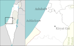
| Coordinates: 31°44′36.36″N 34°46′8.99″E / 31.7434333°N 34.7691639°ECoordinates: 31°44′36.36″N 34°46′8.99″E / 31.7434333°N 34.7691639°E | |
| District | Southern |
| Council | Be'er Tuvia |
| Founded | 1974 |
| Population (2017)[1] | 293 |
| Name meaning | Brotherhood |
| Look up אחווה in Wiktionary, the free dictionary. |
Ahva (Hebrew: אַחֲוָה, Aḥava, lit. Brotherhood) is a village in the northern Negev desert of southern Israel. It falls under the jurisdiction of Be'er Tuvia Regional Council and had a population of 293 in 2017.[1]
The village was established in 1976 for civil servants of the regional council. It is adjacent to the Ahva Academic College and acts as a service center for the surrounding settlements, including Kfar Ahim, Kfar HaRif, Talmei Yehiel and Yenon.[2]
Ahva was founded on the lands of the depopulated Palestinian village of Al-Masmiyya al-Kabira.[3]
References
- 1 2 "List of localities, in Alphabetical order" (PDF). Israel Central Bureau of Statistics. Retrieved August 26, 2018.
- ↑ Mapa's concise gazetteer of Israel (in Hebrew). Yuval El'azari (ed.). Tel-Aviv: Mapa Publishing. 2005. p. 26. ISBN 965-7184-34-7.
- ↑ Khalidi, Walid (1992). All That Remains: The Palestinian Villages Occupied and Depopulated by Israel in 1948. Washington D.C.: Institute for Palestine Studies. p. 125. ISBN 0-88728-224-5.
This article is issued from
Wikipedia.
The text is licensed under Creative Commons - Attribution - Sharealike.
Additional terms may apply for the media files.