Kannot
| Kannot כַּנּוֹת | |
|---|---|
 | |
 Kannot | |
| Coordinates: 31°48′8.27″N 34°45′8.64″E / 31.8022972°N 34.7524000°ECoordinates: 31°48′8.27″N 34°45′8.64″E / 31.8022972°N 34.7524000°E | |
| District | Southern |
| Council | Be'er Tuvia |
| Founded | 1952 |
| Founded by | Histadrut Workers' Council |
| Population (2017)[1] | 433 |
| Name meaning | Seedlings |
| Website | kannot.org.il |
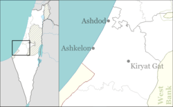
Kannot (Hebrew: כַּנּוֹת, eng. Seedlings) is an educational institution and youth village in central Israel. Located near Gedera, it falls under the jurisdiction of Be'er Tuvia Regional Council. In 2017 it had a population of 433.[1]
Etymology
It is named after an occasional word, just mentioned once: in the Bible in Psalm 80:16:[2] (God, watch over) "the seedling your right hand has planted".
History
The village was founded in 1952 by the Workers' Council of the Histadrut, on the lands of the depopulated Palestinian village of Bashshit.[3]
References
- 1 2 "List of localities, in Alphabetical order" (PDF). Israel Central Bureau of Statistics. Retrieved August 26, 2018.
- ↑ Place Names in Israel. A Compendium of Place Names in Israel compiled from various sources. Translated from Hebrew, Jerusalem 1962 (Israel Prime Minister’s Office. The Israeli Program for Scientific Translations) p.211 (Location of the book: Ben Zvi Institute Library, 12 Abarbanel St., Jerusalem; in the online-catalogue: "Archived copy". Archived from the original on 2013-07-25. Retrieved 2013-07-29.
)
Bitan, Hanna: 1948-1998: Fifty Years of 'Hityashvut': Atlas of Names of Settlements in Israel, Jerusalem 1999, Carta, p.31, ISBN 965-220-423-4 (Hebrew) - ↑ Khalidi, Walid (1992). All That Remains: The Palestinian Villages Occupied and Depopulated by Israel in 1948. Washington D.C.: Institute for Palestine Studies. p. 363. ISBN 0-88728-224-5.
External links
- Official website (in Hebrew)
This article is issued from
Wikipedia.
The text is licensed under Creative Commons - Attribution - Sharealike.
Additional terms may apply for the media files.