Habergham Eaves
| Habergham Eaves | |
|---|---|
 Buildings at Higher Timber Hill Farm | |
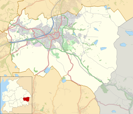 Habergham Eaves Shown within Burnley Borough  Habergham Eaves Habergham Eaves shown within Lancashire | |
| Area | 2.87 sq mi (7.4 km2) [1] |
| Population | 1,466 (2011) [1] |
| • Density | 511/sq mi (197/km2) |
| OS grid reference | SD8319229904 |
| Civil parish |
|
| District | |
| Shire county | |
| Region | |
| Country | England |
| Sovereign state | United Kingdom |
| Post town | BURNLEY |
| Postcode district | BB11 |
| Dialling code | 01282 |
| Police | Lancashire |
| Fire | Lancashire |
| Ambulance | North West |
| EU Parliament | North West England |
| UK Parliament | |
Habergham Eaves is a civil parish in the borough of Burnley, in Lancashire, England. The parish consists of a rural area south of Burnley, and suburban areas on the outskirts of the town, including a large industrial estate in the north-west corner of the parish. Habergham is also the name of an area west of Burnley, although it is no longer within the parish.[2] According to the United Kingdom Census 2011, the parish has a population of 1,466,[1] a decrease from 1,581 in the 2001 census.[3] The A646 Padiham to Todmorden road runs approximately along the northern boundary of the parish. Surrounding areas include the unparished areas of Burnley and Rossendale, and the parishes of Hapton, Dunnockshaw and Cliviger.
Habergham Eaves was historically a township in the ancient parish of Whalley, extending further to the north from Gawthorpe Hall in the west to Towneley Hall in the east, the River Calder generally separating it from the neighbouring townships, and from 1861 the Borough of Burnley. However, in 1894 a large part of the township, with a population of over 40,000 and including Rose Grove, Burnley Wood, Gannow and Habergham, was transferred to the County Borough of Burnley, and taken out of the control of the newly established Lancashire County Council. The remainder, with the exception of a small area transferred to Ightenhill, became the civil parish of Habergham Eaves.[4][5] under the governance of Lancashire and the Burnley Rural District. During World War II a Starfish site bombing decoy was constructed off Crown Point Road, part of a network designed to protect Accrington.[6]
Media gallery
 Burnley Golf Club
 view from Crown Point Road
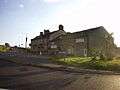 The Bull on Manchester Road
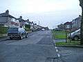 Burnley's suburbs have continued to encroach
 Crown Point House
See also
References
- 1 2 3 UK Census (2011). "Local Area Report – Habergham Eaves Parish (1170214984)". Nomis. Office for National Statistics. Retrieved 8 February 2018.
- ↑ "Map of Habergham Eaves parish". MARIO. Lancashire County Council. Retrieved 2008-11-03.
- ↑ Office for National Statistics : Census 2001 : Parish Headcounts : Burnley Retrieved 4 February 2010
- ↑ "Habergham Eaves Tn/CP Lancashire through time: Administrative History of Parish-level unit: hierarchies, boundaries". A Vision of Britain through Time. University of Portsmouth & others. 2008. Archived from the original on 2007-10-13. Retrieved 2008-11-03.
- ↑ William Farrer & J. Brownbill, eds. (1911). Townships: Habergham Eaves. A History of the County of Lancaster. 6. University of London & History of Parliament Trust. pp. 454–468. Retrieved 2008-11-03.
- ↑ Historic England. "STARFISH BOMBING DECOY SF35C (1469064)". PastScape. Retrieved 1 August 2015.
External links
![]()
- Map of Habergham Eaves parish boundary Today - Lancashire County Council
- Map of Habergham Eaves parish boundary circa 1850
- Habergham Eaves Township - British History Online
Geography of the Borough of Burnley | |||||||
|---|---|---|---|---|---|---|---|
| Towns |  | ||||||
| Villages & suburbs | |||||||
| Parishes | |||||||
| Topography |
| ||||||