Haarlem, Western Cape
| Haarlem | |
|---|---|
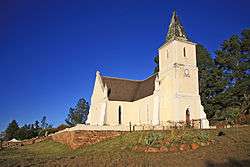 Evangelical Lutheran Church, Haarlem | |
 Haarlem  Haarlem Haarlem (South Africa)  Haarlem Haarlem (Africa) | |
| Coordinates: 33°44′02″S 23°20′19″E / 33.73389°S 23.33861°ECoordinates: 33°44′02″S 23°20′19″E / 33.73389°S 23.33861°E | |
| Country | South Africa |
| Province | Western Cape |
| District | Eden |
| Municipality | George |
| Area[1] | |
| • Total | 9.04 km2 (3.49 sq mi) |
| Population (2011)[1] | |
| • Total | 2,376 |
| • Density | 260/km2 (680/sq mi) |
| Racial makeup (2011)[1] | |
| • Black African | 4.2% |
| • Coloured | 94.1% |
| • White | 0.9% |
| • Other | 0.8% |
| First languages (2011)[1] | |
| • Afrikaans | 97.6% |
| • English | 1.3% |
| • Other | 1.1% |
| Time zone | UTC+2 (SAST) |
| PO box | 6467 |
| Area code | 044 |
Haarlem is a settlement in Eden District Municipality in the Western Cape province of South Africa.
Village 16km east of Avontuur and 29 km south-east of Uniondale, in the Langkloof. Originally laid out in 1856, it was taken over by the Berlin Missionary Society in 1860. The mission station was named Anhalt-Schmidt, but the village had already been named Haarlem and bears that name today, presumably after the city of Haarlem 19km west of Amsterdam in the Netherlands.[2]
References
- 1 2 3 4 "Main Place Haarlem". Census 2011.
- ↑ "Dictionary of Southern African Place Names (Public Domain)". Human Science Research Council. p. 195.
Municipalities and communities of Garden Route District Municipality, Western Cape | ||
|---|---|---|
District seat: George | ||
| Bitou | .svg.png) | |
| George | ||
| Hessequa | ||
| Kannaland | ||
| Knysna | ||
| Mossel Bay | ||
| Oudtshoorn | ||
This article is issued from
Wikipedia.
The text is licensed under Creative Commons - Attribution - Sharealike.
Additional terms may apply for the media files.