Guiltcross Rural District
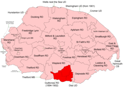 Boundaries in 1894. |
Guiltcross Rural District was a rural district in Norfolk, England from 1894 to 1902.[1]
It was formed under the Local Government Act 1894 based on the Guiltcross rural sanitary district. It lay in the southern part of the county between Thetford and Diss and took its name from the ancient Guiltcross hundred.
In 1902, Guiltcross RD was abolished and its territory divided between Thetford[2], Wayland[3] and Depwade[4] RDs.
Parishes & Statistics
Population figures from 1901 census via Vision of Britain.
| Parish | Area (ha) | Population | Notes |
|---|---|---|---|
| Banham | 1,616 | 987 | To Wayland RD |
| Blo' Norton | 462 | 236 | To Thetford RD |
| Bressingham | 980 | 482 | To Depwade RD |
| Bridgham | 1,106 | 255 | To Thetford RD |
| East Harling | 1,057 | 1,031 | To Thetford RD |
| Fersfield | 565 | 219 | To Depwade RD |
| Garboldisham | 1,116 | 559 | To Thetford RD |
| Gasthorpe | 352 | 71 | To Thetford RD |
| Kenninghall | 1,485 | 976 | To Wayland RD |
| New Buckenham | 146 | 516 | To Wayland RD |
| North Lopham | 817 | 600 | To Thetford RD |
| Old Buckenham | 2,033 | 1,005 | To Wayland RD |
| Quidenham | 718 | 198 | To Wayland RD |
| Riddlesworth | 472 | 75 | To Thetford RD |
| Roydon | 462 | 667 | To Depwade RD |
| Shelfanger | 698 | 307 | To Depwade RD |
| South Lopham | 791 | 449 | To Thetford RD |
| West Harling | 1,261 | 101 | To Thetford RD |
| Wilby | 575 | 95 | To Wayland RD |
| Winfarthing | 1,081 | 461 | To Depwade RD |
| Total | 17,793 | 9,290 | Density 0.52 / ha |
References
- ↑ "Guiltcross RD through time: Census tables with data for the Local Government District". A Vision of Britain through Time. GB Historical GIS / University of Portsmouth. Retrieved 2 July 2017.
- ↑ "Thetford RD through time: Census tables with data for the Local Government District". A Vision of Britain through Time. GB Historical GIS / University of Portsmouth. The change is only apparent as parishes listed "from 1902". Retrieved 2 July 2017.
- ↑ "Wayland RD through time: Census tables with data for the Local Government District". A Vision of Britain through Time. GB Historical GIS / University of Portsmouth. Retrieved 2 July 2017.
- ↑ "Depwade RD through time: Census tables with data for the Local Government District". A Vision of Britain through Time. GB Historical GIS / University of Portsmouth. Retrieved 2 July 2017.
This article is issued from
Wikipedia.
The text is licensed under Creative Commons - Attribution - Sharealike.
Additional terms may apply for the media files.