Grade I listed buildings in the City of London
There are over 9,000 Grade I listed buildings in England. This page is a list of these buildings in the City of London.
Buildings
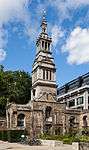
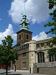
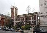
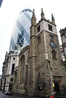
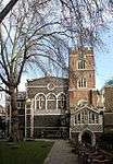
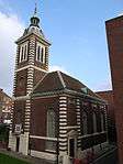
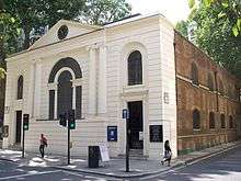
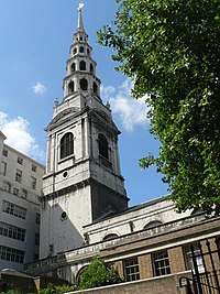
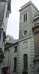
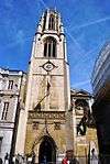
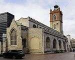
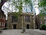
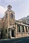
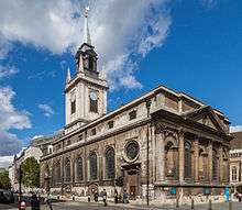
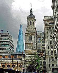
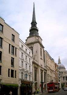
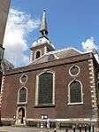
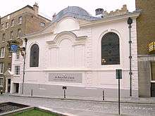
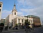
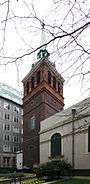
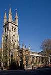
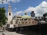
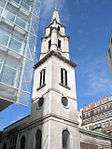
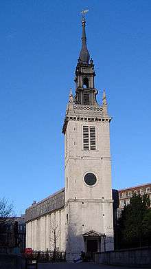
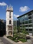
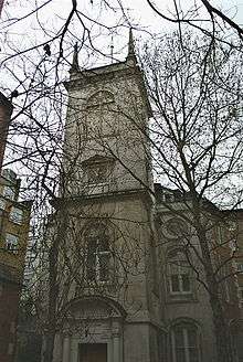
Churches
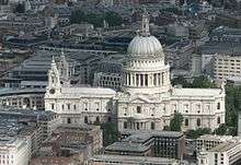
.JPG)

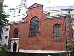
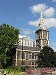
.jpg)
.jpg)
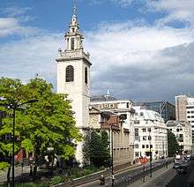

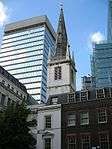

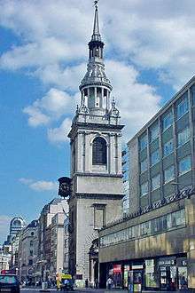
.jpg)
.JPG)
_Royal_-_geograph.org.uk_-_491255.jpg)
.jpg)

Livery company halls
| Name | Location | Type | Completed [note 1] | Date designated | Grid ref.[note 2] Geo-coordinates |
Entry number [note 3] | Image |
|---|---|---|---|---|---|---|---|
| Apothecaries' Hall | Farringdon Within | Livery Hall | 1670 | 4 January 1950 | TQ3171981037 51°30′46″N 0°06′12″W / 51.512912°N 0.103214°W |
1359133 |  |
| Goldsmiths' Hall | City and County of the City of London | Livery Hall | 1829–35 | 4 January 1950 | TQ3221981357 51°30′56″N 0°05′45″W / 51.515671°N 0.095893°W |
1286469 | 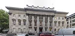 |
| Skinners' Hall | City and County of the City of London | Livery Hall | Late 17th century | 4 January 1950 | TQ3255880861 51°30′40″N 0°05′28″W / 51.511134°N 0.091197°W |
1064686 | _by_W_Jupp.jpg) |
| Stationers' Hall | City and County of the City of London | Livery Hall | c. 1670 | 4 January 1950 | TQ3183181201 51°30′52″N 0°06′06″W / 51.51436°N 0.10154°W |
1064742 |  |
| Vintners Hall | City and County of the City of London | Livery Hall | 1840 | 4 January 1950 | TQ3239380809 51°30′39″N 0°05′37″W / 51.510706°N 0.093593°W |
1180690 |  |
Other
| Name | Location | Type | Completed [note 1] | Date designated | Grid ref.[note 2] Geo-coordinates |
Entry number [note 3] | Image |
|---|---|---|---|---|---|---|---|
| Bank of England | Walbrook | Bank | Late 18th century to early 19th century | 4 January 1950 | TQ3273081211 51°30′51″N 0°05′19″W / 51.514239°N 0.088588°W |
1079134 | |
| College of Arms | City and County of the City of London | House and gate | 1956 | 4 January 1950 | TQ3203380971 51°30′44″N 0°05′55″W / 51.512246°N 0.098717°W |
1079147 | 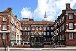 |
| Custom House | City and County of the City of London | Custom House | 1813–17 | 5 June 1972 | TQ3317280611 51°30′31″N 0°04′57″W / 51.508744°N 0.082449°W |
1359193 |  |
| Dr. Johnson's House | City and County of the City of London | House | Late 17th century | 4 January 1950 | TQ3136781267 51°30′54″N 0°06′30″W / 51.515061°N 0.108198°W |
1192738 | 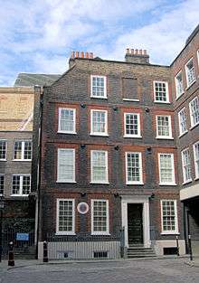 |
| Gateway from Devereux Court | Middle Temple, City and County of the City of London | Gate | Late 17th century | 4 January 1950 | TQ3108481009 51°30′46″N 0°06′45″W / 51.512808°N 0.11237°W |
1193846 |  |
| Guildhall | City and County of the City of London | Guildhall | Early 15th century | 4 January 1950 | TQ3248581384 51°30′57″N 0°05′31″W / 51.515851°N 0.092052°W |
1064675 | 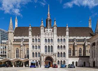 |
| Lloyd's Building | City and County of the City of London | Commercial Office | 1978–86 | 19 December 2011 | TQ3315981082 51°30′47″N 0°04′57″W / 51.512979°N 0.082458°W |
1405493 | 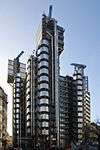 |
| Main North Block, East Block, West Block, St Bartholomew's Hospital | City and County of the City of London | Courtyard | 1750-9 | 4 January 1950 | TQ3189281574 51°31′04″N 0°06′02″W / 51.517697°N 0.100522°W |
1079116 | 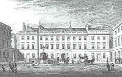 |
| Mansion House | City and County of the City of London | Courtyard | 1739–53 | 4 January 1950 | TQ3266981070 51°30′47″N 0°05′22″W / 51.512987°N 0.08952°W |
1064604 | 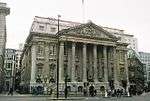 |
| Middle Temple Gatehouse | Middle Temple, City and County of the City of London | Inns of Court | 1684 | 4 January 1950 | TQ3114081104 51°30′49″N 0°06′42″W / 51.513649°N 0.111528°W |
1064612 | 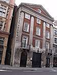 |
| Middle Temple Hall | Middle Temple, City and County of the City of London | Inns of Court | 1562–73 | 4 January 1950 | TQ3114880961 51°30′45″N 0°06′41″W / 51.512362°N 0.111466°W |
1064609 |  |
| Midland Bank | City and County of the City of London | Commercial Office | 1924 | 5 June 1972 | TQ3262281144 51°30′49″N 0°05′25″W / 51.513663°N 0.090169°W |
1064598 | 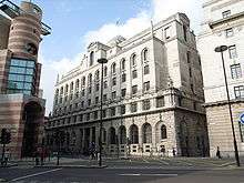 |
| Number 4 5 and 6 and Attached Pump | City and County of the City of London | Inns of Chancery | c. 1586 | 24 October 1951 | TQ3115781585 51°31′05″N 0°06′40″W / 51.517967°N 0.111105°W |
1246100 | 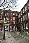 |
| Railings to Churchyard of Cathedral Church of St Paul | City and County of the City of London | Gate | 1714 | 5 June 1972 | TQ3197881099 51°30′48″N 0°05′58″W / 51.513409°N 0.099461°W |
1194622 | 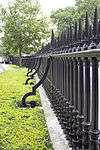 |
| Royal Exchange | City and County of the City of London | Exchange | 1841-4 | 4 January 1950 | TQ3282581144 51°30′49″N 0°05′14″W / 51.513615°N 0.087245°W |
1064713 | 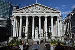 |
| Screen Wall and Gateways to Forecourt of St Paul's Deanery | City and County of the City of London | Gate | 5 June 1972 | TQ3192181080 51°30′48″N 0°06′01″W / 51.513251°N 0.100289°W |
1359191 | 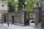 | |
| St Paul's Deanery | City and County of the City of London | Deanery | 1670 | 4 January 1950 | TQ3190081082 51°30′48″N 0°06′02″W / 51.513274°N 0.100591°W |
1064683 | 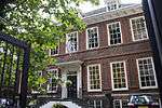 |
| Bevis Marks Synagogue | City and County of the City of London | Synagogue | 1701 | 4 January 1950 | TQ3339581257 51°30′52″N 0°04′44″W / 51.514496°N 0.078993°W |
1064745 |  |
| Temple Bar Gate | City and County of the City of London | Gate | 1806 | 15 June 2010 | TQ3196981195 51°30′51″N 0°05′58″W / 51.514274°N 0.099554°W |
1393844 | 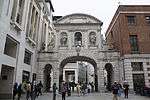 |
| The Gatehouse, St Bartholomew's Hospital | City and County of the City of London | Gate | 1702 | 4 January 1950 | TQ3186381599 51°31′05″N 0°06′03″W / 51.517929°N 0.10093°W |
1079115 |  |
| The Monument | City and County of the City of London | Column | 1671-7 | 4 January 1950 | TQ3292380760 51°30′37″N 0°05′10″W / 51.510141°N 0.085978°W |
1193901 | 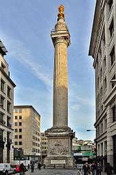 |
| Trinity House | City and County of the City of London | House | 1793-6 | 4 January 1950 | TQ3352280803 51°30′37″N 0°04′38″W / 51.510386°N 0.077336°W |
1079137 | 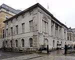 |
| Westminster Bank | City and County of the City of London | Bank (financial) | 1865 | 4 January 1950 | TQ3307081267 51°30′53″N 0°05′01″W / 51.514663°N 0.08367°W |
1191569 | 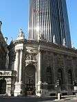 |
| 1 Kings Bench Walk | Inner Temple, City and County of the City of London | Inns of Court | Late 17th century | 4 January 1950 | TQ3131581071 51°30′48″N 0°06′32″W / 51.513312°N 0.10902°W |
1064647 | 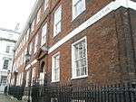 |
| 7 Kings Bench Walk | Inner Temple, City and County of the City of London | Inns of Court | Late 17th century | 4 January 1950 | TQ3135180976 51°30′45″N 0°06′31″W / 51.512449°N 0.108537°W |
1064650 |  |
| 2 King's Bench Walk | Inner Temple, City and County of the City of London | Inns of Court | Late 17th century | 4 January 1950 | TQ3131681056 51°30′47″N 0°06′32″W / 51.513177°N 0.109011°W |
1193156 |  |
| 4 King's Bench Walk | Inner Temple, City and County of the City of London | Inns of Court | Late 17th century | 4 January 1950 | TQ3134681033 51°30′47″N 0°06′31″W / 51.512962°N 0.10858577°W |
1193173 |  |
| 4–6 Pump Court | Middle Temple, City and County of the City of London | Inns of Court | 1686 | 4 January 1950 | TQ3116881031 51°30′47″N 0°06′40″W / 51.512986°N 0.111152°W |
1193870 |  |
| 1 Essex Court | Middle Temple, City and County of the City of London | Inns of Court | 1685 | 4 January 1950 | TQ3112581000 51°30′46″N 0°06′42″W / 51.512718°N 0.111783°W |
1286024 | 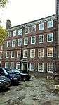 |
| 6 Kings Bench Walk | Inner Temple, City and County of the City of London | Inns of Court | Late 17th century | 4 January 1950 | TQ3134880998 51°30′46″N 0°06′31″W / 51.512648°N 0.108572°W |
1286279 |  |
| 1 Hare Court | Middle Temple, City and County of the City of London | Inns of Court | Late 17th century | 4 January 1950 | TQ3119381038 51°30′47″N 0°06′39″W / 51.513043°N 0.110789°W |
1359200 | 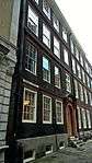 |
| 5 Kings Bench Walk | Inner Temple, City and County of the City of London | Inns of Court | Late 17th century | 4 January 1950 | TQ3134781014 51°30′46″N 0°06′31″W / 51.512792°N 0.10858°W |
1359177 | |
| 2 & 3 Essex Court | Middle Temple, City and County of the City of London | Inns of Court | 1677 | 4 January 1950 | TQ3110481011 51°30′46″N 0°06′43″W / 51.512821°N 0.112081°W |
1359199 |  |
| 3 Kings Bench Walk | Inner Temple, City and County of the City of London | Inns of Court | Late 17th century | 4 January 1950 | TQ3134681045 51°30′47″N 0°06′31″W / 51.513071°N 0.108583°W |
1064648 | 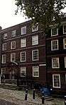 |
| 1–4 Holborn Bars | City and County of the City of London | House | 18th century | 14 May 1974 | TQ3115881588 51°31′05″N 0°06′40″W / 51.517994°N 0.111089°W |
1246103 | 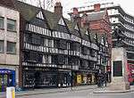 |
See also
Notes
- 1 2 3 The date given is the date used by Historic England as significant for the initial building or that of an important part in the structure's description.
- 1 2 3 Sometimes known as OSGB36, the grid reference is based on the British national grid reference system used by the Ordnance Survey.
- 1 2 3 The "List Entry Number" is a unique number assigned to each listed building and scheduled monument by Historic England.
External links

| Wards |  | |
|---|---|---|
| Enclaves | ||
| Localities | ||
| Attractions |
| |
| Notable structures | ||
| Civil parishes | ||
| Bridges | ||
| Rail and tube stations | ||
| Topics | ||
| ||
- ↑ See Wikipedia St Paul's Cathedral.
This article is issued from
Wikipedia.
The text is licensed under Creative Commons - Attribution - Sharealike.
Additional terms may apply for the media files.