Grade II* listed buildings in West Oxfordshire
There are over 20,000 Grade II* listed buildings in England. This page is a list of these buildings in the district of West Oxfordshire in Oxfordshire.
List of buildings
| Name | Location | Type | Completed [note 1] | Date designated | Grid ref.[note 2] Geo-coordinates |
Entry number [note 3] | Image |
|---|---|---|---|---|---|---|---|
| Church of St Peter | Alvescot | Church | Early 13th century | 12 September 1955 | SP2738604597 51°44′22″N 1°36′17″W / 51.739414°N 1.604792°W |
1198102 | 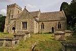 |
| Church of the Holy Trinity | Ascott d'Oyley, Ascott-under-Wychwood | Church | Late 12th century | 27 August 1956 | SP3005818658 51°51′57″N 1°33′54″W / 51.865697°N 1.564882°W |
1368158 | 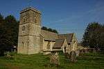 |
| Manor House | Ascott-under-Wychwood | Manor house | 1129–50 | 27 August 1956 | SP3021719020 51°52′08″N 1°33′45″W / 51.868943°N 1.562541°W |
1052609 | 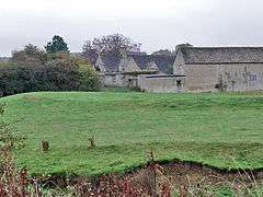 |
| Church of Saint Nicholas | Asthall | Church | 13th century | 12 September 1955 | SP2871511390 51°48′02″N 1°35′06″W / 51.800423°N 1.584986°W |
1053514 | 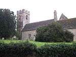 |
| Cote Baptist Church | Cote, Shifford and Chimney | Church | Mid-18th century | 8 October 1981 | SP3511403097 51°43′32″N 1°29′35″W / 51.725499°N 1.493028°W |
1284460 | 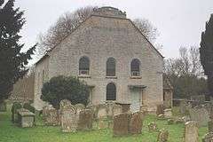 |
| Cote House and attached forecourt walls, gatepiers and gates | Cote, Shifford and Chimney | House | Mainly early 17th century | 12 September 1955 | SP3552502303 51°43′06″N 1°29′14″W / 51.718334°N 1.487159°W |
1284444 |  |
| Ham Court | Bampton | House | 17th century | 12 September 1955 | SP3096903058 51°43′31″N 1°33′11″W / 51.725392°N 1.55304°W |
1053536 | |
| The Deanery | Bampton | Clergy house | Late 11th/early 12th century | 12 September 1955 | SP3117603312 51°43′40″N 1°33′00″W / 51.727664°N 1.550021°W |
1053558 | |
| Weald Manor | Weald | House | Late 17th century | 12 September 1955 | SP3109302850 51°43′25″N 1°33′05″W / 51.723515°N 1.551263°W |
1198982 | |
| East formal garden, statue of knife-grinder in north-east corner | Blenheim Park (statue now sold) | Statue | c.1700 | 27 July 1988 | SP4421316143 51°50′32″N 1°21′35″W / 51.842147°N 1.359645°W |
1368003 | |
| East formal garden, statue of wrestlers in south-east corner | Blenheim Park (statue now sold) | Statue | c.1700 | 27 July 1988 | SP4423216115 51°50′31″N 1°21′34″W / 51.841894°N 1.359373°W |
1052915 | |
| High Lodge and attached walls | Blenheim Park | House | c.1768 | 27 August 1957 | SP4304815547 51°50′13″N 1°22′36″W / 51.836879°N 1.376628°W |
1052918 | |
| Temple of Diana | Blenheim Park | Temple | 1772–73 | 27 July 1988 | SP4400415834 51°50′22″N 1°21′46″W / 51.839385°N 1.362718°W |
1281682 | 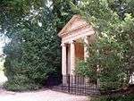 |
| Temple of Health | Blenheim Park | Temple | 1789 | 27 July 1988 | SP4444716040 51°50′28″N 1°21′23″W / 51.841202°N 1.356262°W |
1203467 | 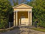 |
| Church of St Britius | Brize Norton | Church | Late 12th century | 12 September 1955 | SP2999607596 51°45′58″N 1°34′00″W / 51.766245°N 1.566736°W |
1368227 | 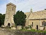 |
| Village Cross | Broadwell | Village cross | 15th century | 12 September 1955 | SP2524004133 51°44′07″N 1°38′09″W / 51.735343°N 1.635903°W |
1199125 | 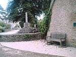 |
| Bruern Abbey | Bruern | Abbey | c.1720 | 27 August 1957 | SP2652020392 51°52′53″N 1°36′58″W / 51.881465°N 1.616129°W |
1053360 | 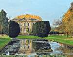 |
| Red Brick Cottage | Bruern | Abbey | Early 18th century | 27 August 1957 | SP2664920368 51°52′52″N 1°36′51″W / 51.881243°N 1.614257°W |
1367759 | |
| Aubrey Newman (now Hamilton's Sweet Shop) | Burford, Oxfordshire | House | 16th century | 12 September 1955 | SP2513412206 51°48′29″N 1°38′13″W / 51.807931°N 1.636857°W |
1266772 | 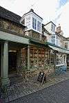 |
| Bridge over River Windrush | River Windrush, Burford | Bridge | 15th century | 12 September 1955 | SP2518212487 51°48′38″N 1°38′10″W / 51.810455°N 1.63614°W |
1267151 | 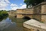 |
| Bridge over River Windrush (that part in Fulbrook civil parish) | Burford | Bridge | 15th century | 21 August 1989 | SP2518112498 51°48′38″N 1°38′10″W / 51.810554°N 1.636154°W |
1300961 | |
| Bull Cottage | Burford | House | Early 14th century | 12 September 1955 | SP2520912158 51°48′27″N 1°38′09″W / 51.807496°N 1.635772°W |
1225698 | |
| Burford Grammar School (main part including Lenthall House) | Burford | Grammar school | Rebuilt c.1570s | 12 September 1955 | SP2526412371 51°48′34″N 1°38′06″W / 51.809409°N 1.634959°W |
1267149 | 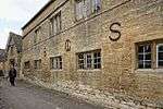 |
| Calendars | Burford | House | Late 15th century | 12 September 1955 | SP2502912152 51°48′27″N 1°38′18″W / 51.80745°N 1.638383°W |
1266408 | |
| Chapel of St John, Burford Priory | Burford | Manor house | 1661–62 | 12 September 1955 | SP2499612334 51°48′33″N 1°38′20″W / 51.809088°N 1.638849°W |
1266497 |  |
| Cob House | Burford | House | Dated 1672 | 12 September 1955 | SP2518112420 51°48′35″N 1°38′10″W / 51.809853°N 1.636159°W |
1224292 | |
| Falkland Hall | Burford | Town house | c.1578 | 12 September 1955 | SP2515912328 51°48′32″N 1°38′11″W / 51.809027°N 1.636485°W |
1224323 | 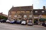 |
| 96 High Street | Burford | House | 16th century | 12 September 1955 | SP2513212197 51°48′28″N 1°38′13″W / 51.80785°N 1.636886°W |
1224332 | |
| Hill House | Burford | House | 16th century | 12 September 1955 | SP2512512027 51°48′23″N 1°38′13″W / 51.806322°N 1.637°W |
1224184 | |
| Jackie's Tea Rooms, the Antiquary | Burford | House | 15th/early 16th century | 12 September 1955 | SP2514612255 51°48′30″N 1°38′12″W / 51.808371°N 1.636679°W |
1266884 | |
| Link between the Priory and Lenthall's Chapel | Burford | Loggia | 1661–62 | 12 September 1955 | SP2499912341 51°48′33″N 1°38′20″W / 51.809151°N 1.638805°W |
1225187 | 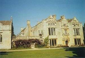 |
| London House, the Crypt Antiques | Burford | House | Late 15th century | 12 September 1955 | SP2515312140 51°48′26″N 1°38′12″W / 51.807337°N 1.636586°W |
1224036 | 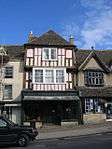 |
| Methodist Church | Burford | Town house | c.1720–30 | 12 September 1955 | SP2518012242 51°48′30″N 1°38′10″W / 51.808253°N 1.636187°W |
1223964 | 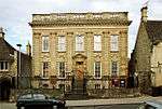 |
| Forecourt walls, railings, gates and alleyway gateway of Methodist Church | Burford | Gate | c.1720–30 | 12 September 1955 | SP2516912244 51°48′30″N 1°38′11″W / 51.808271°N 1.636346°W |
1223874 | |
| Old George Yard | Burford | Loggia | 15th or 16th century | 12 September 1955 | SP2511412185 51°48′28″N 1°38′14″W / 51.807743°N 1.637148°W |
1224562 | 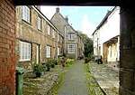 |
| Oxford Knitwear, WJ Castle (butcher) | Burford | House | 15th or early 16th century | 12 September 1955 | SP2515712124 51°48′26″N 1°38′12″W / 51.807193°N 1.636529°W |
1224037 | 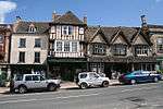 |
| R Reavley, Chemist | Burford | House | Remodelled 1700–20 | 12 September 1955 | SP2511512159 51°48′27″N 1°38′14″W / 51.807509°N 1.637135°W |
1224598 | .jpg) |
| Red Lion House | Burford | House | 17th century | 12 September 1955 | SP2511512165 51°48′27″N 1°38′14″W / 51.807563°N 1.637135°W |
1266762 |  |
| Riverside House | Burford | Town house | Late 18th century | 12 September 1955 | SP2521612445 51°48′36″N 1°38′08″W / 51.810076°N 1.63565°W |
1223724 | 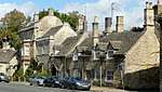 |
| Robert Aston tomb, about 10 metres south of south-west corner of Church of St John | Burford | Table tomb | 1698 | 1 March 1990 | SP2528212389 51°48′34″N 1°38′05″W / 51.80957°N 1.634697°W |
1284083 | 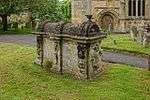 |
| Symon Wysdom's House | Burford | House | Remodelled 1576 | 12 September 1955 | SP2521012470 51°48′37″N 1°38′09″W / 51.810301°N 1.635735°W |
1223797 | 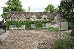 |
| The Bull Hotel | Burford | Coaching inn | Largely rebuilt c.1620 | 12 September 1955 | SP2518612150 51°48′27″N 1°38′10″W / 51.807425°N 1.636106°W |
1223880 | 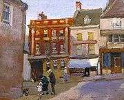 |
| The former George Inn | Burford | Jettied house | 15th or 16th century | 12 September 1955 | SP2513012174 51°48′28″N 1°38′13″W / 51.807643°N 1.636917°W |
1224560 | 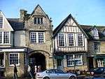 |
| The Great Almshouses | Burford | Almshouse | Mid-15th century | 12 September 1955 | SP2529212345 51°48′33″N 1°38′04″W / 51.809174°N 1.634555°W |
1053285 |  |
| The Great House | Burford | Town house | 1685 | 12 September 1955 | SP2527512139 51°48′26″N 1°38′05″W / 51.807322°N 1.634816°W |
1266237 | 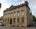 |
| The Highway Hotel | Burford | House | 18th century | 12 September 1955 | SP2514712106 51°48′25″N 1°38′12″W / 51.807031°N 1.636675°W |
1224038 | |
| The House of Simon | Burford | Jettied house | 16th century | 12 September 1955 | SP2515012087 51°48′25″N 1°38′12″W / 51.80686°N 1.636633°W |
1224146 | 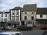 |
| The Old Rectory | Burford | Vicarage | c.1680–1700 | 12 September 1955 | SP2507912369 51°48′34″N 1°38′16″W / 51.809399°N 1.637642°W |
1224757 | .jpg) |
| The Tolsey | Burford | Market house | 16th century | 12 September 1955 | SP2512212134 51°48′26″N 1°38′13″W / 51.807284°N 1.637036°W |
1224632 |  |
| Wysdomes | Burford | Timber-framed house | Early 18th century | 12 September 1955 | SP2515112093 51°48′25″N 1°38′12″W / 51.806914°N 1.636618°W |
1267018 | |
| 115 High Street (Early Oak) | Burford | Continuous Jetty House | 16th century | 12 September 1955 | SP2516212111 51°48′25″N 1°38′11″W / 51.807076°N 1.636457°W |
1224106 | |
| Church of St Nicholas | Chadlington | Church | Late 12th century | 30 August 1988 | SP3336722032 51°53′45″N 1°30′59″W / 51.895844°N 1.516503°W |
1368037 | 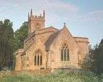 |
| Lower Court Farmhouse | Greenend, Chadlington | Farmhouse | c.1700 | 30 August 1988 | SP3236721158 51°53′17″N 1°31′52″W / 51.888045°N 1.531116°W |
1368038 | |
| Manor House and attached walls and outbuildings | Chadlington | Manor house | Early/mid-17th century | 27 August 1957 | SP3334521961 51°53′43″N 1°31′01″W / 51.895207°N 1.516829°W |
1052835 | 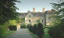 |
| Lee Place | Charlbury | Country house | c.1640 | 27 August 1956 | SP3582419104 51°52′10″N 1°28′52″W / 51.869367°N 1.481101°W |
1284015 | |
| Church of St Mary | Chastleton | Church | Late 12th century | 27 August 1957 | SP2486829068 51°57′34″N 1°38′22″W / 51.959544°N 1.639505°W |
1183347 | 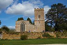 |
| Dovecote about 130m south-east of Chastleton House | Chastleton | Dovecote | 1762 | 27 August 1957 | SP2492628989 51°57′32″N 1°38′19″W / 51.958831°N 1.638666°W |
1284029 | 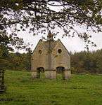 |
| Gateway, attached garden walls and coachhouse to south of main front of Chastleton House | Chastleton | Gate | Early 17th century | 15 May 1989 | SP2485429034 51°57′33″N 1°38′23″W / 51.959239°N 1.639711°W |
1367763 | 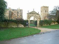 |
| Stables and brewhouse about 12m south-west of Chastleton House | Chastleton | Brewhouse | Early 17th century | 27 August 1957 | SP2480829039 51°57′33″N 1°38′25″W / 51.959286°N 1.64038°W |
1053368 | 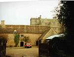 |
| Church of All Saints | Shorthampton, Chilson | Church | 12th century | 27 August 1957 | SP3282220102 51°52′43″N 1°31′29″W / 51.878524°N 1.524606°W |
1053112 | 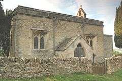 |
| Barclays Bank | Chipping Norton | Town house | c.1780 | 20 June 1986 | SP3140327117 51°56′30″N 1°32′40″W / 51.941674°N 1.544581°W |
1368162 | |
| Bliss Tweed Mill | Chipping Norton | Tweed mill | 1872 | 3 July 1980 | SP3043426696 51°56′17″N 1°33′31″W / 51.937943°N 1.558714°W |
1198094 | 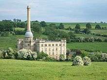 |
| Co-operative Chemist | Chipping Norton | House | c.1730 | 23 April 1952 | SP3136927070 51°56′29″N 1°32′42″W / 51.941253°N 1.54508°W |
1052656 | |
| Kings Head Court | Chipping Norton | Apartment | Refronted c.1720 | 23 April 1952 | SP3118327085 51°56′29″N 1°32′52″W / 51.941399°N 1.547785°W |
1368152 | |
| National Westminster Bank | Chipping Norton | Town house | c.1780 | 23 April 1952 | SP3131327121 51°56′30″N 1°32′45″W / 51.941715°N 1.54589°W |
1183153 | 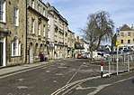 |
| The Playpen | Chipping Norton | House | Late 14th century | 23 April 1952 | SP3142627162 51°56′31″N 1°32′39″W / 51.942077°N 1.544243°W |
1052618 |  |
| Town Hall | Chipping Norton | Town hall | 1842 | 23 April 1952 | SP3133327054 51°56′28″N 1°32′44″W / 51.941112°N 1.545605°W |
1183188 |  |
| Former White Hart Hotel | Chipping Norton | Office | 1725 | 23 April 1952 | SP3138827138 51°56′31″N 1°32′41″W / 51.941864°N 1.544798°W |
1052616 | .jpg) |
| 15 Market Place | Chipping Norton | House | 17th century | 23 April 1952 | SP3131027113 51°56′30″N 1°32′45″W / 51.941643°N 1.545935°W |
1052623 | |
| 1–4 Church Street | Chipping Norton | Almshouse | 1640 | 23 April 1952 | SP3133427279 51°56′35″N 1°32′44″W / 51.943134°N 1.54557°W |
1182730 | 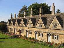 |
| Church of All Saints | Churchill | Church | 1826 | 27 August 1957 | SP2832524104 51°54′53″N 1°35′23″W / 51.91475°N 1.589603°W |
1053342 | 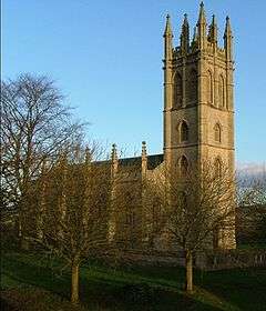 |
| Church of St Stephen | Clanfield | Church | Early 14th century | 12 September 1955 | SP2834502153 51°43′03″N 1°35′28″W / 51.717393°N 1.591102°W |
1053402 | 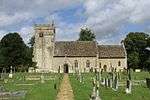 |
| Combe Mill | Combe | Saw mill | By 1852 | 29 June 1988 | SP4166015041 51°49′57″N 1°23′49″W / 51.832435°N 1.396833°W |
1053004 | 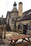 |
| Stable block about 40m north-east of Cornbury House | Cornbury and Wychwood | Stable | 1663 | 27 August 1957 | SP3507518209 51°51′41″N 1°29′31″W / 51.861368°N 1.49207°W |
1183387 | |
| Church of St Peter | Cornwell | Church | 12th century | 27 August 1954 | SP2736627156 51°56′32″N 1°36′12″W / 51.942237°N 1.603304°W |
1283726 | 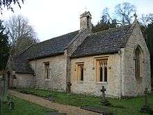 |
| Cornwell Manor | Cornwell | House | 16/17th century | 27 August 1954 | SP2718227170 51°56′33″N 1°36′22″W / 51.942372°N 1.605979°W |
1198747 |  |
| Caswell House, Caswell Farmhouse and attached outbuilding | Caswell, Curbridge | House | Late 15th century | 12 September 1955 | SP3205808234 51°46′19″N 1°32′12″W / 51.771867°N 1.536799°W |
1048993 | |
| Church of St John the Baptist | Curbridge | Church | 1906 | 17 October 1988 | SP3318208811 51°46′37″N 1°31′14″W / 51.776989°N 1.520455°W |
1368232 | 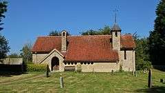 |
| Church of St Kenelm | Enstone | Church | Late 12th century | 30 August 1988 | SP3797025119 51°55′24″N 1°26′57″W / 51.923303°N 1.449274°W |
1052805 |  |
| Rectorial Tithe Barn | Enstone | Abbey | 1382 | 27 August 1957 | SP3785325106 51°55′23″N 1°27′04″W / 51.923194°N 1.450977°W |
1368063 | 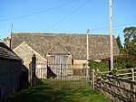 |
| Wayside Cross | Gagingwell | Wayside cross | Late medieval | 30 August 1988 | SP4079225115 51°55′23″N 1°24′30″W / 51.923068°N 1.408241°W |
1052803 | 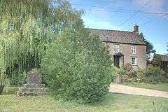 |
| Church of St Leonard | Eynsham | Church | Late 13th century | 12 September 1955 | SP4330509226 51°46′48″N 1°22′25″W / 51.780031°N 1.373686°W |
1048964 | 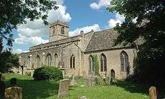 |
| Church of St John the Baptist | Fifield | Church | Early 13th century | 27 August 1957 | SP2394818753 51°52′01″N 1°39′13″W / 51.866845°N 1.653607°W |
1283580 | 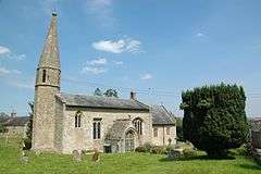 |
| Fifield House | Fifield | Farmhouse | Late 17th or early 18th century | 15 May 1989 | SP2414718765 51°52′01″N 1°39′03″W / 51.866945°N 1.650716°W |
1198985 | |
| Church of St Peter | Broughton Poggs, Filkins and Broughton Poggs | Church | 12th century | 12 September 1955 | SP2354603821 51°43′57″N 1°39′38″W / 51.732611°N 1.660454°W |
1199479 | 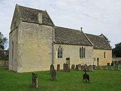 |
| Finstock Manor House | Finstock | Manor house | 1660 | 27 August 1957 | SP3613016716 51°50′52″N 1°28′37″W / 51.847878°N 1.476906°W |
1367894 | 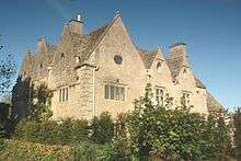 |
| Church of St Mary | Freeland | Church | 1869 | 1 September 1973 | SP4139212714 51°48′42″N 1°24′04″W / 51.811534°N 1.400999°W |
1367941 | 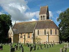 |
| Church of Saint James the Great | Fulbrook | Church | 12th century | 12 September 1955 | SP2583713034 51°48′55″N 1°37′36″W / 51.815343°N 1.626599°W |
1199969 |  |
| Medieval chest tomb about 5m south of tower of Church of St James the Great | Fulbrook | Chest tomb | 15th century | 21 August 1989 | SP2583013025 51°48′55″N 1°37′36″W / 51.815263°N 1.626701°W |
1053491 | |
| Gatepiers and gates about 80m south-east of Great Tew House | Great Tew Park, Great Tew | Gate | c.1700 | 27 August 1956 | SP3979629004 51°57′29″N 1°25′20″W / 51.958104°N 1.422275°W |
1286304 | 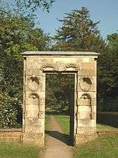 |
| 57 and 58 The Lane | Great Tew | House | 17th century | 27 August 1956 | SP3947329367 51°57′41″N 1°25′37″W / 51.96139°N 1.426933°W |
1286152 | 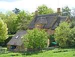 |
| The Old Manor House | Hailey | House | Late 15th or early 16th century | 12 September 1955 | SP3585312490 51°48′36″N 1°28′53″W / 51.809902°N 1.481363°W |
1198776 | 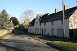 |
| Church of St Mary | Cokethorpe, Hardwick-with-Yelford | Church | Late 15th century | 12 September 1955 | SP3735606244 51°45′13″N 1°27′37″W / 51.753648°N 1.460234°W |
1368277 | 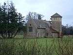 |
| Church of St Nicholas and St Swithin | Yelford, Hardwick-with-Yelford | Church | c.1500 | 12 September 1955 | SP3587604709 51°44′24″N 1°28′55″W / 51.739944°N 1.481831°W |
1198970 | 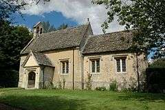 |
| Cokethorpe School | Cokethorpe, Hardwick-with-Yelford | Country house | 1709 | 12 September 1955 | SP3710606170 51°45′11″N 1°27′50″W / 51.752999°N 1.463863°W |
1048970 |  |
| Yelford Manor | Yelford, Hardwick-with-Yelford | House | Late 15th century | 12 September 1955 | SP3596304746 51°44′25″N 1°28′50″W / 51.740271°N 1.480567°W |
1368241 | |
| Bath House, reservoir and conduit SSW of Heythrop House | Heythrop Park, Heythrop | Bath house | c.1710 | 16 September 1999 | SP3627826086 51°55′56″N 1°28′26″W / 51.93211°N 1.473775°W |
1112993 | 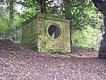 |
| Heythrop House | Heythrop Park, Heythrop | Country house | c.1705 | 27 August 1957 | SP3639126437 51°56′07″N 1°28′20″W / 51.935258°N 1.472095°W |
1052781 | 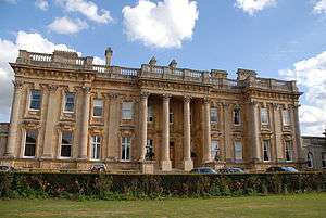 |
| Old Church of St Nicholas | Heythrop | Church | 12th century | 27 August 1957 | SP3522327713 51°56′48″N 1°29′20″W / 51.946804°N 1.488952°W |
1052776 | |
| Screen with alcove and niches SSW of Heythrop House | Heythrop Park, Heythrop | Garden Screen | c.1710 | 16 September 1999 | SP3622026148 51°55′58″N 1°28′29″W / 51.932671°N 1.474612°W |
1112992 | 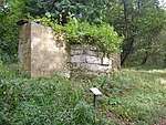 |
| Bradshaw's Farmhouse with attached garden wall | Kelmscott | Farmhouse | 1757 | 12 September 1955 | SU2456999325 51°41′32″N 1°38′45″W / 51.692144°N 1.645957°W |
1199066 | |
| Church of St George | Kelmscott | Church | Late 12th century | 12 September 1955 | SU2491999368 51°41′33″N 1°38′27″W / 51.692515°N 1.640891°W |
1199126 |  |
| Manor Cottages | Kelmscott | Farm labourer's cottage | 1914 | 30 March 1989 | SU2501698998 51°41′21″N 1°38′22″W / 51.689184°N 1.639514°W |
1199315 | |
| Memorial Cottages with attached outbuildings and garden walls | Kelmscott | House | 1902 | 12 September 1955 | SU2498799017 51°41′22″N 1°38′24″W / 51.689357°N 1.639932°W |
1367768 | |
| Church of St George | Kencot | Church | 12th century | 12 September 1955 | SP2543904734 51°44′27″N 1°37′59″W / 51.740738°N 1.632978°W |
1053501 | 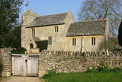 |
| Church of St Nicholas | Kiddington | Church | 12th century | 27 August 1957 | SP4114322912 51°54′12″N 1°24′12″W / 51.903237°N 1.4034°W |
1198490 | 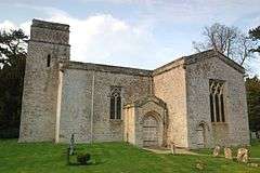 |
| Wayside cross at SP4107022310 | Over Kiddington, Kiddington with Asterleigh | Wayside cross | 15th century | 27 August 1957 | SP4107022310 51°53′52″N 1°24′16″W / 51.89783°N 1.404532°W |
1198629 | 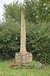 |
| Church of St Andrew | Kingham, Oxfordshire | Church | Mid-14th century | 27 August 1957 | SP2582623725 51°54′41″N 1°37′33″W / 51.911464°N 1.625963°W |
1283232 | 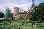 |
| Kingham House | Kingham | House | c.1688 | 27 August 1957 | SP2583523762 51°54′42″N 1°37′33″W / 51.911796°N 1.625829°W |
1367805 | 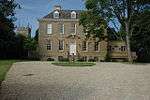 |
| Churchyard cross about 50m east of Church of St Matthew | Langford | Cross | 15th century | 12 September 1955 | SP2497302541 51°43′16″N 1°38′24″W / 51.721041°N 1.639883°W |
1199490 | |
| Church of St Michael and All Angels | Leafield | Church | c.1858 | 21 August 1989 | SP3186015336 51°50′09″N 1°32′20″W / 51.83573°N 1.539018°W |
1367730 | 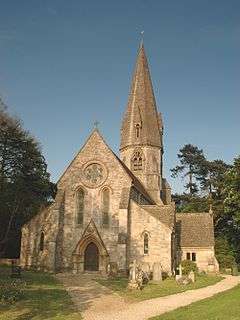 |
| Langley Farmhouse | Leafield | Farmhouse | c.1478 | 19 December 1986 | SP2952715510 51°50′15″N 1°34′22″W / 51.837422°N 1.572861°W |
1182682 | |
| St Margaret's Church | Little Faringdon | Church | 12th century | 12 September 1955 | SP2262701407 51°42′39″N 1°40′26″W / 51.710945°N 1.673917°W |
1283247 | 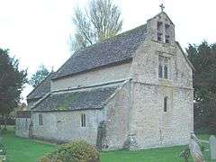 |
| Barn about 55m ESE of Manor Farmhouse | Minster Lovell | Barn | Probably 15th century | 12 September 1955 | SP3247811392 51°48′01″N 1°31′50″W / 51.800236°N 1.530418°W |
1367717 | 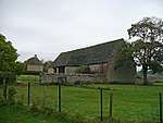 |
| Manor Farmhouse | Minster Lovell | Farmhouse | 12th century | 12 September 1955 | SP3239911409 51°48′01″N 1°31′54″W / 51.800393°N 1.531562°W |
1053432 |  |
| Minster Lovell Manor Dovecot | Minster Lovell | Dovecote | 15th century | 12 September 1955 | SP3246311446 51°48′03″N 1°31′50″W / 51.800722°N 1.53063°W |
1367756 | 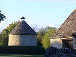 |
| 19 and 21 Upper Crescent | Charterville, Minster Lovell | Chartist colony school | c.1847 | 7 July 1977 | SP3120810883 51°47′45″N 1°32′56″W / 51.795731°N 1.54888°W |
1053438 |  |
| Church of St Peter | Wilcote, North Leigh | Church | Late 12th century | 12 September 1955 | SP3710415288 51°50′06″N 1°27′47″W / 51.834976°N 1.46292°W |
1367959 | 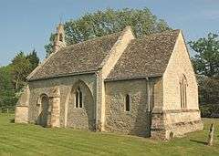 |
| Rectory Farm, barn about 60m NNE of farmhouse | Northmoor | Barn | 18th century | 17 October 1988 | SP4215802892 51°43′23″N 1°23′28″W / 51.723172°N 1.391077°W |
1048940 | 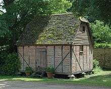 |
| Rectory Farmhouse | Northmoor | Farmhouse | 1629 | 12 September 1955 | SP4214802825 51°43′21″N 1°23′28″W / 51.72257°N 1.39123°W |
1048939 | 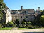 |
| Wychwood Lodge | Ramsden | Farmhouse | Late 16th century | 12 September 1955 | SP3534115388 51°50′10″N 1°29′19″W / 51.835989°N 1.488495°W |
1283705 | |
| Church of St Philip | Little Rollright, Rollright | Church | Early 13th century | 27 August 1957 | SP2935330125 51°58′08″N 1°34′27″W / 51.968829°N 1.574146°W |
1251364 | 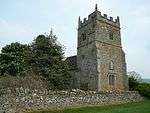 |
| Church of St James | Rousham | Church | Late 12th century | 27 August 1957 | SP4799324169 51°54′50″N 1°18′13″W / 51.913991°N 1.303669°W |
1199466 |  |
| Boat House | Rousham Park Gardens, Rousham | Boathouse | 1733–40 | 27 August 1957 | SP4802824262 51°54′53″N 1°18′11″W / 51.914824°N 1.303147°W |
1052958 | |
| Cowhouse about 410m south of Rousham Park | Rousham Park, Rousham | Ferme ornée | 1733–40 | 27 August 1957 | SP4786823802 51°54′39″N 1°18′20″W / 51.910702°N 1.305537°W |
1199269 | 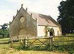 |
| Dovecote about 74m east-south-east of Rousham House | Rousham Park Gardens, Rousham | Dovecote | 17th century | 27 August 1957 | SP4794024189 51°54′51″N 1°18′16″W / 51.914175°N 1.304437°W |
1052959 | 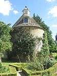 |
| Garden seat next to River Cherwell, and garden walls, doorways and gateway to east of Rousham Park | Rousham Park Gardens, Rousham | Gate | 17th century | 27 August 1957 | SP4801824236 51°54′53″N 1°18′12″W / 51.914591°N 1.303296°W |
1199448 | |
| Grotto about 4m west of the Cold Bath | Rousham Park Gardens, Rousham | Grotto | 1738–40 | 27 August 1957 | SP4777624542 51°55′03″N 1°18′24″W / 51.917363°N 1.306772°W |
1199415 | |
| Herm about 86m NNE of Rousham Park and at north-east corner of bowling green | Rousham Park Gardens, Rousham | Herm | 1733–40 | 27 August 1957 | SP4787524311 51°54′55″N 1°18′19″W / 51.915278°N 1.305365°W |
1283442 | |
| Herm about 86m north of Rousham Park and at north-west corner of bowling green | Rousham Park Gardens, Rousham | Herm | 1733–40 | 27 August 1957 | SP4783224323 51°54′55″N 1°18′22″W / 51.915389°N 1.305988°W |
1283417 | |
| Heyford Bridge (that part in Rousham civil parish) | Rousham | Bridge | 1255 | 27 August 1957 | SP4780224778 51°55′10″N 1°18′23″W / 51.919482°N 1.306361°W |
1367979 | 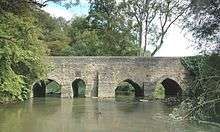 |
| Lodge about 10m SSE of Palladian gateway | Rousham Park Gardens, Rousham | Cow house | 1733–40 | 27 August 1957 | SP4762824371 51°54′57″N 1°18′32″W / 51.915838°N 1.308947°W |
1283415 | |
| Lower Cascade in Venus' Vale | Rousham Park Gardens, Rousham | Cascade | 1738–40 | 27 August 1957 | SP4777024477 51°55′00″N 1°18′25″W / 51.916779°N 1.306868°W |
1367986 | 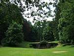 |
| Palladian Gateway | Rousham Park Gardens, Rousham | Gate | 1733–40 | 27 August 1957 | SP4762324383 51°54′57″N 1°18′32″W / 51.915947°N 1.309018°W |
1052953 |  |
| Praeneste | Rousham Park Gardens, Rousham | Garden building | 1738–40 | 27 August 1957 | SP4776924425 51°54′59″N 1°18′25″W / 51.916312°N 1.30689°W |
1367983 |  |
| Retaining walls to the Cold Bath, Octagon Pool and Watery Walk | Rousham Park Gardens, Rousham | Pond | 1738–40 | 27 August 1957 | SP4776424500 51°55′01″N 1°18′25″W / 51.916986°N 1.306952°W |
1052955 |  |
| Stables and attached walls attached to, and south-east of, Rousham House | Rousham Park, Rousham | Stable | c.1738 | 27 August 1957 | SP4787524178 51°54′51″N 1°18′19″W / 51.914082°N 1.305383°W |
1199244 | |
| Statue of Apollo at end of Long Walk and about 12m south-east of the Temple of Echo | Rousham Park Gardens, Rousham | Statue | c.1739 | 27 August 1957 | SP4781124595 51°55′04″N 1°18′23″W / 51.917836°N 1.306256°W |
1199424 |  |
| Statue of Bacchus in Bridgeman's Amphitheatre | Rousham Park Gardens, Rousham | Statue | Early 18th century | 27 August 1957 | SP4780624406 51°54′58″N 1°18′23″W / 51.916138°N 1.306354°W |
1283359 | 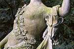 |
| Statue of Ceres in Bridgeman's Amphitheatre | Rousham Park Gardens, Rousham | Statue | Early 18th century | 27 August 1957 | SP4782224398 51°54′58″N 1°18′22″W / 51.916064°N 1.306123°W |
1283365 | |
| Statue of Dying Gaul about 5m south-west of balustrade of Praeneste | Rousham Park Gardens, Rousham | Statue | c.1743 | 27 August 1957 | SP4776224421 51°54′59″N 1°18′25″W / 51.916276°N 1.306992°W |
1283423 | 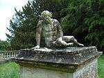 |
| Statue of Faun in Venus Vale, to ENE of Upper Cascade | Rousham Park Gardens, Rousham | Statue | 1701 | 27 August 1957 | SP4771524478 51°55′00″N 1°18′28″W / 51.916793°N 1.307667°W |
1367985 | |
| Statue of Lion and Horse about 85m north of Rousham Park and at north end of bowling green | Rousham Park Gardens, Rousham | Statue | 1743 | 27 August 1957 | SP4785124318 51°54′55″N 1°18′21″W / 51.915343°N 1.305712°W |
1052950 | 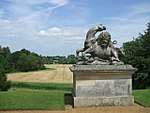 |
| Statue of Mercury in Bridgeman's Amphitheatre | Rousham Park Gardens, Rousham | Statue | Early 18th century | 27 August 1957 | SP4781124396 51°54′58″N 1°18′23″W / 51.916047°N 1.306283°W |
1052957 | |
| Statue of Pan in Venus Vale, to ESE of Upper Cascade | Rousham Park Gardens, Rousham | Statue | 1701 | 27 August 1957 | SP4772624447 51°54′59″N 1°18′27″W / 51.916513°N 1.307512°W |
1052954 | |
| Temple of Echo | Rousham Park Gardens, Rousham | Garden temple | 1738–40 | 27 August 1957 | SP4778224598 51°55′04″N 1°18′24″W / 51.917866°N 1.306677°W |
1052956 | |
| The Pyramid House | Rousham Park Gardens, Rousham | Gazebo | 1733–40 | 27 August 1957 | SP4793624274 51°54′54″N 1°18′16″W / 51.91494°N 1.304483°W |
1367987 | |
| Upper Cascade including statues of Venus and swans in Venus Vale | Rousham Park Gardens, Rousham | Statue | 1738–40 | 27 August 1957 | SP4771324459 51°55′00″N 1°18′28″W / 51.916622°N 1.307699°W |
1283383 |  |
| Urn about 10m ENE of Palladian Gateway | Rousham Park Gardens, Rousham | Urn | 1733–40 | 27 August 1957 | SP4762924385 51°54′57″N 1°18′32″W / 51.915964°N 1.308931°W |
1199384 | |
| Urn about 10m ESE of Palladian Gateway | Rousham Park Gardens, Rousham | Urn | 1733–40 | 27 August 1957 | SP4762724381 51°54′57″N 1°18′32″W / 51.915928°N 1.30896°W |
1367984 | |
| Urn about 3m from north-east corner of Praeneste | Rousham Park Gardens, Rousham | Urn | c.1738 | 27 August 1957 | SP4776724440 51°54′59″N 1°18′25″W / 51.916447°N 1.306917°W |
1052952 | 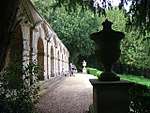 |
| Urn about 3m from south-east corner of Praeneste | Rousham Park Gardens, Rousham | Urn | c.1738 | 27 August 1957 | SP4778224417 51°54′58″N 1°18′24″W / 51.916239°N 1.306702°W |
1283406 | |
| Church of St Martin | Sandford St. Martin | Church | 13th century | 27 August 1956 | SP4202826691 51°56′14″N 1°23′24″W / 51.937145°N 1.390077°W |
1052510 | 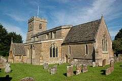 |
| Sandford Park | Sandford Park, Sandford St. Martin | Country house | c.1700 | 27 August 1956 | SP4196526717 51°56′15″N 1°23′28″W / 51.937384°N 1.39099°W |
1286006 | |
| Summerhouse about 200m north-west of Sandford Park | Sandford Park, Sandford St. Martin | Summerhouse | Late 18th century | 18 May 1987 | SP4180826814 51°56′18″N 1°23′36″W / 51.938268°N 1.393262°W |
1368187 | |
| Former stables immediately to south-east of Sarsden House | Sarsden | House | Probably early to mid-17th century | 27 August 1957 | SP2897122971 51°54′16″N 1°34′49″W / 51.904531°N 1.580307°W |
1053277 | |
| Sarsden House | Sarsden | Country house | Rebuilt after 1689 | 27 August 1957 | SP2891423006 51°54′17″N 1°34′52″W / 51.904848°N 1.581132°W |
1367832 | |
| The Dower House | Sarsden | House | c.1825 | 1 May 1985 | SP3055924376 51°55′01″N 1°33′26″W / 51.917078°N 1.557101°W |
1200341 | |
| Wayside cross at NGR SP29082329 | Sarsden | Wayside Cross | Early to mid-14th century | 27 August 1957 | SP2908723282 51°54′26″N 1°34′43″W / 51.907321°N 1.578595°W |
1053279 | 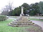 |
| Church of the Holy Rood | Shilton | Church | 12th century | 12 September 1955 | SP2671608299 51°46′22″N 1°36′51″W / 51.772731°N 1.614211°W |
1357113 | 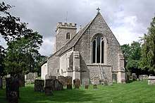 |
| Dovecote about 45m north-west of the Old Manor | Shilton | Dovecote | Early 16th century | 12 September 1955 | SP2682908491 51°46′28″N 1°36′45″W / 51.774452°N 1.612559°W |
1225800 | |
| Manor House | Shilton | Manor house | 1678 | 12 September 1955 | SP2654308441 51°46′26″N 1°37′00″W / 51.774016°N 1.616708°W |
1266168 | |
| Morgan bale tomb about 3m east of Church of St Mary | Shipton-under-Wychwood | Table tomb | 18th century | 19 December 1986 | SP2798917991 51°51′35″N 1°35′42″W / 51.859807°N 1.594982°W |
1182707 | 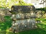 |
| Shaven Crown Hotel | Shipton-under-Wychwood | House | 16th century | 27 August 1959 | SP2784017850 51°51′31″N 1°35′50″W / 51.858547°N 1.597157°W |
1052553 | 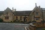 |
| Shipton Court | Shipton-under-Wychwood | Country house | c.1603 | 27 August 1956 | SP2776517526 51°51′20″N 1°35′54″W / 51.855638°N 1.598272°W |
1052592 |  |
| The New House with surrounding pool and garden wall to the west | Shipton-under-Wychwood | Detached House | 1964 | 15 July 1998 | SP2808417917 51°51′33″N 1°35′37″W / 51.859137°N 1.593609°W |
1375658 | |
| The Old Prebendal | Shipton-under-Wychwood | Clergy house | Perhaps 13th century | 27 August 1956 | SP2798518023 51°51′36″N 1°35′42″W / 51.860095°N 1.595038°W |
1182931 | 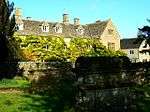 |
| Tithe barn about 75m north-west of the Old Prebendal | Shipton-under-Wychwood | Tithe barn | 14th century | 27 August 1956 | SP2796118063 51°51′38″N 1°35′43″W / 51.860456°N 1.595383°W |
1284303 | |
| Church of All Saints | Spelsbury | Church | 11th/12th century | 27 August 1957 | SP3491921509 51°53′28″N 1°29′38″W / 51.891047°N 1.494002°W |
1251447 | 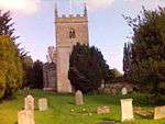 |
| Cross | Taston, Spelsbury | Village cross | Medieval | 27 August 1957 | SP3590822082 51°53′46″N 1°28′46″W / 51.896136°N 1.479572°W |
1251432 | 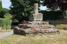 |
| Lodge Farmhouse | Ditchley, Spelsbury | Farmhouse | c.1770 | 30 August 1988 | SP3938119959 51°52′37″N 1°25′46″W / 51.876815°N 1.429345°W |
1262767 | 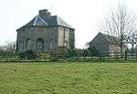 |
| The Rotunda about 600m WNW of Ditchley House | Ditchley Park, Spelsbury | Balustrade | c.1760 | 27 August 1957 | SP3846621361 51°53′22″N 1°26′33″W / 51.889483°N 1.44248°W |
1251530 | |
| Church of St Giles | Standlake | Church | Late 12th century | 12 September 1955 | SP3972803624 51°43′48″N 1°25′34″W / 51.72993°N 1.426171°W |
1367885 | 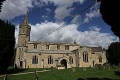 |
| The Old Rectory and attached wall | Standlake | House | 13th century | 12 September 1955 | SP3987703490 51°43′43″N 1°25′27″W / 51.728715°N 1.424029°W |
1053147 | |
| Harcourt House and attached walls and outbuildings | Stanton Harcourt | House | Mid-12th century | 12 September 1955 | SP4159105673 51°44′54″N 1°23′56″W / 51.748217°N 1.398954°W |
1199690 | |
| Parsonage House and attached forecourt walls, gates and gatepiers and rear wall with outbuilding | Stanton Harcourt | House | 16th century | 12 September 1955 | SP4142305905 51°45′01″N 1°24′05″W / 51.750315°N 1.40136°W |
1199558 | |
| Church of St Mary | Steeple Barton | Church | Early 14th century | 27 August 1957 | SP4482424896 51°55′15″N 1°20′59″W / 51.92079°N 1.349643°W |
1052931 | 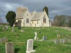 |
| Church of St James the Great | Stonesfield | Church | 13th century | 27 August 1957 | SP3934617094 51°51′04″N 1°25′49″W / 51.85106°N 1.430179°W |
1053074 | 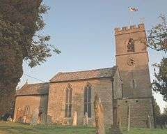 |
| Church of St Mary | Swerford | Church | Late 13th century | 27 August 1956 | SP3723831130 51°58′39″N 1°27′33″W / 51.977394°N 1.459268°W |
1193995 |  |
| Old Rectory | Swerford | House | Late 17th century | 18 May 1987 | SP3718731038 51°58′36″N 1°27′36″W / 51.97657°N 1.460021°W |
1194004 | 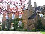 |
| Church of St Mary | Swinbrook, Swinbrook and Widford | Church | 11th century | 12 September 1955 | SP2798712147 51°48′26″N 1°35′44″W / 51.807266°N 1.595482°W |
1053441 | 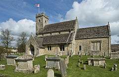 |
| Church of St Oswald | Widford | Church | 13th century | 12 September 1955 | SP2734112090 51°48′24″N 1°36′17″W / 51.806785°N 1.604856°W |
1300619 |  |
| Church of St Nicholas | Tackley | Church | 11th century | 27 August 1957 | SP4758720170 51°52′41″N 1°18′36″W / 51.878074°N 1.310122°W |
1281634 | 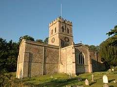 |
| Stables at Manor Farm | Tackley | Stable | 1616 | 27 August 1957 | SP4769820445 51°52′50″N 1°18′30″W / 51.880537°N 1.308471°W |
1052894 | |
| Church of St John the Evangelist | Taynton | Church | c.1360 | 12 September 1955 | SP2341213544 51°49′12″N 1°39′42″W / 51.820035°N 1.661742°W |
1300575 | 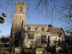 |
| Strongs House | Taynton | House | 17th century | 12 September 1955 | SP2324013641 51°49′15″N 1°39′51″W / 51.820914°N 1.664231°W |
1183509 | |
| Church of St Edward the Confessor | Westcott Barton | Church | 12th century | 27 August 1956 | SP4309425685 51°55′41″N 1°22′29″W / 51.92802°N 1.374698°W |
1285863 | 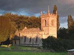 |
| Manor House | Westwell | Manor house | Pre-1657 | 12 September 1955 | SP2235909883 51°47′14″N 1°40′38″W / 51.787163°N 1.677254°W |
1357459 | |
| Manor House: barn at north-east corner | Westwell | Barn | 18th century | 12 September 1955 | SP2237709912 51°47′15″N 1°40′37″W / 51.787423°N 1.676991°W |
1065942 | |
| Manor House: boundary wall and archway at right angles to outer north-west wing | Westwell | Boundary wall | 13th century | 1 March 1990 | SP2232709889 51°47′14″N 1°40′40″W / 51.787218°N 1.677717°W |
1357460 | |
| Manor House: dovecote about 10 metres to south-west | Westwell | Dovecote | 17th century | 1 March 1990 | SP2234509851 51°47′13″N 1°40′39″W / 51.786875°N 1.677459°W |
1065943 | |
| The Old Rectory | Westwell | Cross-passage House | Pre-1700 | 12 September 1955 | SP2228410020 51°47′18″N 1°40′42″W / 51.788397°N 1.678332°W |
1065936 | |
| Batt House | Witney | House | Early 18th century | 14 May 1952 | SP3556909686 51°47′05″N 1°29′09″W / 51.78471°N 1.485769°W |
1289128 | 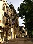 |
| Blanket Hall | Witney | Assay Office | 18th century | 14 May 1952 | SP3577110106 51°47′19″N 1°28′58″W / 51.788473°N 1.482798°W |
1212999 | 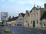 |
| Butter Cross | Witney | Market cross | 1683 | 14 May 1952 | SP3560709567 51°47′01″N 1°29′07″W / 51.783638°N 1.48523°W |
1213348 |  |
| Henry Box School | Witney | House | Dated 1660 | 14 May 1952 | SP3542809308 51°46′53″N 1°29′16″W / 51.781321°N 1.487852°W |
1212271 | 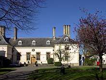 |
| Manor Farmhouse | Cogges, Witney | Farmhouse | Mid-13th century | 3 March 1988 | SP3620009632 51°47′03″N 1°28′36″W / 51.784184°N 1.476628°W |
1367920 |  |
| St Mary's Priory House | Cogges, Witney | House | 1859 | 3 March 1988 | SP3608609652 51°47′04″N 1°28′42″W / 51.784371°N 1.478278°W |
1053064 | |
| The Hermitage | Witney | Apartment | Early 16th century | 14 May 1952 | SP3564609502 49°46′01″N 7°33′26″W / 49.766806°N 7.55716°W |
1053083 | |
| The Old Rectory and attached wall | Witney | Vicarage | 1723 | 14 May 1952 | SP3557909232 51°46′50″N 1°29′08″W / 51.780628°N 1.485671°W |
1212211 | |
| Town Hall | Witney | Town hall | c.1770–80 | 14 May 1952 | SP3560409595 51°47′02″N 1°29′07″W / 51.78389°N 1.485271°W |
1213347 |  |
| Woodcote | Witney | House | 17th century | 14 May 1952 | SP3561009552 51°47′01″N 1°29′07″W / 51.783503°N 1.485189°W |
1213349 | |
| Wychwood | Witney | House | Early 16th century | 14 May 1952 | 49°46′01″N 7°33′26″W / 49.766806°N 7.55716°W | 1053044 | |
| Bartholomew House | Woodstock | House | Early 17th century | 18 October 1949 | SP4451816775 51°50′52″N 1°21′18″W / 51.847805°N 1.355137°W |
1368010 | |
| Church of St Mary Magdalene | Woodstock | Church | Late 12th century | 18 October 1949 | SP4438616716 51°50′50″N 1°21′25″W / 51.847285°N 1.357061°W |
1262223 | 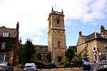 |
| Hope House | Woodstock | Apartment | c.1708 | 18 October 1949 | SP4463816711 51°50′50″N 1°21′12″W / 51.84722°N 1.353404°W |
1204018 | |
| Manor Farmhouse | Old Woodstock, Woodstock | Farmhouse | Late 13th century | 18 October 1949 | SP4419417061 51°51′01″N 1°21′35″W / 51.850401°N 1.359804°W |
1368040 | |
| The Bear Hotel | Woodstock | House | 17th century | 18 October 1949 | SP4441916728 51°50′51″N 1°21′24″W / 51.84739°N 1.35658°W |
1252557 | 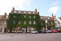 |
| The Bishop's House | Woodstock | Vicarage | Late 17th century | 18 October 1949 | SP4431016707 51°50′50″N 1°21′29″W / 51.84721°N 1.358165°W |
1262191 | |
| Church of St Mary | Wootton | Church | Mid-13th century | 27 August 1957 | SP4390319882 51°52′33″N 1°21′49″W / 51.875786°N 1.363671°W |
1052899 | 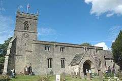 |
| Hordley House | Wootton | House | Mid- to late 16th century | 27 August 1957 | SP4467619200 51°52′11″N 1°21′09″W / 51.869593°N 1.352531°W |
1283262 | |
| Nether Worton House | Nether Worton, Worton | Manor house | Dated 1653, possibly earlier | 27 August 1956 | SP4252730072 51°58′03″N 1°22′57″W / 51.967504°N 1.382402°W |
1052464 | 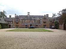 |
See also
Notes
- ↑ The date given is the date used by Historic England as significant for the initial building or that of an important part in the structure's description.
- ↑ Sometimes known as OSGB36, the grid reference is based on the British national grid reference system used by the Ordnance Survey.
- ↑ The "List Entry Number" is a unique number assigned to each listed building and scheduled monument by Historic England.
External links
![]()
This article is issued from
Wikipedia.
The text is licensed under Creative Commons - Attribution - Sharealike.
Additional terms may apply for the media files.