Graçay
| Graçay | ||
|---|---|---|
| Commune | ||
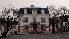 Town hall | ||
| ||
 Graçay Location within Centre-Val de Loire region  Graçay | ||
| Coordinates: 47°08′37″N 1°50′51″E / 47.1436°N 1.8475°ECoordinates: 47°08′37″N 1°50′51″E / 47.1436°N 1.8475°E | ||
| Country | France | |
| Region | Centre-Val de Loire | |
| Department | Cher | |
| Arrondissement | Vierzon | |
| Canton | Vierzon-2 | |
| Intercommunality | CC Vierzon-Sologne-Berry | |
| Government | ||
| • Mayor (2008–2014) | Jean-Pierre Charles | |
| Area1 | 31.82 km2 (12.29 sq mi) | |
| Population (2008)2 | 1,557 | |
| • Density | 49/km2 (130/sq mi) | |
| Time zone | UTC+1 (CET) | |
| • Summer (DST) | UTC+2 (CEST) | |
| INSEE/Postal code | 18103 /18310 | |
| Elevation |
97–164 m (318–538 ft) (avg. 111 m or 364 ft) | |
|
1 French Land Register data, which excludes lakes, ponds, glaciers > 1 km2 (0.386 sq mi or 247 acres) and river estuaries. 2 Population without double counting: residents of multiple communes (e.g., students and military personnel) only counted once. | ||
.svg.png)
Graçay is a commune in the Cher department in the Centre-Val de Loire region of France.
Geography
It is a farming area comprising the small town and several hamlets, on the right bank of the Fouzon river, situated some 12 miles (19 km) southwest of Vierzon at the junction of the D68, D19, D83 and D922 roads. Junction 9 of the A20 autoroute lies within the territory of the commune
Population
| Historical population | ||
|---|---|---|
| Year | Pop. | ±% |
| 1962 | 1,889 | — |
| 1968 | 2,043 | +8.2% |
| 1975 | 2,019 | −1.2% |
| 1982 | 1,844 | −8.7% |
| 1990 | 1,559 | −15.5% |
| 1999 | 1,562 | +0.2% |
| 2008 | 1,557 | −0.3% |
Sights
See also
References
External links
| Wikimedia Commons has media related to Graçay. |
- Official town website (in French)
- Graçay on the Quid website (in French)
This article is issued from
Wikipedia.
The text is licensed under Creative Commons - Attribution - Sharealike.
Additional terms may apply for the media files.