Bannay, Cher
| Bannay | ||
|---|---|---|
| Commune | ||
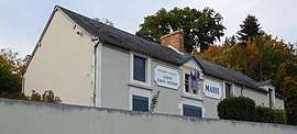 Town hall | ||
| ||
 Bannay Location within Centre-Val de Loire region  Bannay | ||
| Coordinates: 47°23′12″N 2°52′52″E / 47.3867°N 2.8811°ECoordinates: 47°23′12″N 2°52′52″E / 47.3867°N 2.8811°E | ||
| Country | France | |
| Region | Centre-Val de Loire | |
| Department | Cher | |
| Arrondissement | Bourges | |
| Canton | Sancerre | |
| Intercommunality | CC Pays Fort Sancerrois Val de Loire | |
| Government | ||
| • Mayor (2008–2014) | Michel Paye | |
| Area1 | 25.03 km2 (9.66 sq mi) | |
| Population (2008)2 | 771 | |
| • Density | 31/km2 (80/sq mi) | |
| Time zone | UTC+1 (CET) | |
| • Summer (DST) | UTC+2 (CEST) | |
| INSEE/Postal code | 18020 /18300 | |
| Elevation |
139–260 m (456–853 ft) (avg. 148 m or 486 ft) | |
|
1 French Land Register data, which excludes lakes, ponds, glaciers > 1 km2 (0.386 sq mi or 247 acres) and river estuaries. 2 Population without double counting: residents of multiple communes (e.g., students and military personnel) only counted once. | ||
.svg.png)
Bannay is a commune in the Cher department in the Centre-Val de Loire region of France.
Geography
An area of forestry and farming comprising the village and several hamlets situated by the banks of the river Loire, some 30 miles (48 km) northeast of Bourges at the junction of the D86 with the D955 road.
Population
| Historical population | ||
|---|---|---|
| Year | Pop. | ±% |
| 1962 | 655 | — |
| 1968 | 673 | +2.7% |
| 1975 | 737 | +9.5% |
| 1982 | 785 | +6.5% |
| 1990 | 766 | −2.4% |
| 1999 | 771 | +0.7% |
| 2008 | 771 | +0.0% |
Places of interest
- The church of St.Julien, dating from the 15th century.
- Vestiges of a Roman bathhouse.
- Three watermills, at Deza, Granger and Fricambaut.
- An eighteenth-century château, with a park designed by Le Nôtre.
See also
References
External links
| Wikimedia Commons has media related to Bannay (Cher). |
- Website about Bannay (in French)
- Bannay on the Quid website (in French)
This article is issued from
Wikipedia.
The text is licensed under Creative Commons - Attribution - Sharealike.
Additional terms may apply for the media files.