Gao Cercle
| Gao | |
|---|---|
| Cercle | |
 | |
 Cercle of Gap in Mali | |
| Country |
|
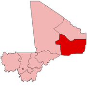
| Region | Gao Region |
| Capital | Gao |
| Area[1] | |
| • Total | 31,250 km2 (12,070 sq mi) |
| Population (2009 census)[2] | |
| • Total | 239,853 |
| • Density | 7.7/km2 (20/sq mi) |
| Time zone | UTC+0 (GMT) |
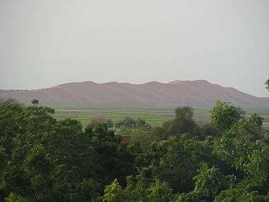
Gao Cercle is an administrative subdivision of the Gao Region of north-eastern Mali. The administrative center (chef-lieu) is the town of Gao.
During the Northern Mali conflict in 2012, the main Tuareg rebel group, the National Movement for the Liberation of Azawad (MNLA) lost the region to the Islamist groups Ansar Dine, Movement for Oneness and Jihad in West Africa (MOJWA) and Al-Qaeda in the Islamic Maghreb (AQIM). In 2013, the Islamists then lost most of the region to French and Malian soldiers.
The cercle is divided into seven communes:[2]
- Anchawadi
- Gabero
- Gao (an urban commune)
- Gounzoureye
- N'Tillit
- Sony Aliber
- Tilemsi
References
- ↑ Synthèsis des Plans de Securité Alimentaire des Communes du Cercle de Gao 2005-2009 (PDF) (in French), Commissariat à la Sécurité Alimentaire, République du Mali, USAID-Mali, 2005 .
- 1 2 Resultats Provisoires RGPH 2009 (Région de Gao) (PDF) (in French), République de Mali: Institut National de la Statistique, archived from the original (PDF) on 2011-07-22 .
| Kayes Region | 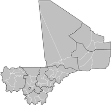 | |
|---|---|---|
| Koulikoro Region | ||
| Sikasso Region | ||
| Ségou Region | ||
| Mopti Region | ||
| Tombouctou Region | ||
| Gao Region | ||
| Kidal Region | ||
| Bamako Capital District | ||
| Ménaka Region |
| |
| Taoudénit Region |
| |
This article is issued from
Wikipedia.
The text is licensed under Creative Commons - Attribution - Sharealike.
Additional terms may apply for the media files.