Ganga Canal (Rajasthan)
| Gang Canal (Bikaner canal) | |
|---|---|
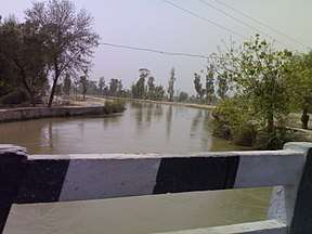 Gang canal in northern-western area of district near Ganganagar |
The Ganga Canal[1] (Gang Canal) of Rajasthan is an irrigation system of canals laid down by Maharaja Ganga Singh of Bikaner in his princely state in the present district of Sri Ganganagar in the early twentieth century. It is fed from the Sutlej River near Firozpur, Punjab, close to the India–Pakistan border, and passes through the Faridkot and Muktsar districts. Faridkot's Jhok Sarkari village lies on its path.
History
The Bikaner state was affected by the worst famine in 1899–1900. In order to get rid of this problem permanently, in 1903 Maharaja Sri Ganga Singh obtained the services of A. W. E. Standley, Chief Engineer, who demonstrated the feasibility of the western area of the Bikaner State being brought under irrigation from the Satluj Waters. The plan of the Satluj Valley Project was drawn by then Chief Engineer of Punjab Mr. R. G. Kennedy according to which the vast area of erstwhile Bikaner state could be brought under irrigation. Because of objections by the erstwhile State of Bahawalpur, the project got delayed and finally with intervention of then Viceroy of India, Lord Curzon, in 1906, a Tripartite Conference was held and an agreement was reached and signed on 4 September 1920. The foundation stone of the Canal Head Works at Ferozepur was laid on 5 December 1925 and the work completed in 1927 by constructing 89 miles of lined canal. The opening ceremony was performed on 26 October 1927 by Lord Irwin, the then Viceroy of India. The plan for Sri Ganganagar was drawn at this time. And irrigated parts of Bikaner state came under Sri Ganganagar district and now parted Hanumangargh District.
During the Partition of India, Sir Cyril Radcliffe, the chairman of the Punjab Boundary Commission, initially proposed to award the Ferozpur and Zira tehsils of the Ferozpur District to Pakistan. This would have put the headwaters of the Ganga Canal in the territory of Pakistan. Bikaner's prime minister K. M. Panikkar warned the Viceroy Lord Mountbatten that the Bikaner state would have no choice but to accede to Pakistan in that event. Jawaharlal Nehru also wrote to the Viceroy stating that it would be "most dangerous" for the Ferozpur district to go to Pakistan for "strategic and irrigation reasons". Subsequently, Radcliffe altered the boundary line retaining the entire Ferozpur district within India.[2]
See also
References
- ↑ Daniel Hillel (22 January 2016), Advances in Irrigation, Elsevier, pp. 132–, ISBN 978-1-4832-1527-3
- ↑ Wolpert, Shameful Flight 2009, pp. 167–168.
Bibliography
- Wolpert, Stanley (2009), Shameful Flight: The Last Years of the British Empire in India, Oxford University Press, USA, p. 167