Fischer Creek State Recreation Area
| Fischer Creek State Recreation Area | |
| Wisconsin State Park | |
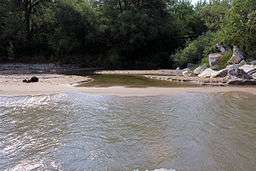 The mouth of Fischer Creek from Lake Michigan | |
| Country | United States |
|---|---|
| State | Wisconsin |
| County | Manitowoc |
| Location | Manitowoc |
| - coordinates | 43°56′18″N 87°43′13″W / 43.93833°N 87.72028°WCoordinates: 43°56′18″N 87°43′13″W / 43.93833°N 87.72028°W |
| Area | 124 acres (50 ha) |
| Founded | 1991 |
| Management | Manitowoc County Park System |
| IUCN category | V - Protected Landscape/Seascape |
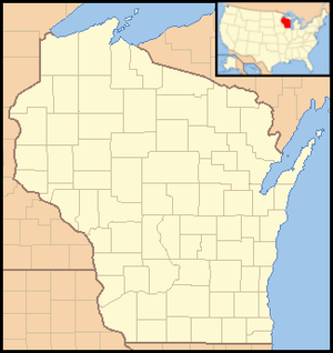 Location of Fischer Creek State Recreation Area in Wisconsin | |
Fischer Creek State Recreation Area is a state park unit of Wisconsin, United States. The 142-acre (57 ha) park preserves about a mile of shoreline on Lake Michigan flanking the mouth of Fischer Creek. The site is owned by the state but is developed and managed by the Manitowoc County Park System. The developments currently consist of trails and day-use amenities.
External links
This article is issued from
Wikipedia.
The text is licensed under Creative Commons - Attribution - Sharealike.
Additional terms may apply for the media files.