Fillmore, Missouri
| Fillmore, Missouri | |
|---|---|
| City | |
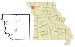 Location of Fillmore, Missouri | |
| Coordinates: 40°1′32″N 94°58′24″W / 40.02556°N 94.97333°WCoordinates: 40°1′32″N 94°58′24″W / 40.02556°N 94.97333°W | |
| Country | United States |
| State | Missouri |
| County | Andrew |
| Area[1] | |
| • Total | 0.14 sq mi (0.36 km2) |
| • Land | 0.14 sq mi (0.36 km2) |
| • Water | 0 sq mi (0 km2) |
| Elevation | 945 ft (288 m) |
| Population (2010)[2] | |
| • Total | 184 |
| • Estimate (2016)[3] | 185 |
| • Density | 1,300/sq mi (510/km2) |
| Time zone | UTC-6 (Central (CST)) |
| • Summer (DST) | UTC-5 (CDT) |
| ZIP code | 64449 |
| Area code(s) | 816 |
| FIPS code | 29-24184[4] |
| GNIS feature ID | 0717912[5] |
Fillmore is a city in Andrew County, Missouri, United States. The population was 184 at the 2010 census.
History
Fillmore was laid out in 1845[6] and was named for Millard Fillmore, a statesman, and afterward 13th President of the United States.[7] A post office called Fillmore has been in operation since 1851.[8]
Geography
Fillmore is located at 40°1′32″N 94°58′24″W / 40.02556°N 94.97333°W (40.025478, -94.973210).[9]
According to the United States Census Bureau, the city has a total area of 0.14 square miles (0.36 km2), all land.[1]
Demographics
| Historical population | |||
|---|---|---|---|
| Census | Pop. | %± | |
| 1860 | 322 | — | |
| 1870 | 271 | −15.8% | |
| 1880 | 297 | 9.6% | |
| 1890 | 261 | −12.1% | |
| 1900 | 225 | −13.8% | |
| 1910 | 232 | 3.1% | |
| 1920 | 272 | 17.2% | |
| 1930 | 308 | 13.2% | |
| 1940 | 269 | −12.7% | |
| 1950 | 284 | 5.6% | |
| 1960 | 254 | −10.6% | |
| 1970 | 251 | −1.2% | |
| 1980 | 265 | 5.6% | |
| 1990 | 256 | −3.4% | |
| 2000 | 211 | −17.6% | |
| 2010 | 184 | −12.8% | |
| Est. 2016 | 185 | [3] | 0.5% |
| U.S. Decennial Census[10] | |||
2010 census
As of the census[2] of 2010, there were 184 people, 70 households, and 50 families residing in the city. The population density was 1,314.3 inhabitants per square mile (507.5/km2). There were 89 housing units at an average density of 635.7 per square mile (245.4/km2). The racial makeup of the city was 98.4% White, 0.5% Native American, and 1.1% from two or more races.
There were 70 households of which 42.9% had children under the age of 18 living with them, 50.0% were married couples living together, 14.3% had a female householder with no husband present, 7.1% had a male householder with no wife present, and 28.6% were non-families. 24.3% of all households were made up of individuals and 4.3% had someone living alone who was 65 years of age or older. The average household size was 2.63 and the average family size was 3.20.
The median age in the city was 31.5 years. 34.2% of residents were under the age of 18; 7.1% were between the ages of 18 and 24; 26.6% were from 25 to 44; 23.8% were from 45 to 64; and 8.2% were 65 years of age or older. The gender makeup of the city was 50.5% male and 49.5% female.
2000 census
As of the census[4] of 2000, there were 211 people, 83 households, and 52 families residing in the city. The population density was 1,520.0 people per square mile (581.9/km²). There were 94 housing units at an average density of 677.2 per square mile (259.2/km²). The racial makeup of the city was 98.58% White, 0.47% Native American and 0.95% Asian. Hispanic or Latino of any race were 0.47% of the population.
There were 83 households out of which 37.3% had children under the age of 18 living with them, 51.8% were married couples living together, 6.0% had a female householder with no husband present, and 37.3% were non-families. 32.5% of all households were made up of individuals and 12.0% had someone living alone who was 65 years of age or older. The average household size was 2.54 and the average family size was 3.29.
In the city the population was spread out with 31.8% under the age of 18, 10.0% from 18 to 24, 29.4% from 25 to 44, 18.0% from 45 to 64, and 10.9% who were 65 years of age or older. The median age was 32 years. For every 100 females, there were 95.4 males. For every 100 females age 18 and over, there were 102.8 males.
The median income for a household in the city was $31,750, and the median income for a family was $28,750. Males had a median income of $26,667 versus $22,917 for females. The per capita income for the city was $13,047. About 18.0% of families and 15.2% of the population were below the poverty line, including 23.3% of those under the age of eighteen and 4.5% of those sixty five or over.
References
- 1 2 "US Gazetteer files 2010". United States Census Bureau. Archived from the original on January 24, 2012. Retrieved 2012-07-08.
- 1 2 "American FactFinder". United States Census Bureau. Retrieved 2012-07-08.
- 1 2 "Population and Housing Unit Estimates". Retrieved June 9, 2017.
- 1 2 "American FactFinder". United States Census Bureau. Archived from the original on September 11, 2013. Retrieved 2008-01-31.
- ↑ "US Board on Geographic Names". United States Geological Survey. 2007-10-25. Retrieved 2008-01-31.
- ↑ Eaton, David Wolfe (1916). How Missouri Counties, Towns and Streams Were Named. The State Historical Society of Missouri. p. 202.
- ↑ "Andrew County Place Names, 1928-1945 (archived)". The State Historical Society of Missouri. Archived from the original on 24 June 2016. Retrieved 30 August 2016.
- ↑ "Post Offices". Jim Forte Postal History. Archived from the original on 6 March 2016. Retrieved 30 August 2016.
- ↑ "US Gazetteer files: 2010, 2000, and 1990". United States Census Bureau. 2011-02-12. Retrieved 2011-04-23.
- ↑ "Census of Population and Housing". Census.gov. Archived from the original on May 12, 2015. Retrieved June 4, 2015.
Municipalities and communities of Andrew County, Missouri, United States | ||
|---|---|---|
| Cities | 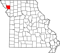 | |
| Villages | ||
| Townships | ||
| Unincorporated communities | ||
| Ghost towns | ||