Feng County, Jiangsu
| Feng County 丰县 | |
|---|---|
| County | |
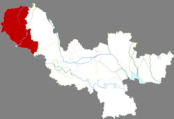 Location in Xuzhou | |
 Fengxian Location in Jiangsu | |
| Coordinates: 34°40′26″N 116°37′05″E / 34.674°N 116.618°ECoordinates: 34°40′26″N 116°37′05″E / 34.674°N 116.618°E | |
| Country | People's Republic of China |
| Province | Jiangsu |
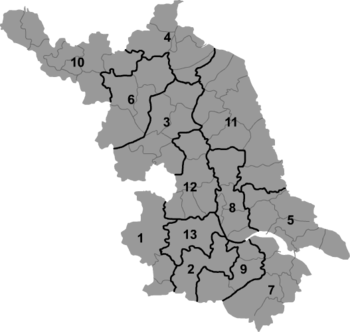
| Prefecture-level city | Xuzhou |
| Area | |
| • Total | 1,450.2 km2 (559.9 sq mi) |
| Population (2013) | |
| • Total | 1,182,300 |
| • Density | 820/km2 (2,100/sq mi) |
| Time zone | UTC+8 (China Standard) |
| Website |
www |
Feng County, or Fengxian (simplified Chinese: 丰县; traditional Chinese: 豐縣; pinyin: Fēng Xiàn), is under the administration of Xuzhou, Jiangsu province, China. The northwestern-most and westernmost county-level division in the province, it borders the provinces of Shandong to the north and west, and Anhui to the south. The county is well known for its about 11,120 acres (or 450,000 ares) of the Fuji apple trees.[1]
Etymology
The word "Feng" (豐) here has dual meanings: For one thing, it was the name of an ancient tributary of the Si River which flowed through the area. For another the area was deemed to be bountiful, while "feng" is also an adjective to describe such a condition in Chinese.[2]
History
Feng county proper was administered as a town under Pei county called Feng yi (豐邑) by the early Han dynasty before its establishment. Then it was assigned to then Pei commandery, Yu province until 583, being a part of Pengcheng commandery (later Xuzhou). It was once disestablished, but was restored in 457. The county was temporarily under the jurisdiction of Shandong province during 1949–53.[2]
References
External links
- www.xzqh.org (in Chinese)