Faverges-Seythenex
| Faverges-Seythenex | |
|---|---|
| Commune | |
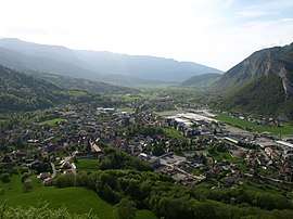 A general view of Faverges | |
 Faverges-Seythenex Location within Auvergne-Rhône-Alpes region  Faverges-Seythenex | |
| Coordinates: 45°45′N 6°18′E / 45.75°N 6.3°ECoordinates: 45°45′N 6°18′E / 45.75°N 6.3°E | |
| Country | France |
| Region | Auvergne-Rhône-Alpes |
| Department | Haute-Savoie |
| Arrondissement | Annecy |
| Canton | Faverges |
| Intercommunality | C.C. des Sources du Lac d'Annecy |
| Area1 | 59.3 km2 (22.9 sq mi) |
| Population (2016)2 | 7,844 |
| • Density | 130/km2 (340/sq mi) |
| Time zone | UTC+1 (CET) |
| • Summer (DST) | UTC+2 (CEST) |
| INSEE/Postal code | 74123 /74210 |
| Website | faverges-seythenex.fr |
|
1 French Land Register data, which excludes lakes, ponds, glaciers > 1 km2 (0.386 sq mi or 247 acres) and river estuaries. 2 Population without double counting: residents of multiple communes (e.g., students and military personnel) only counted once. | |
Faverges-Seythenex is a commune in the Haute-Savoie department in the Auvergne-Rhône-Alpes region in south-eastern France. It was created on 1 January 2016 when the communes Faverges and Seythenex were merged.[1]
See also
References
| Wikimedia Commons has media related to Faverges-Seythenex. |
- ↑ "Arrêté du 30 septembre 2015 portant création de la commune nouvelle de Faverges-Seythenex". Legifrance.gouv.fr (in French). 2015-09-30. Retrieved 2016-01-23.
This article is issued from
Wikipedia.
The text is licensed under Creative Commons - Attribution - Sharealike.
Additional terms may apply for the media files.