Fanø
Fanø is a Danish island in the North Sea off the coast of southwestern Denmark, and is the very northernmost of the Danish Wadden Sea Islands. Fanø municipality is the municipality (Danish, kommune) that covers the island and its seat is the town of Nordby.
Island
Fanø is separated from the mainland by the Wadden Sea over a span of approximately five kilometres (3.1 miles).[1] The island is 16 kilometres (9.9 miles) long and 5 kilometres (3.1 miles) wide, and it is located off the coast from the city of Esbjerg to which it is connected by ferry. The ferry ride takes 12 minutes.
A variety of environments are to be found on Fanø. Not surprisingly, a very common one is sand. The island's whole western shore is one long beach. The island's northwestern corner is a vast sandbank called "Søren Jessens Sand". Søren Jessen was an entrepreneur and captain from Hjerting, today the westernmost suburb of Esbjerg and the bank is named after him because his ship, the "Anne Catriane", stranded here in 1712.
The vegetation on Fanø is mainly heath and small pine trees, never growing tall because of the predominant strong westerly winds from the North Sea.
Fanø relies heavily on tourism and is visited by some 30,000 people each summer. The main attraction is the fine white sand beach, which is also a popular playground for all kinds of wind and water sports, such as kite flying, surfing and buggies.
Long before paved roads, the beach - being long, straight and quite firm - hosted a yearly motorcycle and car racing event from 1919 and until 1923, where a tragic accident killed a local boy and put a stop to further events. Today is possible to drive your own car on the beach all the way from Sønderho to Fanø Vesterhavsbad. A public bus service is also operated on the beach. 1 January 2018 the municipality will take over the responsibilities of public mass transit on the island from the Region of Southern Denmark.
Also unique is the Wadden Sea with seals and migrating birds, as well as the two sailor towns Nordby and Sønderho with their maritime history, once among the most wealthy and influential in Denmark, and their vernacular architecture consisting of thatched-roof houses all oriented west-east, again because of the westerly winds.
During World War II, Fanø was part of the Atlantic Wall and the remains of the 300 bunkers built by the Nazis can still be spotted along the coast line.
A number of animals that are otherwise common in Denmark, such as vipers, squirrels, moles and badgers, are nonexistent on the island, whereas foxes, hedgehogs, roebucks, hares and especially rabbits exist in abundance.
Fanø has the highest rate of alcohol abuse in Denmark, with a rate of 34.6% among males and 15.8% among females.[2] The island also has the highest murder rate, divorce rate and cancer rate in Denmark.[3][4][5]
Notable people
- Henriette Nielsen (1815 - 1900) was a Danish author and playwright. She used local costumes from Fanø
- Lilian Brøgger (born 1950 in Nordby) is a Danish illustrator. The first student to graduate as an illustrator from the Danish Design School in 1972
- Thomas Sneum (1917 - 2007) Naval pilot who, with Keld Pedersen, delivered vital photographs of a Nazi radar installation on Fano to British authorities by using a fragile and risky biplane
- Bo Knudsen (born 1958) is a Danish librarian and local politician
- Eva Louise Buus (born 1979) is a Danish artist. In 2015, she exhibited works in Fanø Museum
- Jacob Bymar (born 1982 in Nordby) is a Danish footballer currently playing for B68. He is a former Danish youth international.
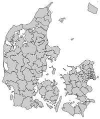
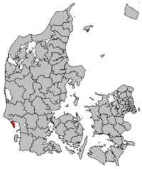
Municipality
The municipality is in Region of Southern Denmark, and covers an area of 56 square kilometres (22 square miles). It has a total population of 3,192 (2008). Its mayor is Erik Nørreby, a member of the Venstre political party.
The main town and the site of its municipal council is the town of Nordby. Other towns include Sønderho, Fanø Vesterhavsbad and Rindby.
Fanø Municipality was not merged with any adjacent municipality under the municipal reform of 2007, as it agreed to enter into a "municipal cooperation agreement" with Esbjerg Municipality.[6]
External links
| Wikivoyage has a travel guide for Fanø. |
| Wikimedia Commons has media related to Fanø. |
References
- ↑ (C. Michael Hogan. 2011)
- ↑ Danish National Health Profile 2010 (in Danish)
- ↑ Murder rate from 1995 to 2013 (in Danish)
- ↑ Divorce rates in Denmark
- ↑ Cancer rates in Denmark
- ↑ https://www.retsinformation.dk/Forms/R0710.aspx?id=10080
- Municipal statistics: NetBorger Kommunefakta, delivered from KMD aka Kommunedata (Municipal Data)
- Municipal mergers and neighbors: Eniro new municipalities map
- C.Michael Hogan. 2011. Wadden Sea. eds. P.Saundry & C.Cleveland. Encyclopedia of Earth. National Council for Science and the Environment. Washington DC
| West Frisian Islands (Netherlands) |
|  | |||||
|---|---|---|---|---|---|---|---|
| East Frisian Islands (Germany) |
| ||||||
| Heligoland Bight (Germany) | |||||||
| North Frisian Islands (Germany) |
| ||||||
| Danish Wadden Sea Islands (Denmark) |
| ||||||