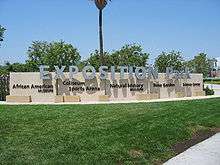
Exposition Park (Los Angeles)
Exposition Park is situated in the south region of Los Angeles, California,[1] in a rectangle bounded by Exposition Boulevard to the north, South Figueroa Street to the east, Martin Luther King Jr. Boulevard to the south and Menlo Avenue to the west. It is directly south of the main campus of the University of Southern California.[2]
The park is public open space, managed by the California Natural Resources Agency.
Features
Exposition Park houses the following:
- LA84 Foundation/John C. Argue Swim Stadium
- Banc of California Stadium
- Home of Los Angeles FC
- Lucas Museum of Narrative Art (under construction)
- Los Angeles Memorial Coliseum
- Home of USC Trojans football and Los Angeles Rams
- Natural History Museum of Los Angeles County
- California Science Center
- IMAX Theatre at California Science Center
- Space Shuttle Endeavour
- Exposition Park Rose Garden
- California African American Museum
- Concrete hand and footprints signed by Ed Begley Jr. of St. Elsewhere and other actors from medical TV shows such as Ben Casey
- EXPO Center (includes the LA84 Foundation/John C. Argue Swim Stadium) and the Soboroff Sports Field (soccer)
- Science Center School and Amgen Center for Science Learning (formerly California National Guard Armory)

The cultural facilities mentioned above are operated by both the state and Los Angeles County.
Former venues
History
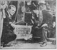
The 160-acre (0.65 km2) site served as an agricultural fairground from 1872 to 1910 (hence its original name, "Agricultural Park"). In 1880, John Edward, Ozro W. Childs, and former California Governor John G. Downey persuaded the State of California to purchase 160 acres (0.65 km2) in Los Angeles to foster agriculture in the Southland. Farmers sold their harvest and arces on the grounds, while horses, dogs, and even camels competed on a racetrack where a rose garden now sits and blooms. In 1909, a group of civic-minded individuals led by former Pasadena Mayor Horace Dobbins set about reforming the park, removing the racetrack and other activities and replacing them with gardens and museums.[3]
At the 2028 Summer Olympics, the Coliseum will host Athletics as well as the main closing ceremony. The Banc of California Stadium will be one of the soccer venues. [4]
Public transportation
Along the northern edge of the park, the Metro Expo Line light rail line serves the park with its Expo Park/USC Station. On the northeast, (Flower Street and 37th Street), the Metro Silver Line bus rapid transit serves Exposition Park & USC at its 37th Street/USC Station on the Harbor Transitway. The Silver Line station is located on the freeway median level of the 1-110 freeway.
See also
References
External links
| Wikimedia Commons has media related to Exposition Park, Los Angeles. |
- Official website — Exposition Park.
- University Park Family — an online newspaper and social network focused on the neighborhoods around USC and Exposition Park, and the surrounding areas.
- Leimert Park Beat — a collaborative online community focused nearby Leimert Park: "The Soul of Los Angeles and the African American cultural center of the city".

Coordinates: 34°00′53″N 118°17′14″W / 34.014659°N 118.287177°W