El Copé
| El Copé | |
|---|---|
| Corregimiento | |
 El Copé | |
| Coordinates: 8°37′12″N 80°36′0″W / 8.62000°N 80.60000°WCoordinates: 8°37′12″N 80°36′0″W / 8.62000°N 80.60000°W | |
| Country |
|
| Province | Coclé |
| District | Olá |
| Area[1] | |
| • Land | 76.7 km2 (29.6 sq mi) |
| Population (2010)[1] | |
| • Total | 1,425 |
| • Density | 18.6/km2 (48/sq mi) |
| Population density calculated based on land area. | |
| Time zone | UTC−5 (EST) |
El Copé is a corregimiento in Olá District, Coclé Province, Panama. La MICA Biological Station is located nearby. It has a land area of 76.7 square kilometres (29.6 sq mi) and had a population of 1,425 as of 2010, giving it a population density of 18.6 inhabitants per square kilometre (48/sq mi).[1] Its population as of 1990 was 1,081; its population as of 2000 was 1,263.[1]
See also
- El Cope National Park
References
- 1 2 3 4 "Cuadro 11 (Superficie, población y densidad de población en la República...)" [Table 11 (Area, population, and population density in the Republic...)] {{webarchive |url=https://web.archive.org/web/20160304030354/http://www.contraloria.gob.pa/inec/archivos/P3601Cuadro11.xls |date=March 4, 2016 }} (.xls). In "Resultados Finales Básicos" [Basic Final Results] (in Spanish). National Institute of Statistics and Census of Panama. Archived from the original on July 10, 2015. Retrieved May 26, 2015.
Capital: Penonomé | ||
| Aguadulce | 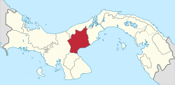 | |
| Antón | ||
| La Pintada |
| |
| Natá | ||
| Olá | ||
| Penonomé |
| |
This article is issued from
Wikipedia.
The text is licensed under Creative Commons - Attribution - Sharealike.
Additional terms may apply for the media files.